GORUCK Selection 2014

* Warning, video contains some cursing.


As some of my readers are aware I am employed by the American gear manufacturer, GORUCK.  We are a multi-faceted company that both builds extremely durable and high quality gear in America as well as the operators of an array of endurance and team building events that last from four hours up to 48+ hours and take place every weekend all over the world.  I have personally participated in our GORUCK Challenge and GORUCK Light events which I can rightly say put ones body to the test.  During our Challenge our team traveled nearly 20 miles over the course of 14 hours.


Not all of our events are about team building.  Our hardest – GORUCK Selection – is all about 100% selfish perseverance in the face of punishing beat down.  Participants will move in excess of 80 miles under great physical duress, with very limited caloric intake, and rest.  The event will last a minimum of 48 hours and the for nearly the entirety of that, the GORUCK Cadre (all former or active Special Forces operators) will make it their goal to force you to quit.  The event was designed by operators and is based on the standards of Special Forces Assessment and Selection course in the armed forces.


GORUCK Selection 2014 takes place in Jacksonville Beach, Florida and begins Thursday, Oct. 9 at 13:00 EST and will include live updates via the GORUCK news blog, Twitter, Facebook, and Instagram.

After Work Scouting Mission

Embarked on a quick scouting mission to a potential hunting zone last evening after work.  Took the Land Cruiser to the trailhead, rode the fatbike to the end of the trail, and then hiked an off-trail ridge to within 15 minutes of sunset.  Glassed for game until sunset (spotted three elk) and then hightailed it back downhill arriving at my truck in the last minutes of twilight.

20140929_182719

20140929_175553

20140929_181455

20140929_183348

20140929_185634

20140929_191127

Canoeing the Smith River, a Montana Gem

If you ask a random American what their stereotypical perspective of a Minnesotan is it may very likely include hotdish, hockey, and canoeing.  As a youngster, being a Minnesota native I ate a lot of hotdish but I didn’t play much hockey and I didn’t do a lot of canoeing.  In the last decade or so I’ve grown very fond of river camping and have done a handful of trips via canoe, packraft, and standard raft.  Two of these trips are firmly rooted near the top of my all time favorite camping experiences, including the one I’m about to tell you of.


IMG_1378


The idea was spawned this past winter to get a group together to put into the lottery for a permit on Montana’s Smith River.  A few of us got together for dinner and drinks, discussed strategy and entered for three different put-in dates ranging from a prime mid-June slot to riskier (low water) slots in early June and early July.  The odds of the lottery aren’t terrible but they’re also not certain.  In 2013 there were 6,662 applicants with only 1062 permits awarded.  One of our group was lucky though and a slot to put-in on Saturday, July 12th was ours.  The ’13/’14 winter hammered SW Montana with near-record snowfalls so our fingers were crossed that the 165% snowpack in the Smith watershed would hold out and provide the needed 240+ cfs flows to get all of our crafts down the river without too much hassle.


The word spread that we had a permit.  The original group of six or seven participants quickly swelled to 13, dropped, swelled again – right up until the last day before we put in when one last member backed out leaving us with an even 10.  We had planned extensively both via group email as well as a thorough planning spreadsheet.  And in late June as many of the participants as were available went on an overnight trip to shakedown gear and group dynamics (that was a gorgeous trip in and of itself).  The logistics of shuttling ten people’s bodies, gear, and boats was solved, group cooking gear was selected, and paddling/rowing teams were set.


IMG_1478


We had participants coming from all over the U.S. – Bozeman, Minneapolis, and Seattle – but all successfully converged at the Camp Baker put-in Friday evening for our Saturday morning departure.  We arrived after dark but shelters were pitched, a fire lit, and beers were in hand in under 30 minutes.  Stoke level was high and we sat around the fire chatting ’til around 11pm.  Smith River policy requires a meeting with a ranger to pay permitting fees, select campsites, and hear a brief safety/regulations talk the morning of your put-in and we were up at 7am and ready with bacon, pancakes, and coffee flying off the Coleman Dual Fuel.


The ranger informed us there had been 8,000 applicants for the lottery this season and that on average there were 135 people putting in per day throughout the summer.  Our July 12th put in is considered near the end of the season but there were still dozens of boats and a few dozen people milling about Camp Baker getting ready.  The nice thing about the permitting and controlled access of the Smith is that it spaces river users out in such a way that although you’re sharing 50 miles of river with hundreds of people you may only see a couple other boats all day.  Some choose to float in a five day window, others choose to fit it into four days. This also helps to limit how many you see as well.  We played hop scotch with one other party who shared a similar itinerary to ours the entire time but only saw a small handful of other groups on days one and four.


IMG_1405


The Smith is everything from a well managed, natural habitat for flora and fauna, to a fishing paradise, to a relaxed and generally worry-free booze cruise.  Our group appreciated each and every one of those aspects day in and day out.  We had folks along who were into fishing, folks who have graduate degrees that are into science, and folks who enjoy cracking a river beer a little after ten in the morning.


IMG_1475


The river proved a very worthy adventure for our group.  We were spaced out in four canoe teams consisting of two paddlers and one raft team with one at the oars and one on a fishin’ rod.  The raft carried a little bit of extra gear but for the most part everyone had their own gear in their own canoes.  We spent a fair amount of time planning group gear (stoves, tables, shelters, et al) so that we had little to no unnecessary redundancy.  Food was also very well thought out and we devoted certain coolers to dry-ice laden deep freeze machines and others to open-as-much-as-needed cold beer dispensing machines.


IMG_1310


Our scheduled permit which came toward the end of the heavy float season meant we’d have whole campsites to ourselves.  The Smith is laid out in such a way that areas containing designated campsites usually have an upper, middle, and lower site.  The sites are pretty well spaced so even on the last night when we had neighbors to the upper and lower sites below us it wasn’t particularly annoying (at least not to us – not sure whether they liked us or not!?!).


IMG_1349


IMG_1354


The trip was absolutely spectacular.  The fishing didn’t prove to be very fruitful because none of us consider ourselves pros with a fly and the lateness of the season meant the water was extremely warm.  Not to worry though, just getting to cast a fly into the water under a few hundred foot tall canyon wall is a relaxing and rewarding activity in and of itself and worth it without a trout reward.


IMG_1359


IMG_1366


Any amount of fishing that may have not proved fruitful was easily made up for in exquisite swimming opportunities.  We made it a point to stop a couple times a day for an hour or more at at time when we’d come to a good swimming hole.  We even found a couple decent “deep water” soloing opportunities with some fun little cliff jumps.


IMG_1416


IMG_1423


Get your friends together and apply for your permit if you want to float the Smith.  If awarded, do yourself a favor and do some pre-trip planning (or a ton of planning as we did).  Dial in your food plan so you can eat gourmet grub three meals a day and figure out which campsites are awesome and which are just so-so.  Find a couple good friends who don’t complain about the sun or the lack of good fishing and hit the river.  The Smith is an absolute treasure and worth sharing.  If you feel the same, consider researching the current plans to attempt to build a mine at the headwaters and write a note to your government reps or consider a donation to at saveoursmith.com.  Let’s keep Montana beautiful as both a natural resource and a recreational playground.


Bridger Ridge Traverse – August 24th, 2008

ridge


*Note – this was originally posted as a trip report on Summit Post in 2008, and subsequently as a post to previous version of my website.  I am re-posting it here for posterity and search-ability.   For all trip photos view the  Bridger Ridge Traverse album on Flickr.


Jeff and Sam started at Fairy Lake USFS campground at 07:30 on 2008-08-24 with light packs, lots of food, water, maps and legs ready to be destroyed. We finished, eleven and a half hours later having ascended 5,170 ft and descended 7,460 ft over nineteen miles.


Preparation

Jeff has lived in Bozeman for two years and has had his eye on the route followed during the Bridger Ridge Run just about ever since. Sam has lived in Bozeman for about a month and a half but has had his eye on a Bridger Traverse since the first time he skiied Bridger Bowl in 2005.


In a passing conversation the week prior to the trip Jeff mentioned his 30th birthday was coming up and that he had a desire to do something meaningful, worthwhile and challenging before his twenties passed. Knowing that Sam was someone who thoroughly enjoyed backpacking, hiking and alpine scrambling he put forth the idea to him as well as some other Bozeman locals. Sam responded with a whole-hearted, hell yes I’d like to join you and the response from others was a bit milder.


Sam and Jeff both did some independent research of the traverse using such tools as the excellent Bozeman Area topographic map, Google Earth and the Ridge Run maps located at the Big Sky Wind Drinkers Web site.


The Hike
Waking at 05:30 on Sunday morning a quick breakfast was consumed and the packs finally loaded. Sam brought Clif bars, salami, cheese, baguette, chocolate and four liters of water. Jeff brought sandwiches, M&Ms and nine and a half liters of water (having miscalculated thinking he was only bringing seven and a half). Driving Sam’s Subaru to the Fairy Lake trailhead they quickly hit the trail opting to change the Bridger Run route to their own liking by tacking on a summit of Hardscrabble Peak to the already big day of travel planned.


Descending from Hardscrabble the meat of the journey began with a climb of Sacagawea Peak, the high point of the trip at 9,665ft of elevation. A use trail exists along the entirety of the Bridge Range as described in this report but side-steps some of the summits in the range. Opting to bag most of these Sam and Jeff next climbed the few dozen extra feet to the summit of Naya Nuki wherein author Kenneth Thomasma has left a few copies of his novel, Naya Nuki, Shoshone Girl Who Ran, the story of the peak’s namesake.


The use trail is excellent for 95% of the route and is the majority of what is traveled in the traverse. The route called for in the Bridger Ridge Run skips a beefy section near Ross Peak which would call for a higher class of scrambling that most are prepared for in a running race. At this point the suggested route is to drop a thousand some odd feet to the National Scenic hiking trail which parallels the Bridger Ridge on the West side. A beautiful trail with excellent tread takes traversers to Ross Pass and then at a well-marked junction (large cairn and two blazes, one paint and one cut) hikers should turn left, head straight uphill on a well-worn use trail back to the summit of the ridge.


The rest of the day was spent hopping rocks, photographing amazing views and calculating mileages and hours. Along the way are great views of many mountain ranges, including the Crazy Mountains, Madison Range, Absaroka Range, Beartooth Range, Gallatin Range, and the Tobacco Root Mountains.


Other named peaks that are ticked off while hiking this traverse are Saddle Peak, Bridger Peak and Baldy Mountain.


Descending from Baldy Mountain to the Bozeman area “M” trail is a knee-pounding affair nearly straight down a few thousand some odd feet. After a grueling day in the sun, hiking on scree and rock it took it’s toll on Jeff and Sam’s knees. We met Jeff’s wife Shannon at the “M” and finshed at the “M” trailhead to shuttle back to Fairy Lake to fetch Sam’s vehicle.


Conclusions
Having hiked this partial section of the Bridger Range Traverse both Sam and Jeff would like to complete the remaining section from Flathead Pass southward to Hardscrabble.


Worthy of mention is the common thread on various Internet resources that the route is hard to follow and both Sam and Jeff agree that these statements are false. With minimal route-finding skills and keeping one’s eyes open anyone with the physical capabilities for big miles and big elevations should have little to no difficulty in completing this traverse.


Fifty Miles on the Pitchstone Plateau and along the Bechler River

20140901_081827

A trip in the Bechler region of Yellowstone National Park has been on my bucket list for years.  I secured a permit encompassing a vast chunk of the SW corner of the park.  My itinerary was to traverse the Pitchstone Plateau, then head westward to the Bechler River Valley, following it northward to my end point in the Old Faithful geyser basin.  This would allow me to experience three vastly different ecosystems, camping one night in each.


I experienced beautiful moonrises, glorious sunrises, sunny afternoons, a seemingly endless thirty-six hours of continuous rain, mile after mile of both grassy savannah walking as well as mud and bog walking, a spectacular soak in one of the best backcountry hotsprings known to humankind, and hours of solo introspection and enjoyment.  The journey through this section of YNP is well worth a visit for someone looking to walk an all-trail route that has just enough an element of navigation and route finding challenge to keep things interesting but is still moderate enough to allow your thoughts to wander without consequence.


The route crosses numerous springs, streams, and rivers so water consumption planning is simple.  I inquired locally and with respected and trusted individuals regarding the fishing potential and fly choices.  I cast my line into three separate stream/river systems, each containing different species and although my luck and skill (lack of?) didn’t pan out, the joy and meditative qualities of tenkara fishing made the extra six ounces of gear well worth it.


Logistically the trip worked out exceptionally.  I left my car at the Pitchstone trailhead, hiked the loop, and grabbed an instantaneous hitchhike with an off duty park employee all the way back to my car at trip’s end.  Bike shuttling along the busy park roads is an option as well but would require planning a morning start to allow for the extra hours needed.  Hitchhiking can be a gamble but in this instance paid off exceptionally.


I decided to photograph the journey through wide shots of the landscape, trying to capture the essence of the different spaces I visited.  From the wide open, grassy savannah of the Pitchstone Plateau, to the woody and wet valleys of Mountain Ash Creek, to the boggy, misty and steamy Bechler River Valley, all zones had a unique character that was constantly bringing a smile to my face.


20140901_100151

IMG_1598


IMG_1605

IMG_1612

IMG_1613

IMG_1619

IMG_1631

IMG_1645

IMG_1646

IMG_1653

IMG_1662

IMG_1604

IMG_1663

Morganzo 55: Double Nickels on the Grime – 2014

I participated in my second (of three) of our little local gravel bike ride/race the Morganzo 55: Double Nickles on the Grime last weekend.  It’s a beautiful fifty-five mile course all of which (minus the first 1/4 mile or so) is on gravel roads of quality varying from regularly graded to rutted farm two tracks.  There were around 15 participants this year who turned out for the ride under partly cloudy skies with temps pushing near 90 deg. F.

I aimed to finish in less than five hours and I pretty much managed that.  My GPS read 05:01 but that included a 1.5 mile out-and-back detour due to a bad route finding decision.  Oops.  As one of the race promoters you’d think I’d know the exact course.  Anyway, it was a great ride, with great participants, and I expect we’ll do it again next year.

morganzo-sam-pugs-01

morganzo-sam-pugs-04

Gravelly Range Overland

The name of this blog is “Going Places Quietly” and it’s intent is to highlight my wilderness treks whether they be on foot, splitboard, bicycle, or skis.  That being said my wife, friends, and I do a lot of car camping and the mini-expedition we set out on over Independence Day was so exceptionally beautiful that I felt the need to write about it here even though car travel isn’t normally considered a “quiet sport”.


gravelly-road2


My wife had told me a tale of a gravel road that traversed the spine of the Gravelly Mountain Range – a seldom visited range in SW Montana – and back in May I pinged a few folks to plan a long loop encompassing the entirety of the range with terrain varying from well-graded gravel to some slightly technical jeep trails.  With the Independence day holiday falling on a Friday the opportunity to hit the road Thursday night, grab a burger on the way and be into the Forest a bit after dark before the weekend really even began was a prime opportunity.


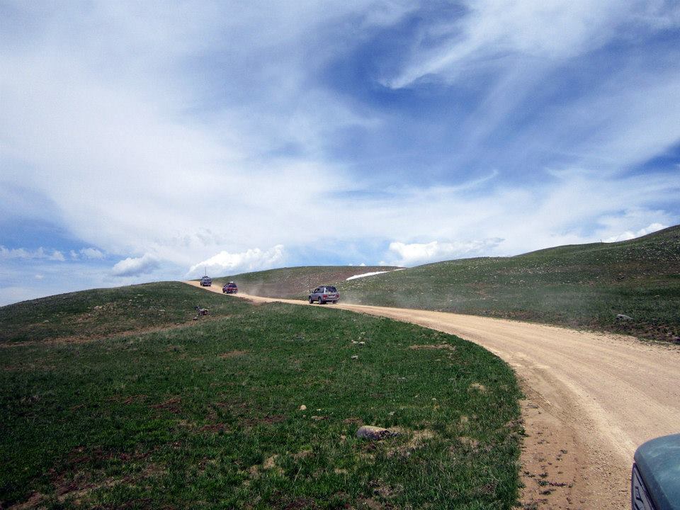
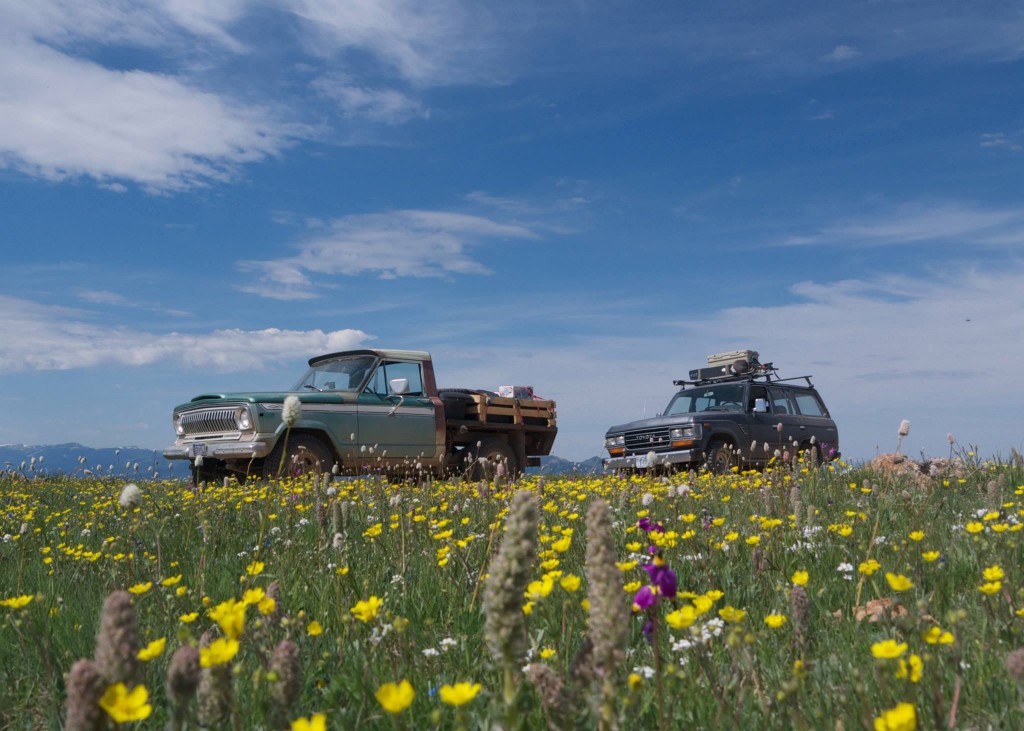
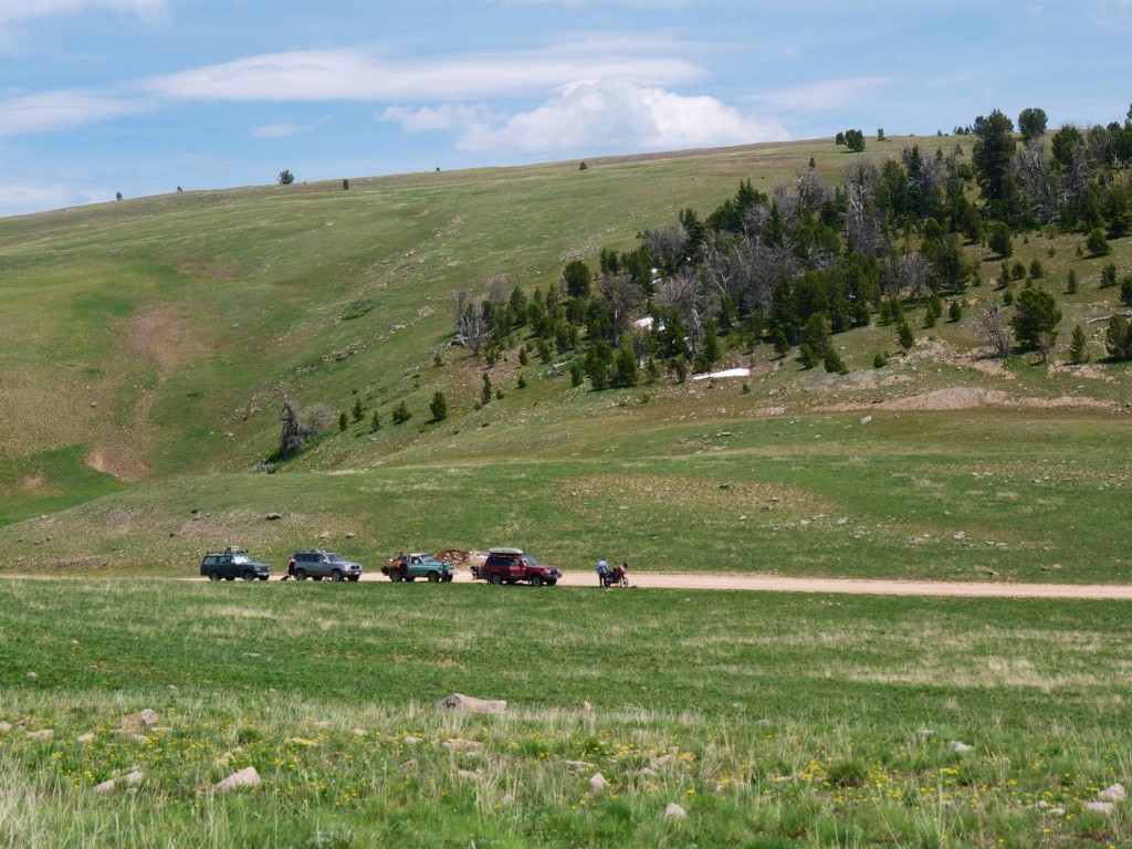
Burgers and beer at the Gravel Bar in Ennis followed by a necessary final fueling of the trucks and our intrepid group of leisure seekers left smooth asphalt for FS roads just as the sun was setting.  Headlights flipped on and our string of four rigs snaked along quality gravel through farmland and the slow climb up to our first camp high atop the gently sloping NE side of the range.  Our posse consisted of three Land Cruisers of various age and a custom Johnny Cash “One Piece at a Time” Jeep our friend Tom has been working on for years that combines a chassis from one year and a cab from another, along with a slew of other parts from other years.


gravelly-road3


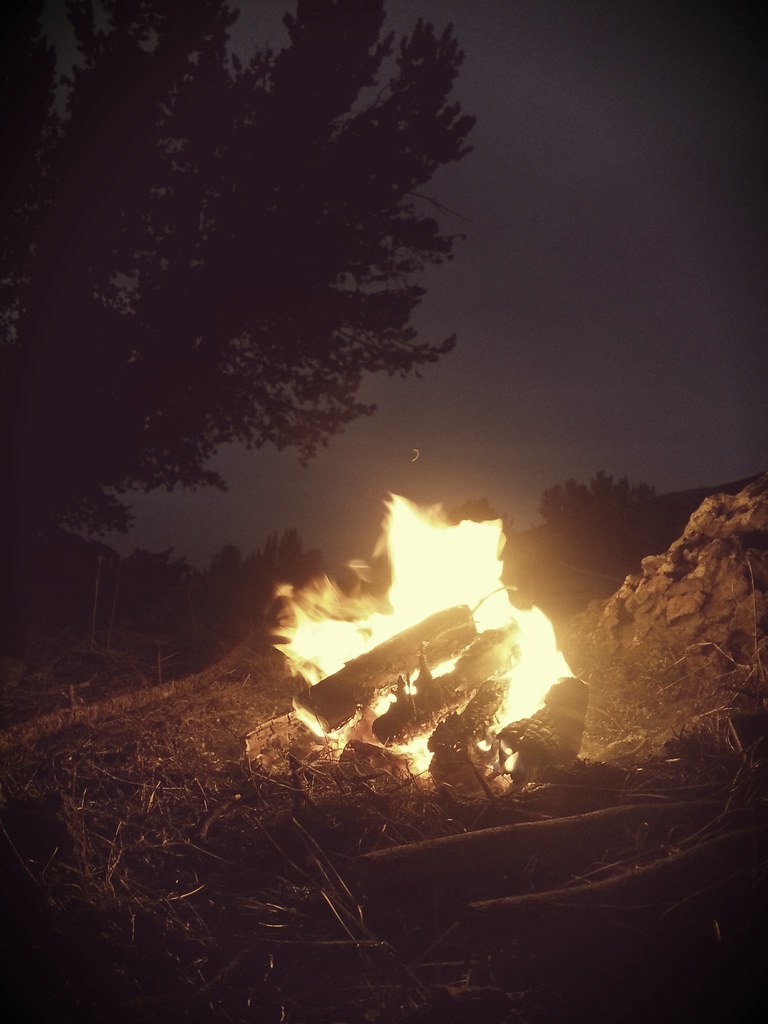
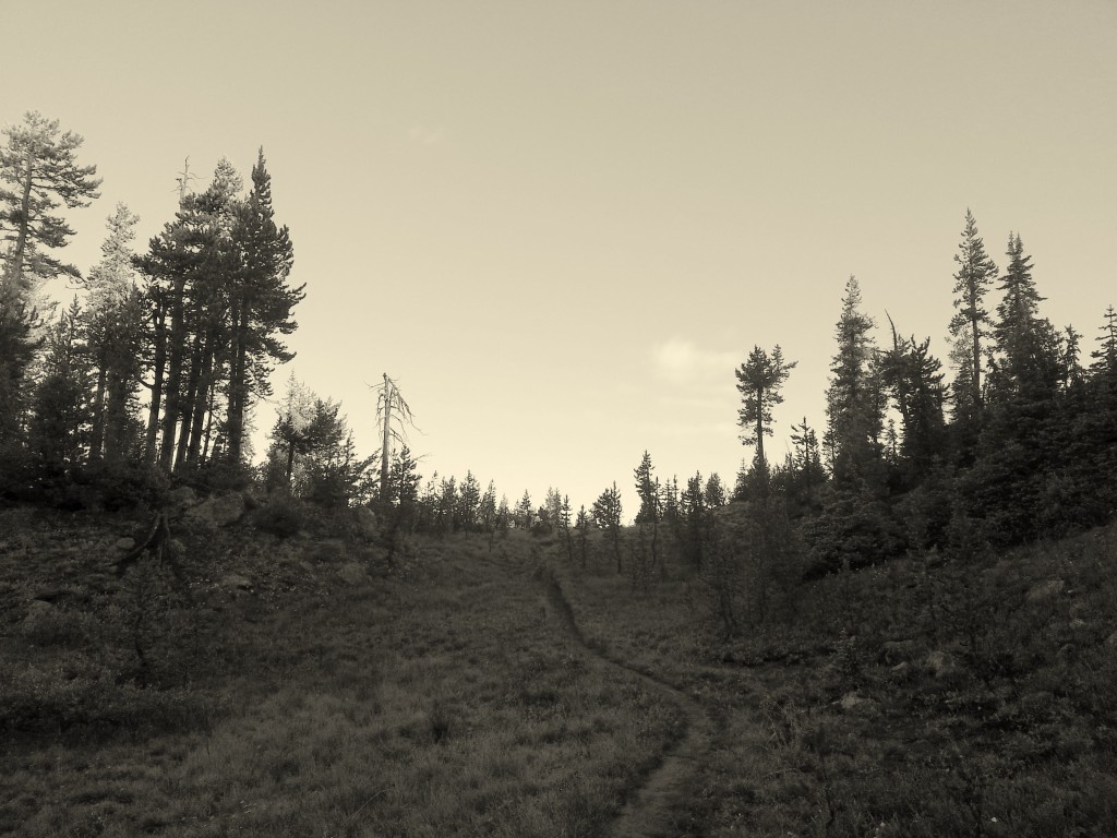
We crossed the forest boundary and began looking for an acceptable camping site for the evening.  I had done much prior research in Google Earth and had a zone generally selected so we followed our GPS track, headlight ablaze on the road and trees alongside.  The lights of the small hamlet of Ennis made for a quaint scene to the NE and the impressive Madison Range to the East loomed in shadow of the twilight.  A tunnel of trees engulfed the road and soon after a small acreage of meadow brimming with Glacier Lilly opened up and I immediately pulled my FJ62 off the road knowing we’d found the perfect first camp.  The rest of our party followed suit and as the hour of 11pm approached we set about making our first camp.  Some were to sleep in their rigs, others put up tents.  I had camp ready first and quickly set about getting a proper campfire going.  Rain sprinkled us once or twice over the course of the next hour but we sat ’round the Ranger TV sipping cold beer and reveling in how great a vacation we were already off to.


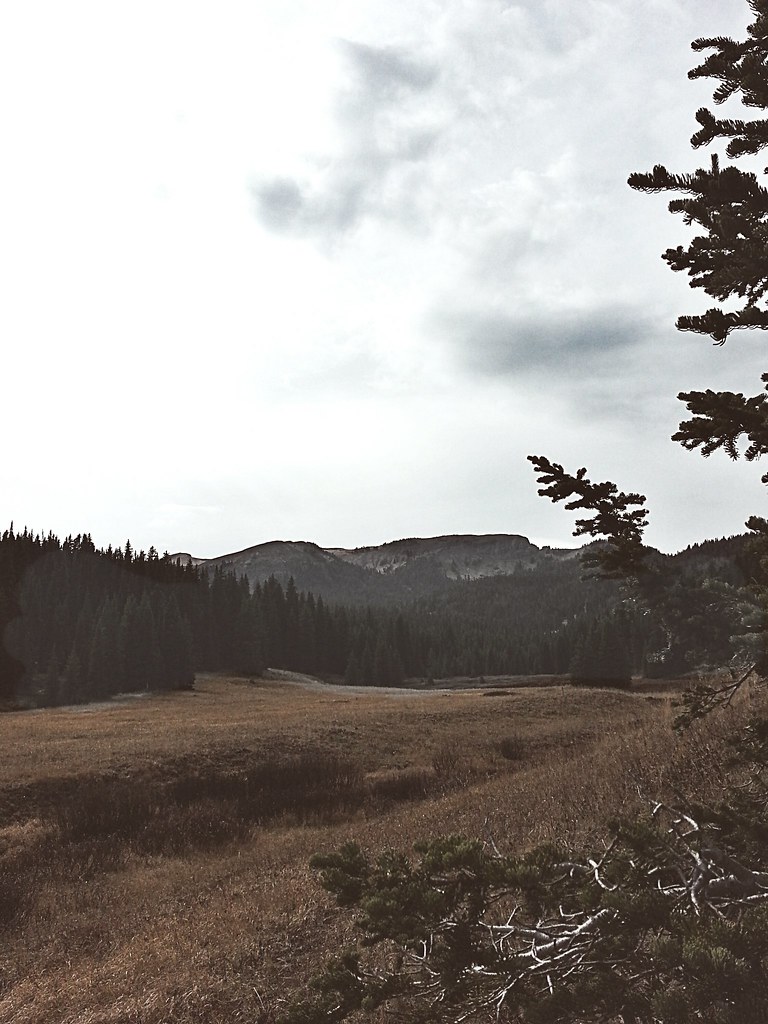
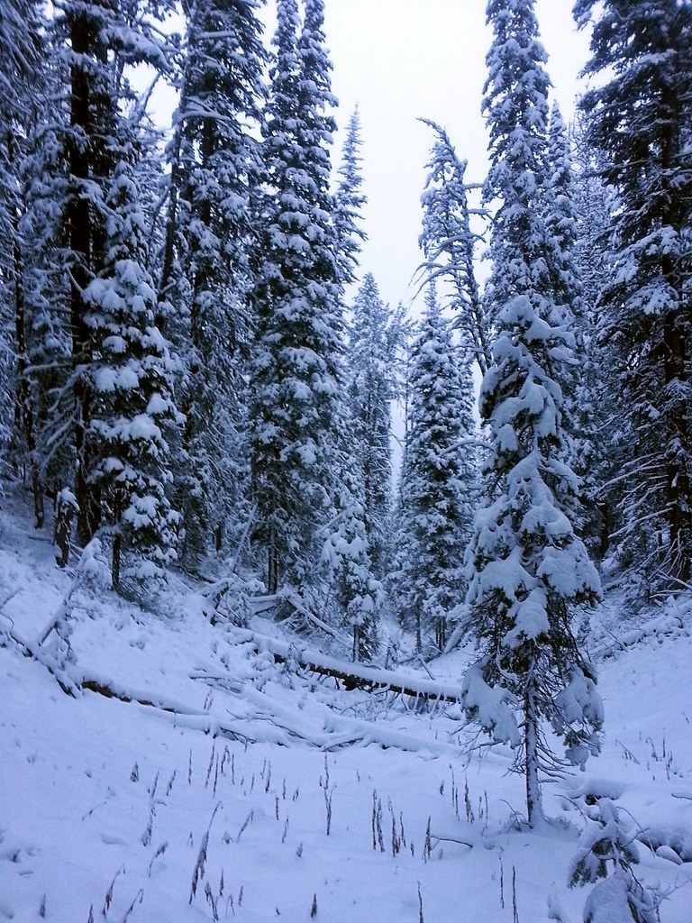
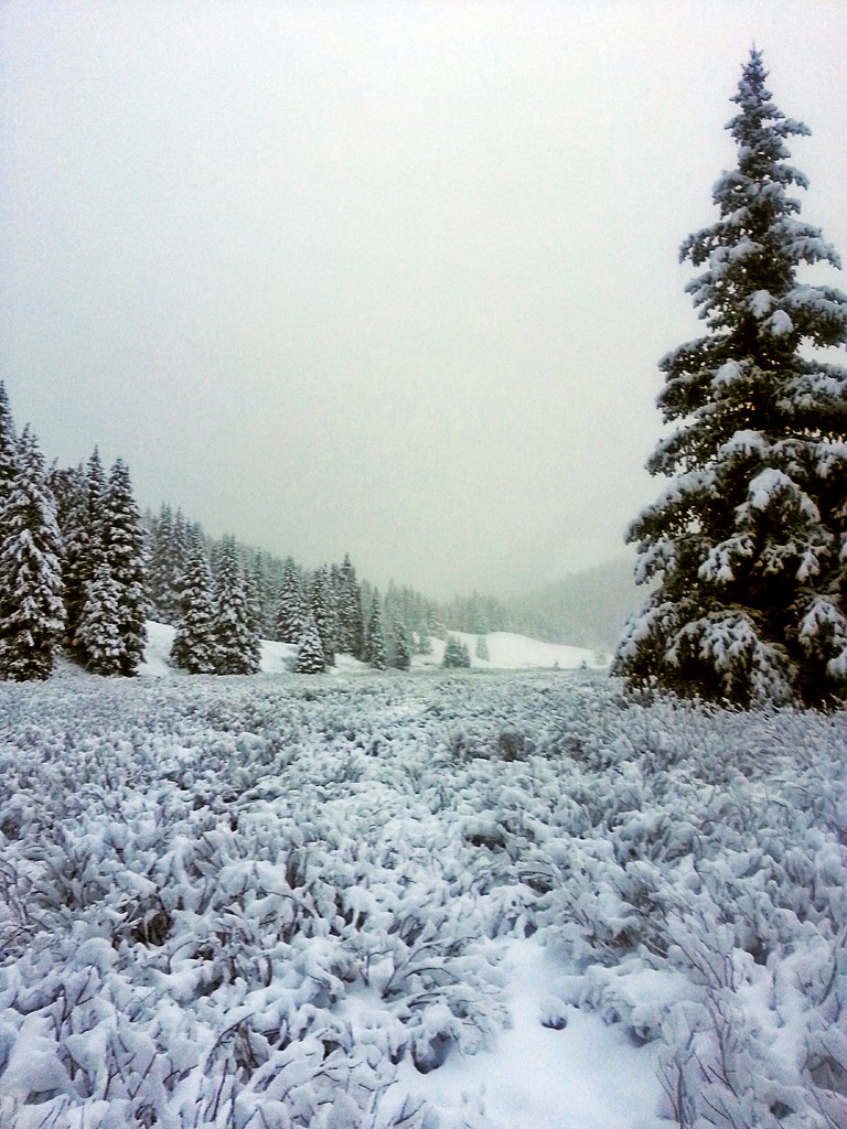
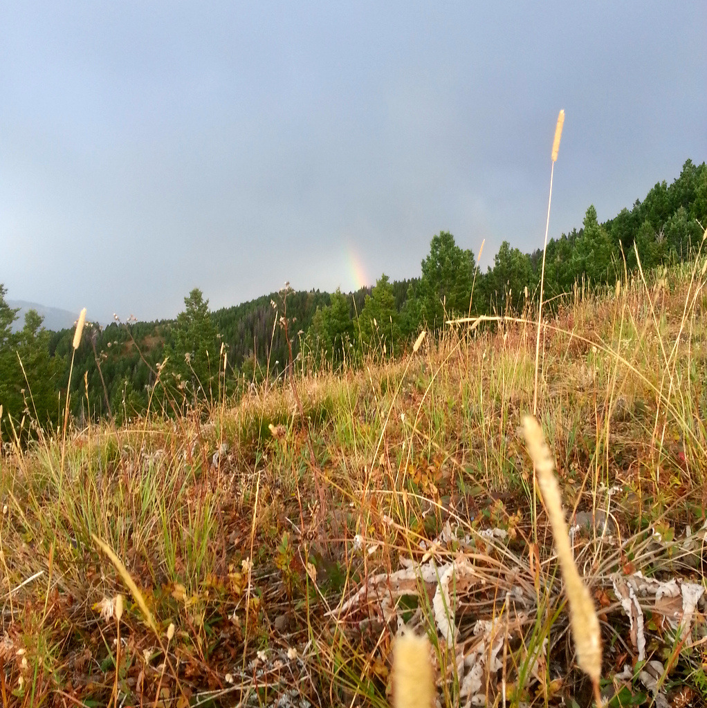
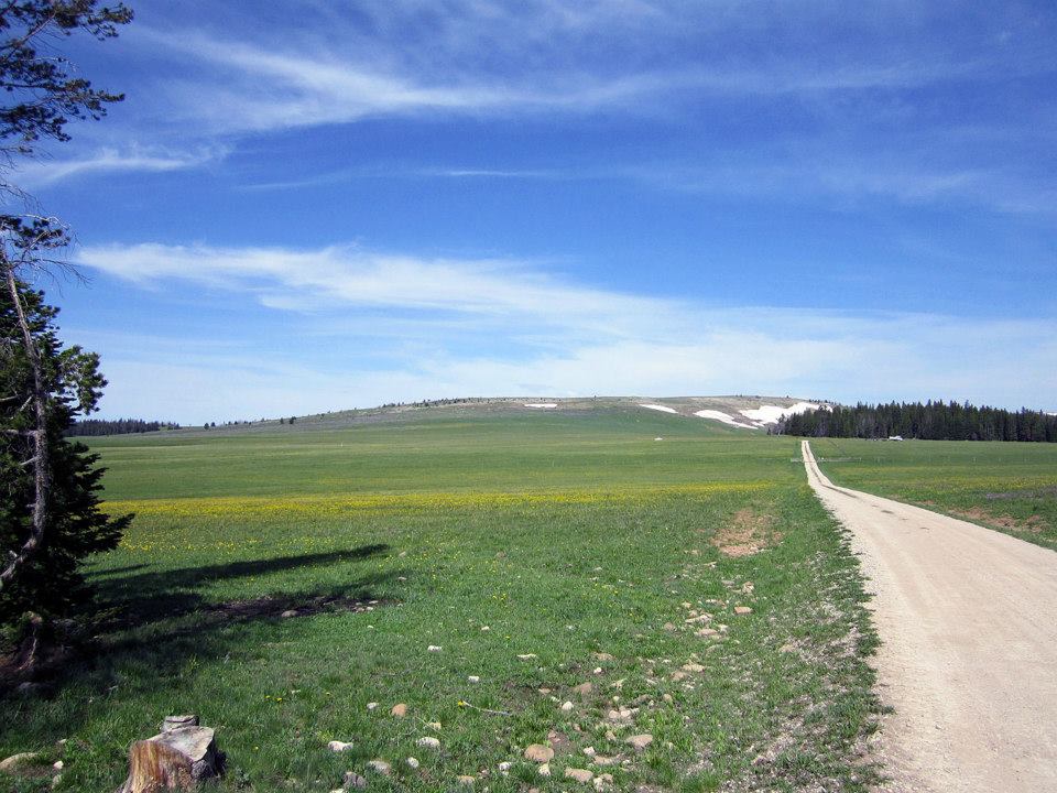
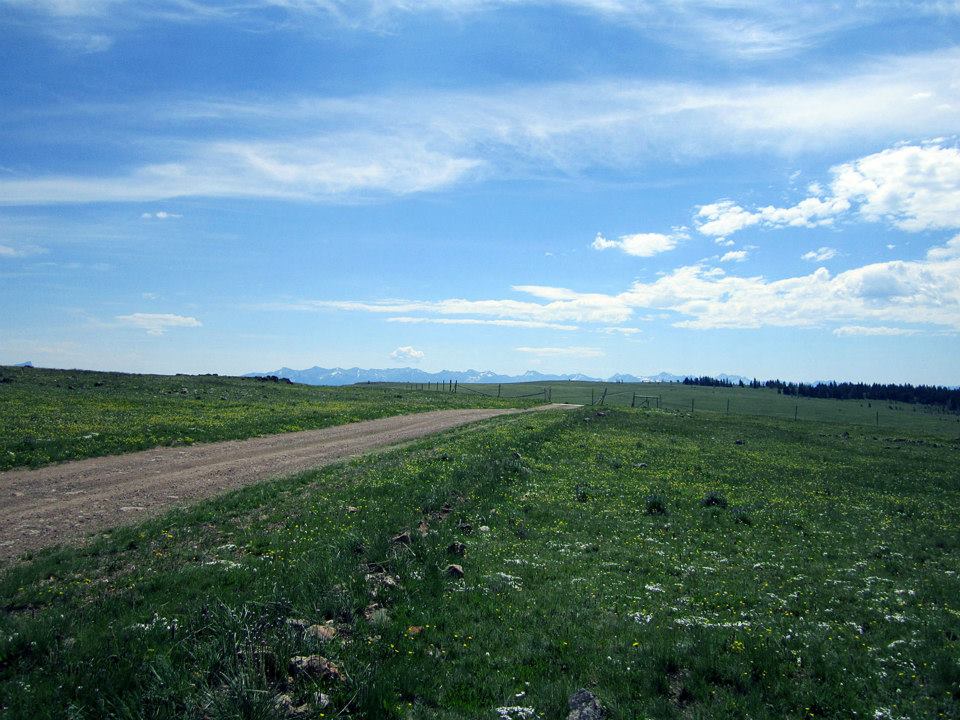
Our Friday itinerary was simple; follow the Gravelly Range Road South for about 20 miles to the impressive Black Butte massif, find a camp and then set out to climb the peak.  Coffee was made, a variety of pancakes, bacon, and fruit was consumed at a leisurely pace, and rigs were packed.  We set out on the road through what was to be the first of  three days of supreme scenery.  The north-facing ridges held slithering slices of snow, the meadows were a carpet of wildflowers in a vast array of colors, and the horizon in all directions was a sea of peaks both jagged and smooth.


gravelly-road4


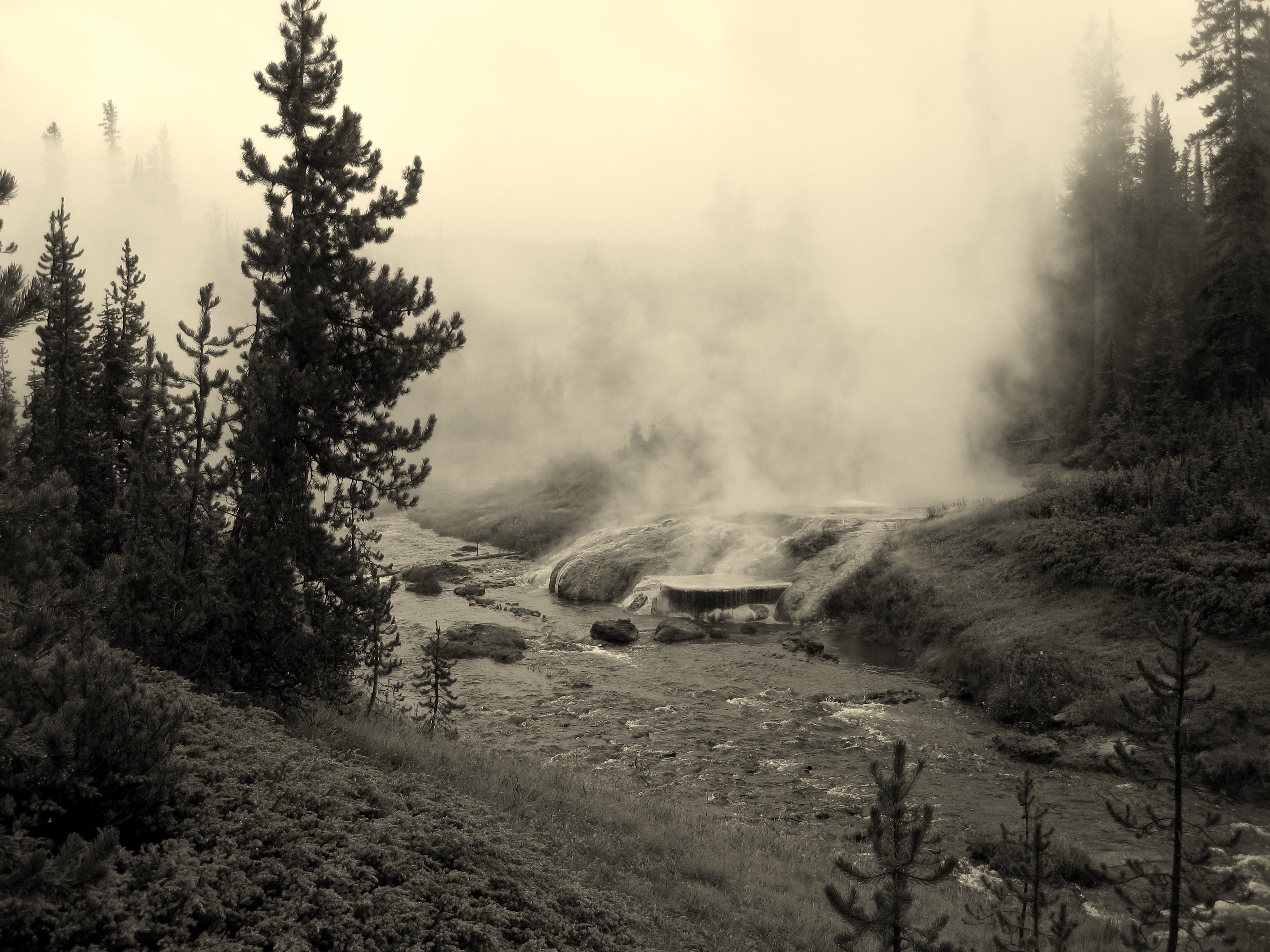
A friend was riding his dual sport motorcycle to meet us at Camp Two so we scouted around Black Butte to find our next home.  Nothing in the direct vicinity felt perfect so we left the main Gravelly Road and down Standard Creek Road a few miles until another lovely prairie of wildflowers revealed itself.  The Gravelly Range Road doesn’t see a large population of traffic but the Forest Service manages camping and requires motorized camping parties to stay at sites marked with a small sign.  The rules are loose regarding what you can do at the sites so we typically spread our rigs out across an area encompassing about an acre and all the sites we saw and stayed at were very nicely rehabbed and it was clear that those who visit the area respect it greatly.  Only one fire ring was at any of the sites and ruts and tire tracks were basically non existent.


gravelly-fj62-jeep


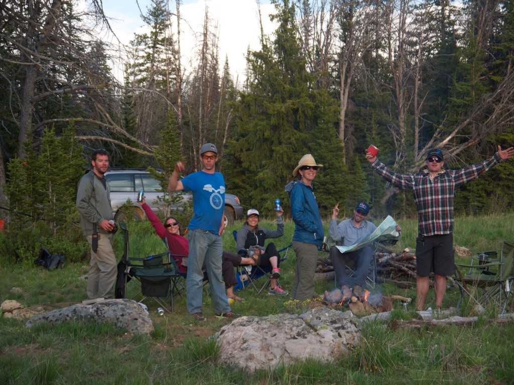
We all opted to simply loaf around most of the day, napping, taking the little Honda Trail 90 (carried on a hitch haul on the back of one of the Cruisers) for quick spins around, and target shooting pistols and rifles at a 50 yd target.  Rain came and went intermittently as is common when camped up near the high alpine so we opted to save a hike to the summit of Black Butte until the following morning.  Two of our party boiled up a massive vat of shrimp, potatoes, and corn on the cob which we ravenously devoured alongside copious cans of beer ’round the fire.


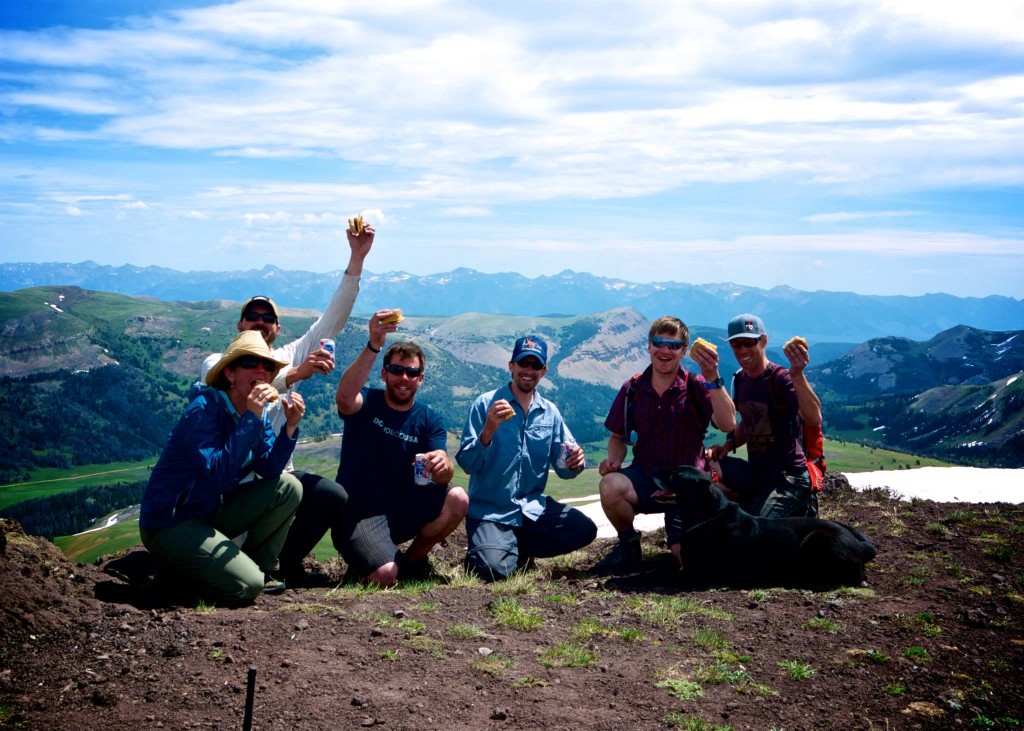
Day three dawned and the coffee flowed freely.  Our dual sport biker had arrived at the end of the previous day and he set out to thank us for carrying much of his gear in the trucks making his bike light and nimble by producing a feast of eggs and fresh veggies wrapped in tortillas.  After all were satiated with breakfast I put together a pound of hamburger patties for our Summit Cheeseburger attempt at Black Butte.  Camp packed up quickly and easily – the group of eight of us all working independently but efficiently at a remarkably similar pace – and we were on the road and to the base of the peak before 11am.


gravelly-road1


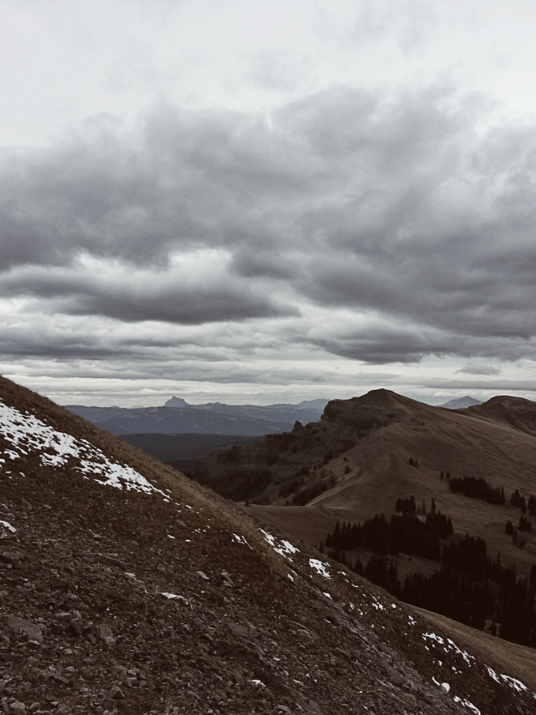
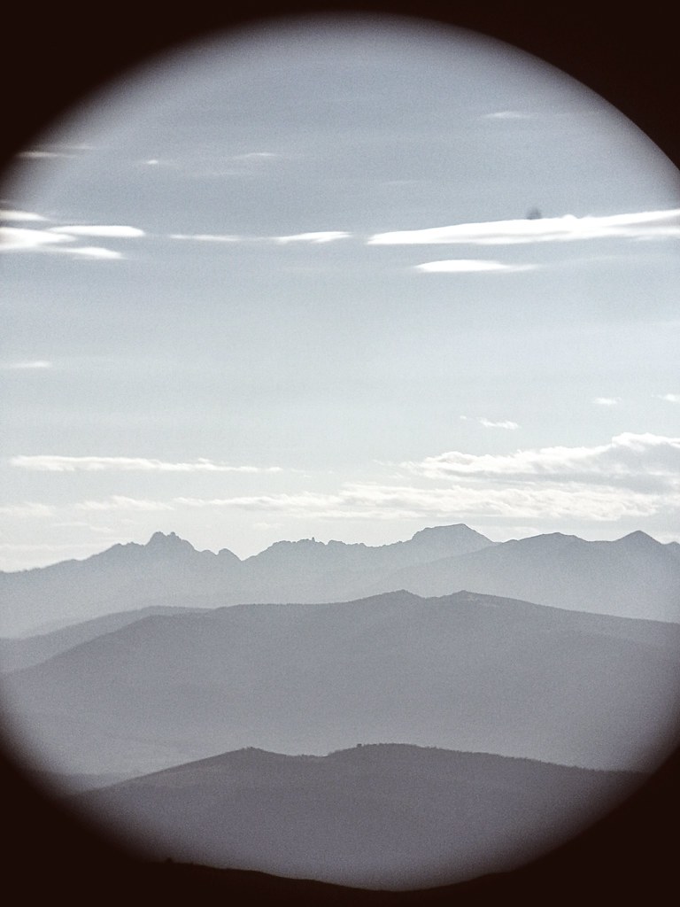
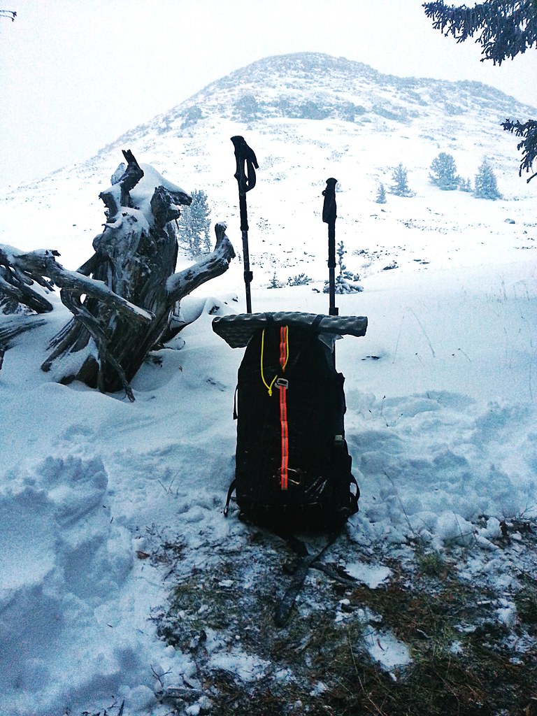
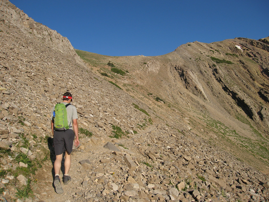
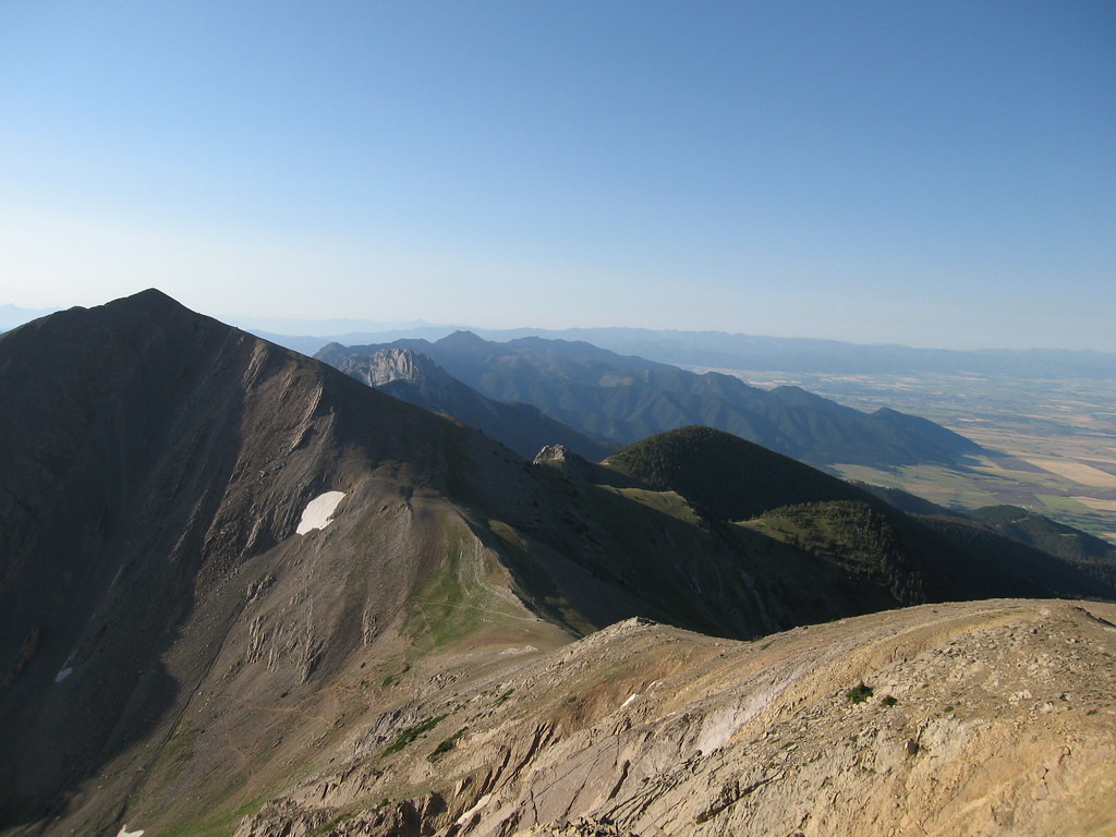
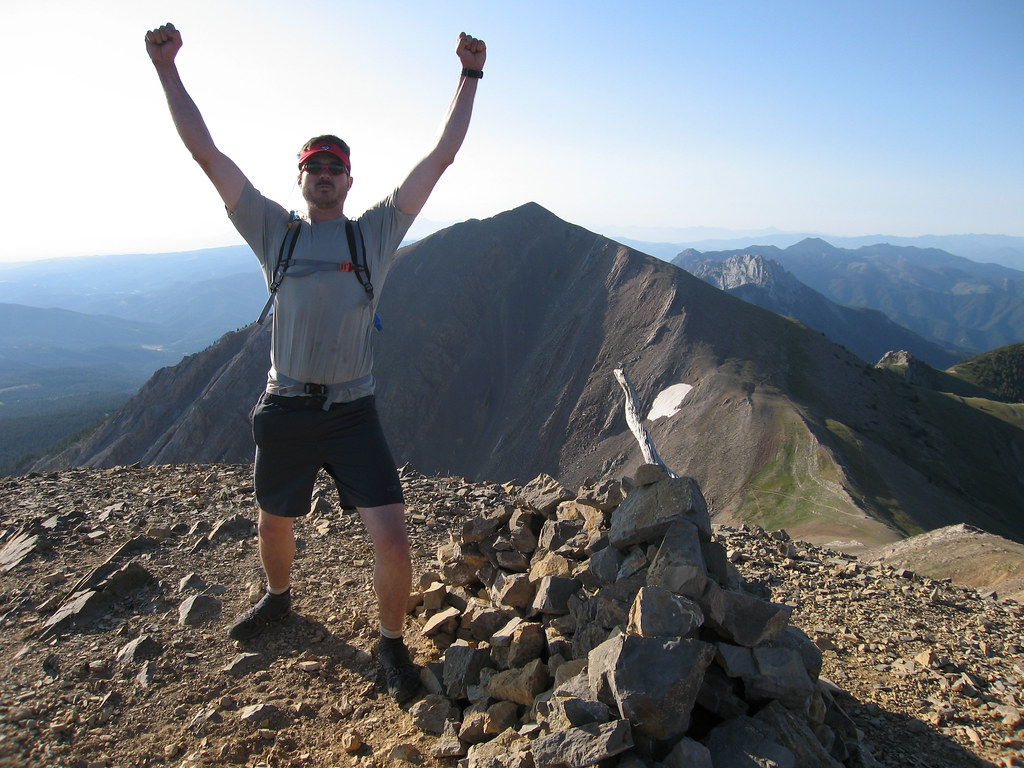
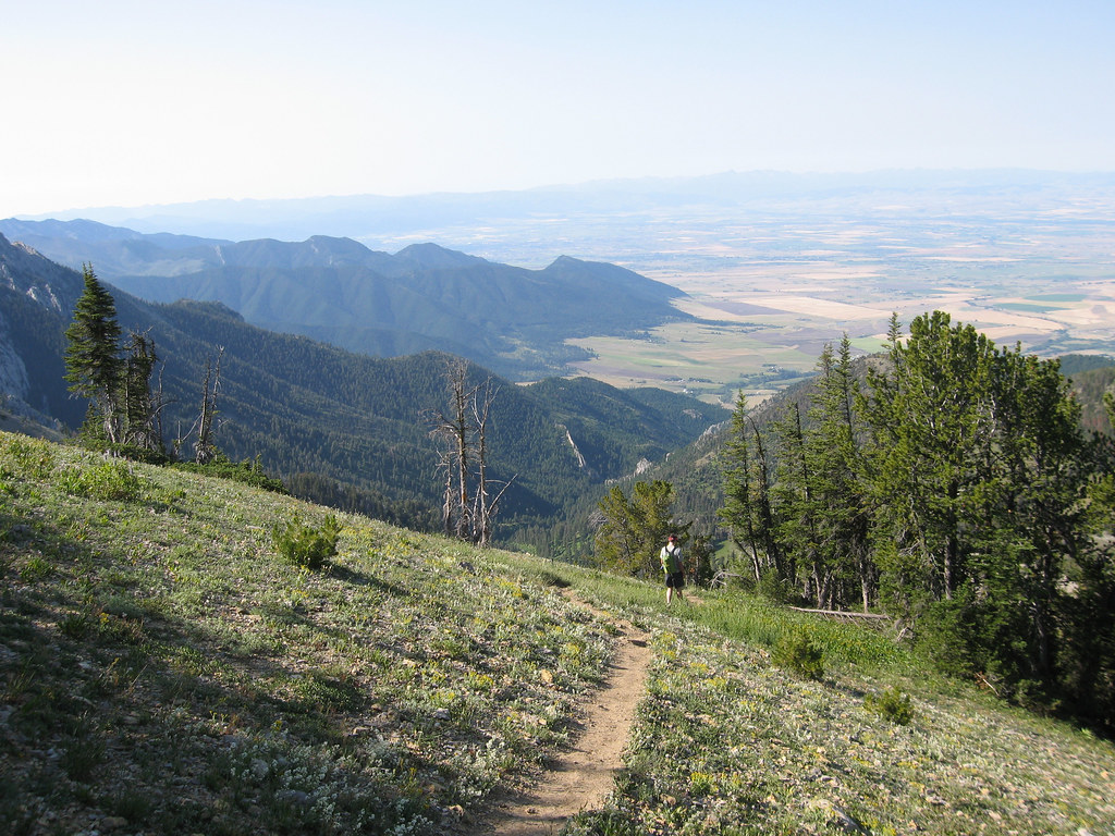
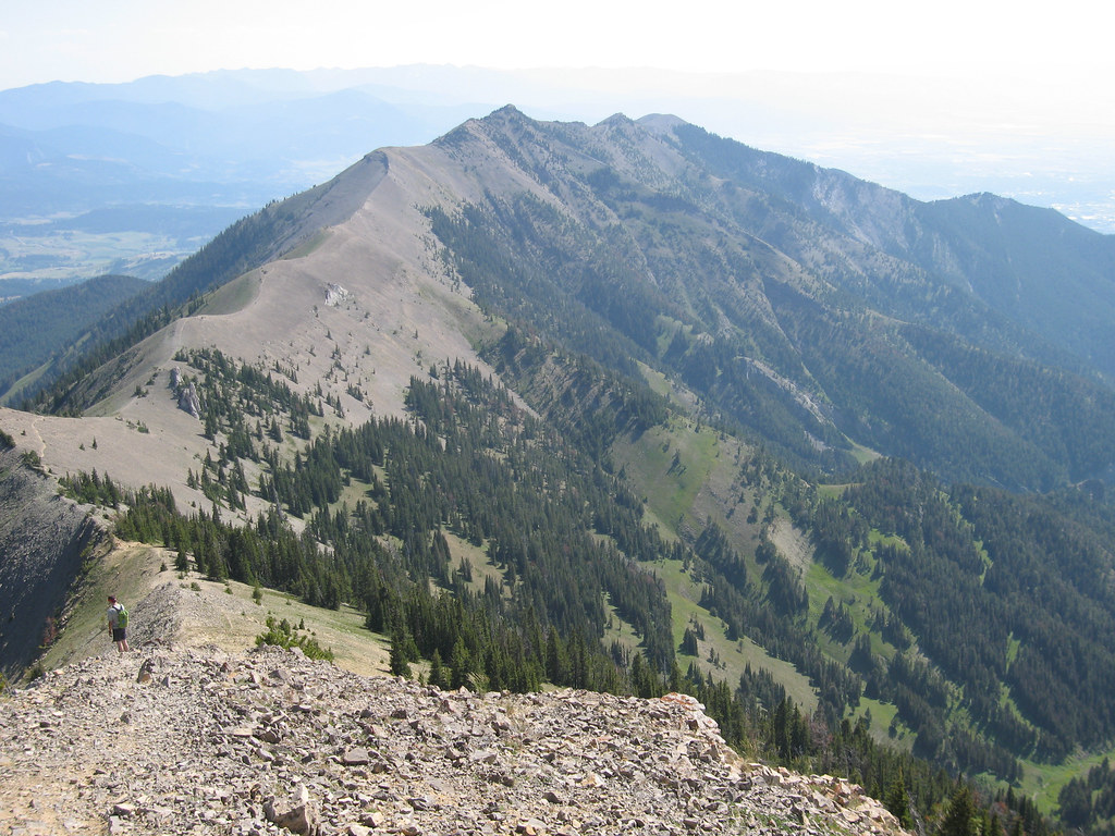
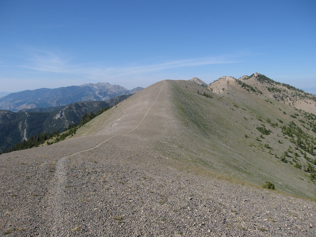
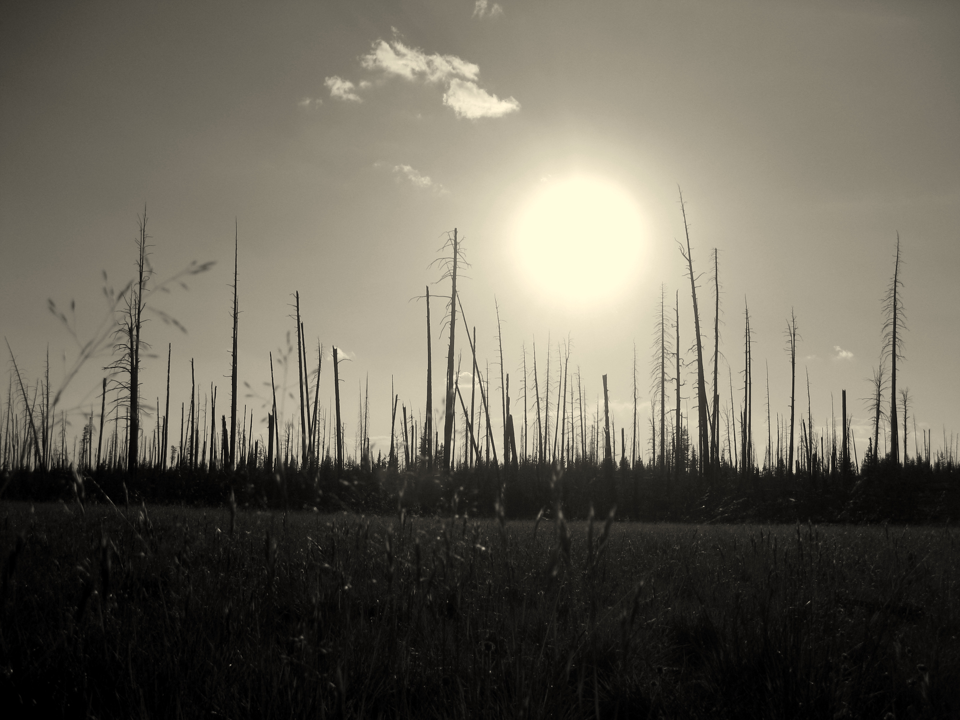
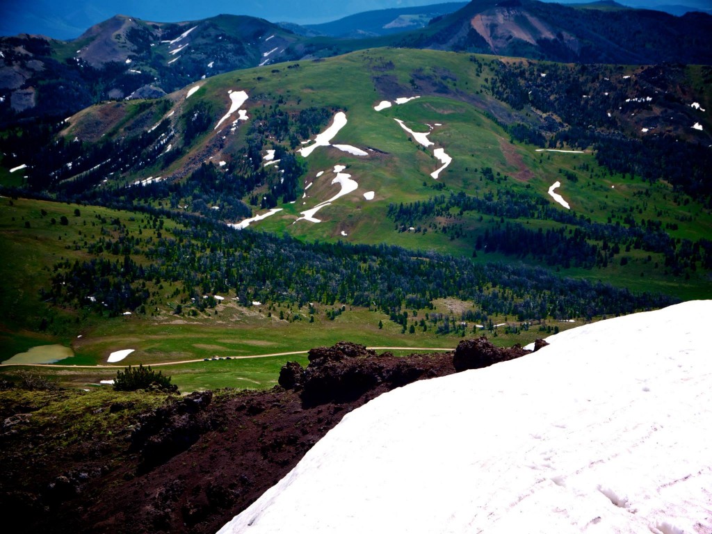
Sunscreen was applied, the fixins for cheeseburgers, a cold can of beer, rain jacket, and water bottle were in my pack and we set out offtrail toward our mountain.  Surprisingly we ran into a few other hikers out to climb the peak as well but they were a decade or two older than us and moving a bit slower so we said hello and continued up.  The climb was simple and directions were aided by previous climber’s cairns.  Only a small amount of snow covered the route which was easily bypassed and the going was smooth on a well worn social path.  We summited in glorious sunshine with views that ranged for many dozens of miles.  A slight haze, probably from a far-off forest fire clouded the horizon but the peaks of the Madison Range, Snowcrest Range, Greenhorn Range, Pintlar Range, Belts, and Tobacco Roots were striking and awe-inspiring.  We nommed cheeseburgers, posed for a photo, and enjoyed a cold beer, relaxed at 10,542 feet before setting back down to the rigs.


gravelly-summitcheese


gravelly-summit


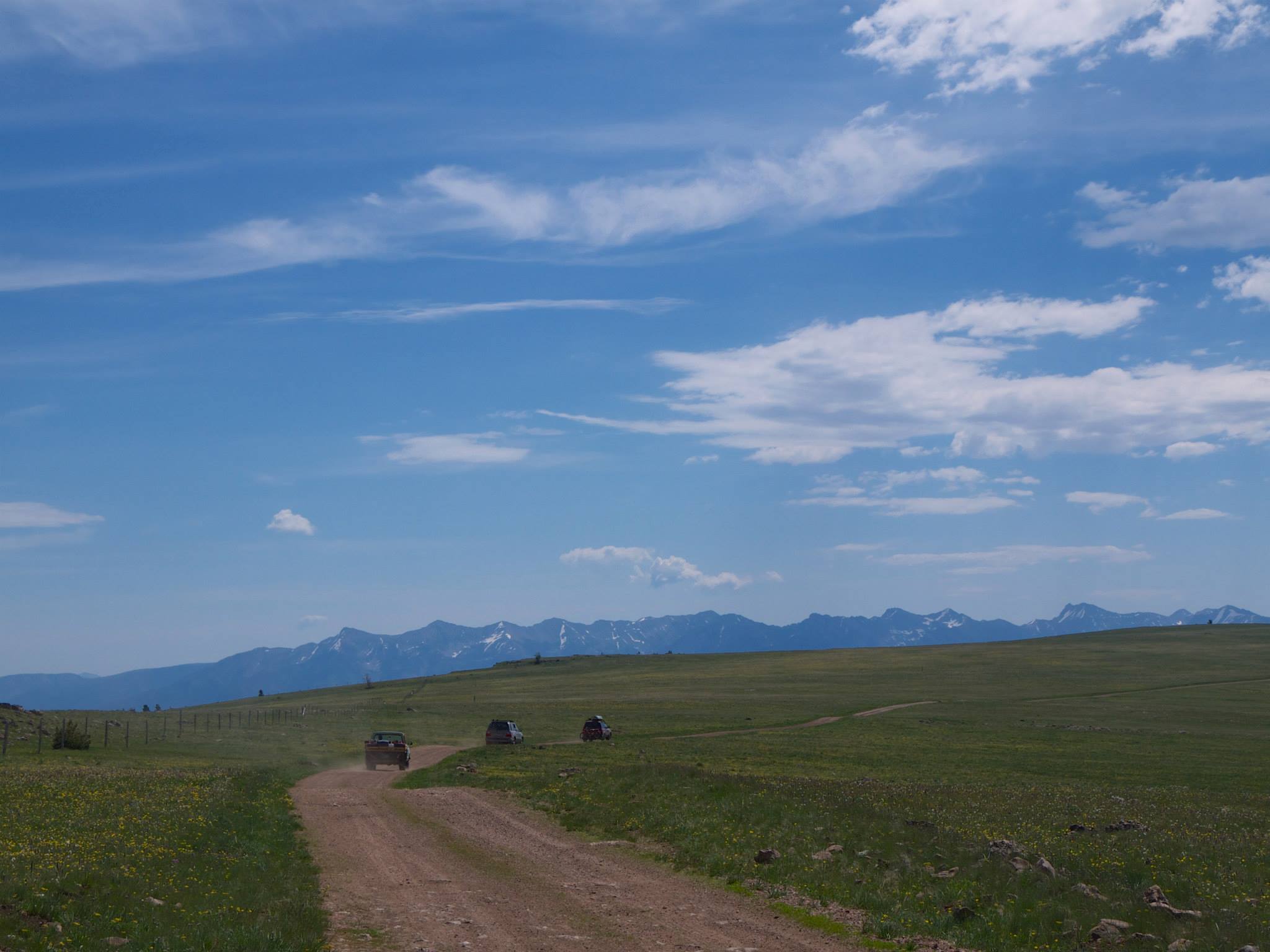
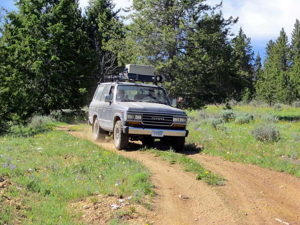
The drive that day was to be a long one and would include finishing the first leg of our trip – the Gravelly Ridge, followed by a slightly higher speed section of wide gravel along the Ruby River – the second leg of the trip, and the start into the technical third leg of the trip – a climb up and over a high pass.  The day was hot, but the breeze from atop the remaining miles of the Gravelly Range Road were heavenly.  The wildflowers were so exquisite that every single twist and turn or up and down section of the road created a new micro ecosystem for a different variety to thrive.  The colors across the landscape were simply alive.


gravelly-wildflowers


Dropping steeply and quickly off the high ridge and into the dusty and dry Ruby River Valley was a bit shocking.  We sped up to keep the air moving and to get some miles under our tires as we needed to get North to our final camping destination.  We made good time and enjoyed the scenery of the Ruby River.  It provides exceptional Grayling fishing and there were many campsites set up alongside with dozens of fishers wading the cool waters.


We reached the Ruby Reservoir, drove a few miles of required asphalt before turning off the highway, crossing a telltale sign of good things to come – a cattle guard – and then turned our speed back down to more of a crawling pace as we made our way up Barton Gulch.  We had FRS walkie talkie radios with us and communication was back and forth as the rigs spread out aways down the canyon.  The group became separated when one of the rigs decided to overheat and another decided it’s lack of fuel injection on the steep slopes was problematic.  After some radio silence issues and not having the whole group together the leaders backtracked until we were all at the same spot giving the Land Cruiser some time to cool down.  Beers were popped, a box of cookies was passed around, and tunes were turned up for a little backwoods dance party session.  Regardless of some minimal mechanicals, the heat was subsiding as the afternoon turned into evening and everyone was in great spirits.


gravelly-group


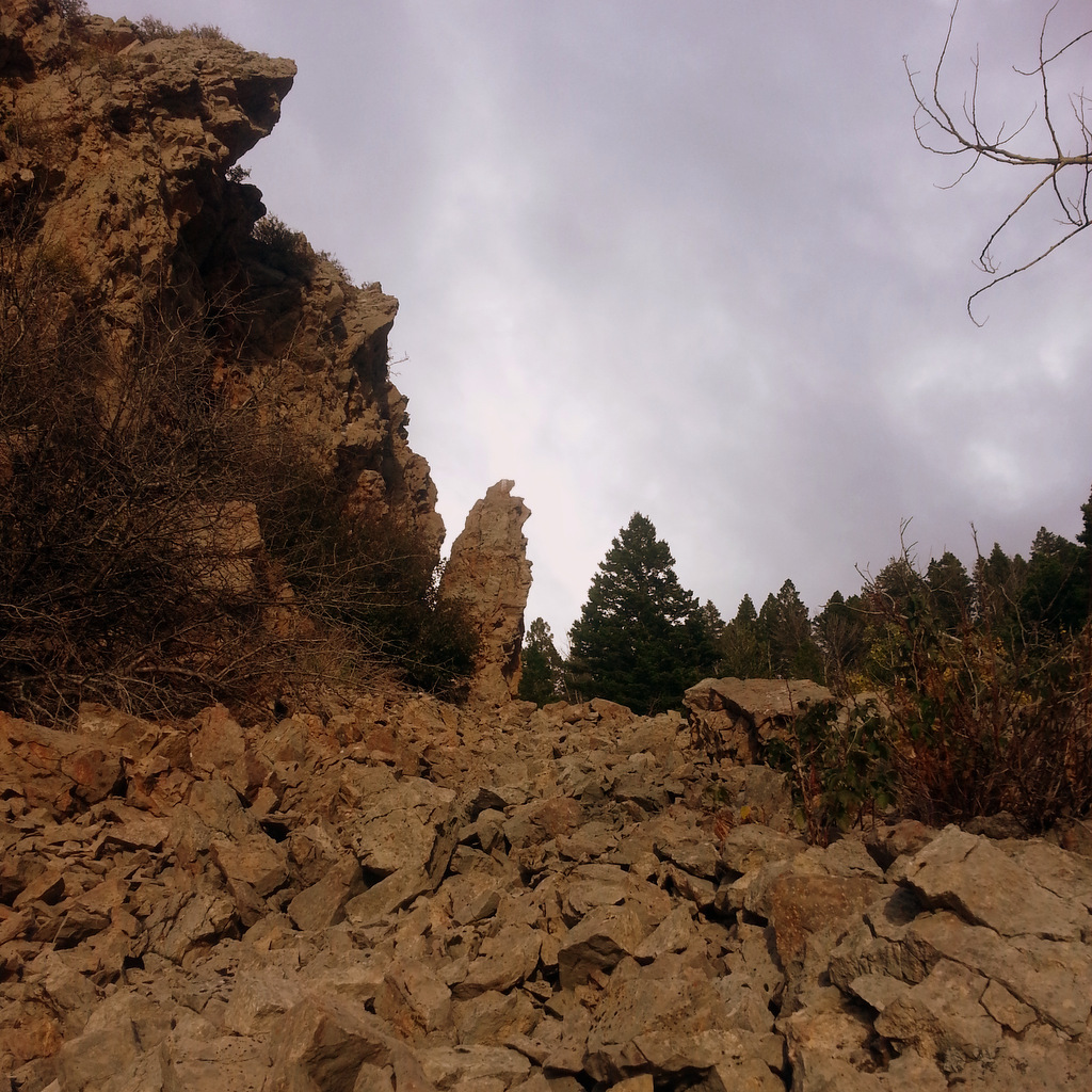
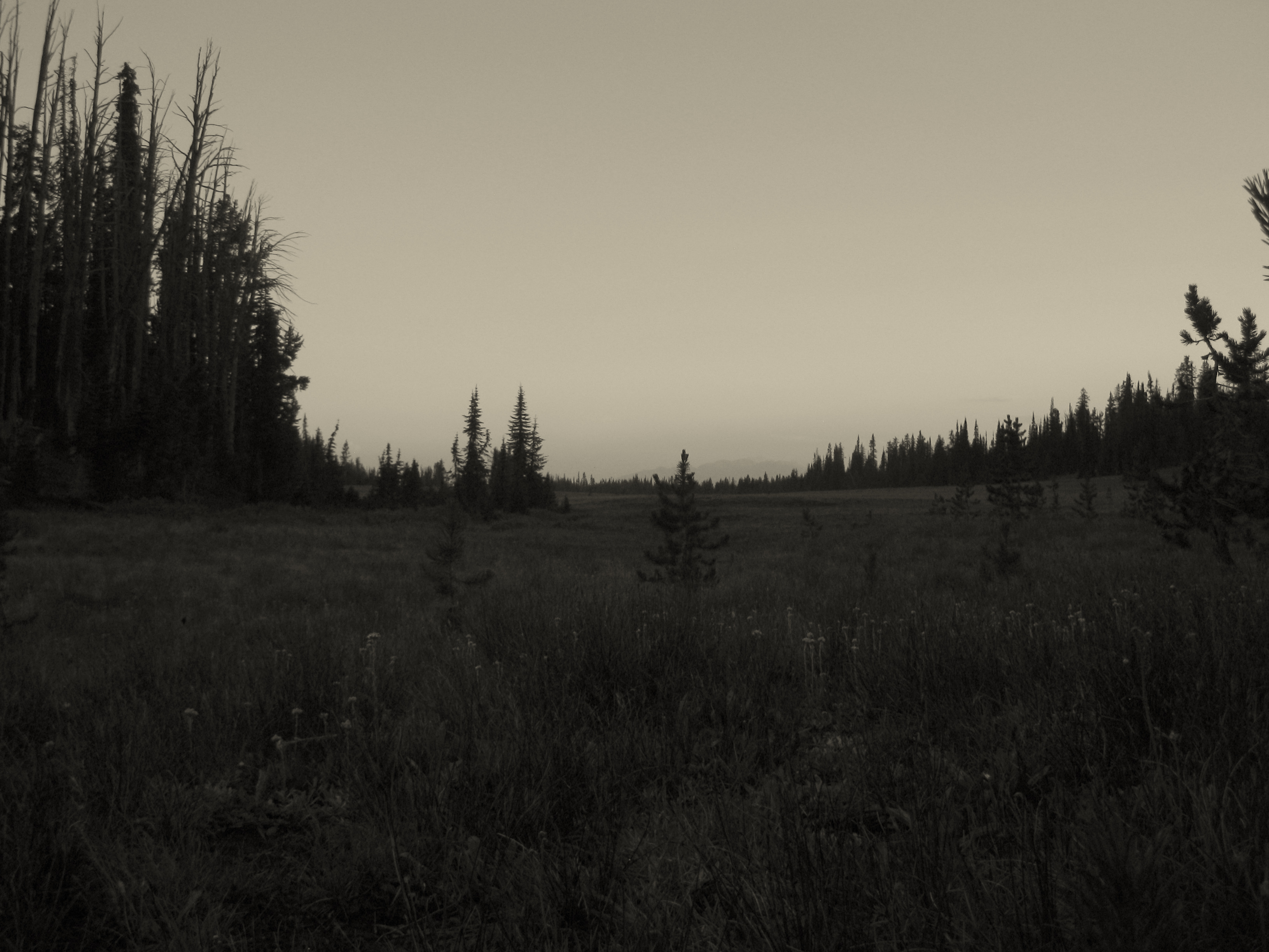
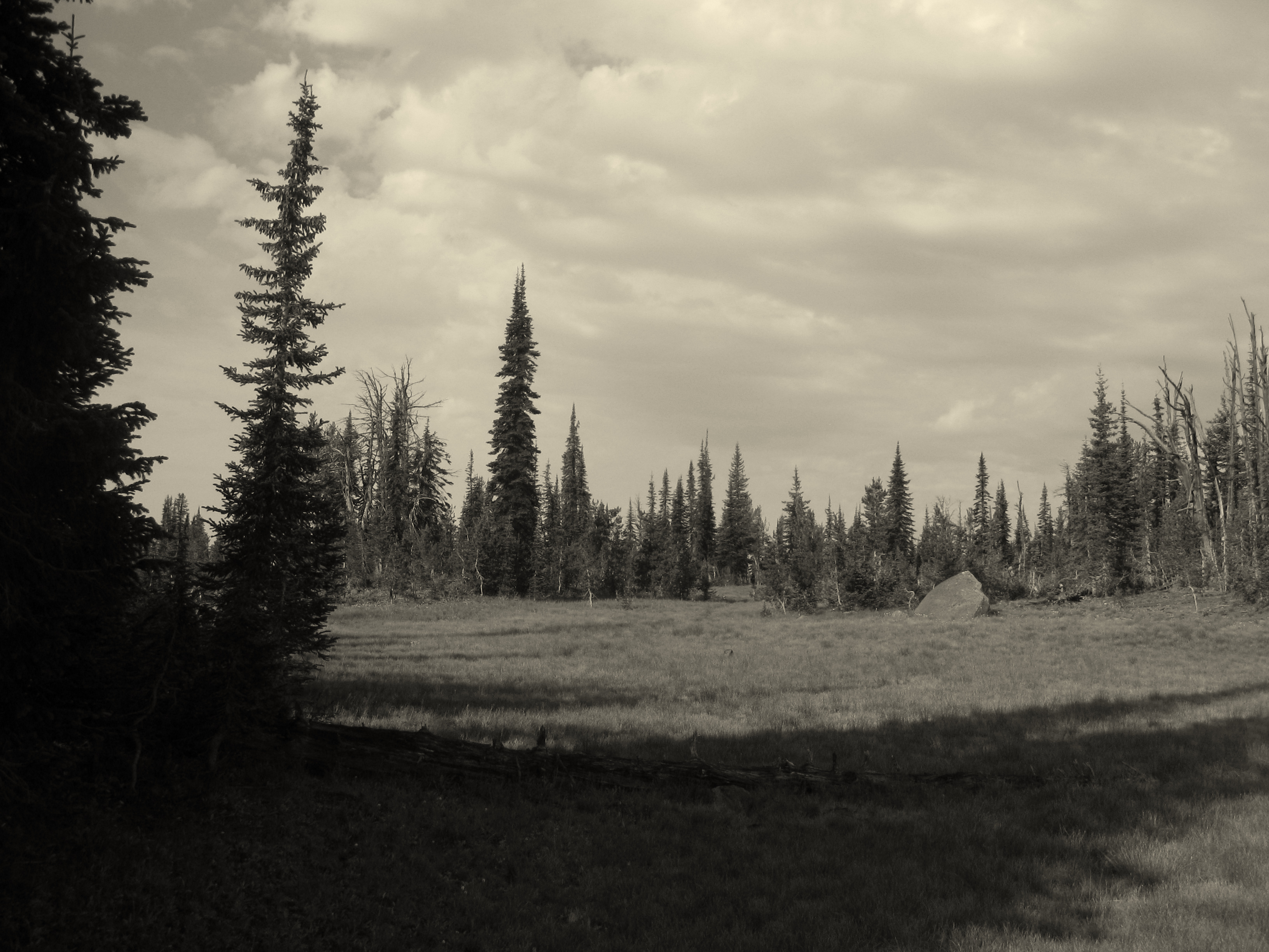
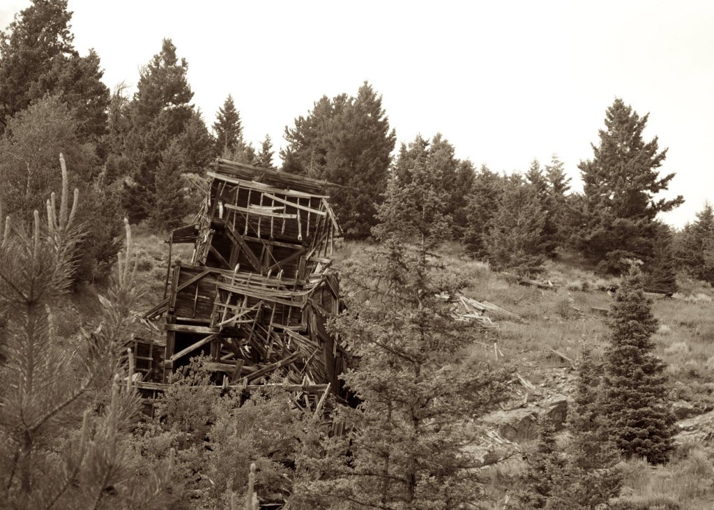
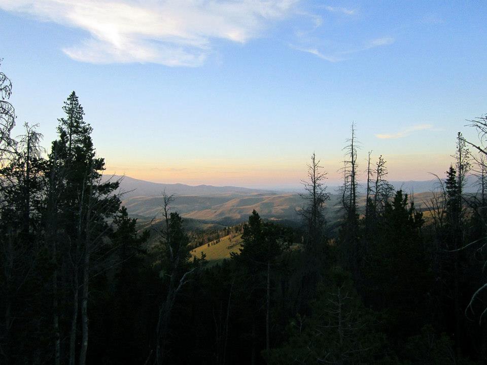
The next few miles of road were to be the most technical of the trip and everyone dialed the techy parts excellently.  The bike was out ahead followed by the two mechanically-prone rigs and the rear was trailed up by the remaining rigs.  We maintained constant radio comms this time around just to be sure.  Hubs were locked, 4wd was on, and the driving was sublime.  An abandoned mine halfway up provided for a photo op along with a few other hulks of buildings long forgotten.  The highlight of it all came as we crested the top of the pass and were treated to what would be our campsite for the evening – a glorious open area at 8500 ft complete with views to both the East and West with just the right amount of shade for the morning, and enough firewood for myriad evenings of relaxing.


gravelly-mine


gravelly-summitcamp


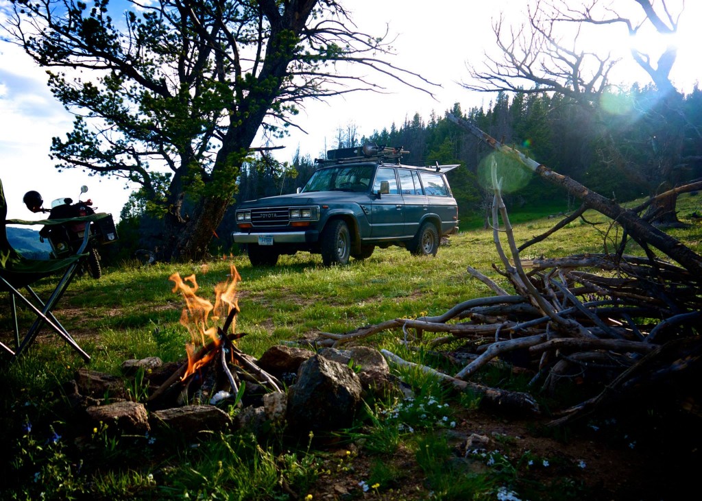
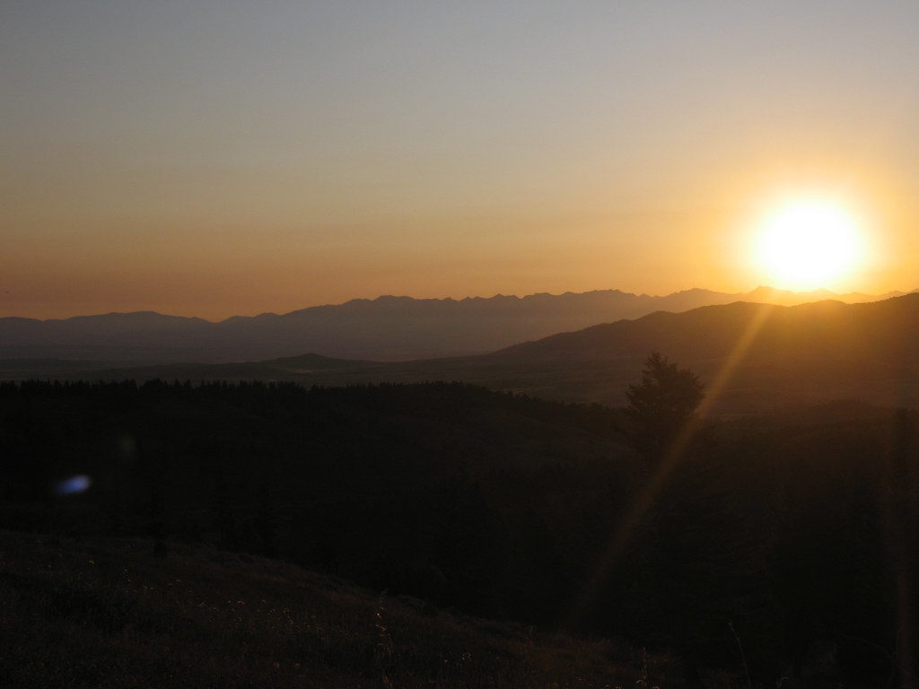
The group fell into the routine of setting up camp.  Dinner and fire-making duties were performed without anyone asking anyone else.  A potluck of grub was laid out on the table and the dwindling beer supply went down can after can.  The alpenglow on the surrounding peaks was stunning and as we watched it fade away into night we were all beside ourselves with how gorgeous the place we live is.  We stayed up around the fire for awhile longer until tiredness overcame each of us at our own pace and then wandered off to our respective places to lay our head.


gravelly-sunset


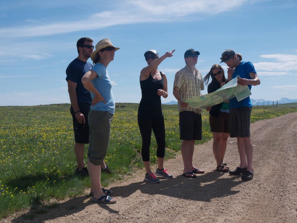
The morning dawned crisp, clear, and just the right amount of chilly.  We breakfasted on great chow with coffee and orange juice and pondered our maps for the final leg of the journey.  A last minute decision to take a route different than the one I had planned prior to the trip (a decision we would later regret but also made us decide to come back someday) and we set off on a steep jeep trail down into a side canyon toward the main draw of Alder Gulch.  It was a relatively short drive the rest of the way out Alder Gulch to the historic town of Virginia City – home to history’s largest silver placer mining operation.  The town was abuzz with tourists as we pulled our dusty rigs off the dirt for the last time and onto the pavement.


gravelly-fj62


Our next destination was back to the town of Ennis and a visit to the local hamburger joint owned and operated by the area school teachers called the Sugar High.  We pulled in a couple minutes before they opened, got in line for cheeseburgers, fries, and malts which we leisurely ate in the shade alongside the restaurant.  The return trip back to Bozeman was leisurely and my wife and I even treated ourselves to the air conditioner in our FJ.  The drive is one we’ve made many times but is beautiful each and every and we thoroughly enjoyed it.  There was a bikini hatch happening on the Madison along the popular “booze cruise” stretch and in the heat of the afternoon a refreshing dip seemed pretty good but we kept on along and were hope at a reasonable hour to do some cleaning up and prepping for re-entry back into society on Monday.


gravelly-group


This region is very vast and I expect we’ll return to visit some of it’s nooks and crannies on foot and on bicycle someday but as a primer, driving this large, primarily gravel loop was a stunning way to see the country.  Very few others were out and about and the camping was exquisite and plentiful.  My recommendation to follow our route or one similar is very high.  Big sky country indeed.


gravelly-rigs


gravelly-map

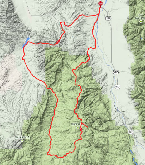
The GPS route of this trip can be found on the everytrail.com page, Gravelly Range Backcountry Drive – Montana.


Practical Bicycling in Bozeman and Beyond

In May of this year I participated in the 11th PechaKucha Bozeman with my presentation of “Practical Bicycling in Bozeman and Beyond”.  The format for PechaKucha is the display of 20 photo slides for 20 seconds apiece.  As a proponent of bicycles as a means of everyday transportation I felt it would be a worthy topic to share with the community.  The fruits of my labor are available to anyone who has seven minutes of free time via Youtube.