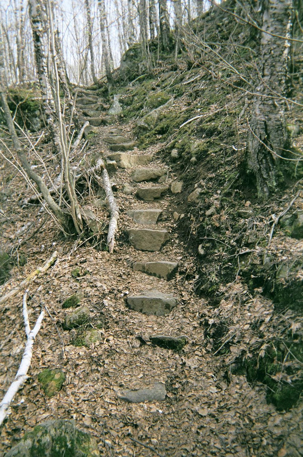
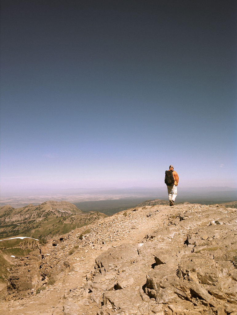
The following is the trip report from my 2007 thru-hike of the Pacific Northwest Trail which I hiked end-to-end in East to West starting at Chief Mountain Ranger Station in Glacier National Park, Montana and ending at Cape Alava in Olympic National Park, Washington. The trip report was written originally in 2007 and was not posted on my “current” blog until 2024.
I completed the trail in 61 days, taking three zero days, and averaging approximately 20 miles per day. Re-supply was a combination of mail drops (thanks, Mom and Dad!) and grocery stores and ranged in length from everyday (grocery) to a max of nine days.
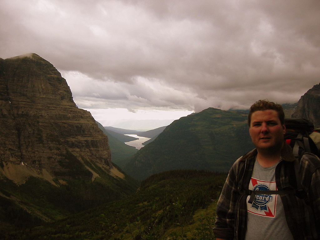
I hiked the trail solo, in ultralight style employing some common gear in that style such as a frameless rucksack, spinnaker-cloth tarp, goose down sleeping quilt, paltry torso-length foam sleeping mat, carbon fiber trekking poles, and stainless wood burning stove. The complete gear list is available for viewing here.
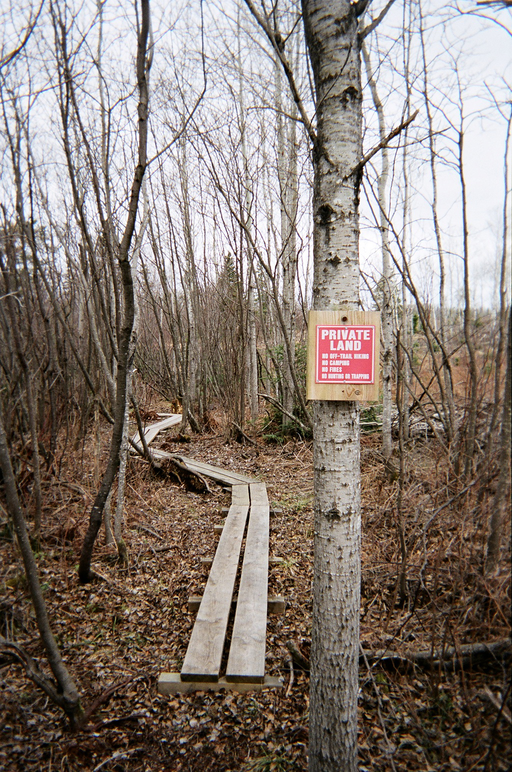
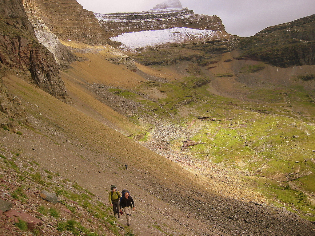
If you are considering a thru-hike of what is now – thanks to the tireless efforts of people like Ron Strickland, Jon Knetchel, and the Pacific Northwest Trail Association – a federally protected National Scenic Trail I recommend the following preparatory work. The trail is mostly unmarked and although the maintenance routine is growing there are many lengths of trail in NW Montana and across Idaho that are little more than game trails or seasonal hunting trails denoted by little more than a sawn log here and there so be comfortable with your ability to “find the way”. Secondly there are few other thru-hikers on the trail so do not expect a party. You may never even hike with another thru-hiker. The popularity of the trail is growing and I the number of thru’s ever summer is probably in the dozens but you may go two or three days in the more remote sections without seeing anyone at all.
Pacific Northwest Thru-Hike – June 21st through August 20th, 2007
I documented my hike in three methods all of which you’ll find below, in general order of how I shared it from beginning to end (photos being displayed throughout). Firstly I had my camera on my person at all times and I documented whatever caught my fancy in the moment. Secondly, I penciled a short journal entry at least once per day. Thirdly, during downtime at town stops spread across the trip I sent a “trail report” to a list of people who had requested to follow my journey via e-mail.
Thursday, June 21, 2007
Destination: Glen’s Lake Head
Starting Location: Chief Mountain Ranger Station
Today’s Miles: 13.00
Trip Miles: 13.00
Starting Off – Click picture to see full size
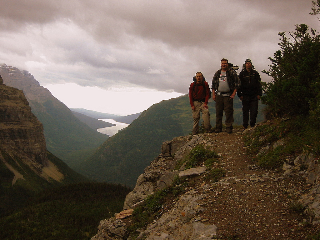
Day 01 of trip [still not at official PNT trailhead yet however]. Met lots of nice people, including Lindsay, East Side ranger [whom I knew from my former Park Service days]. Stoney Indian Pass sounds do-able according to Noel and Pete, Belly River B.C. rangers. Also talked to eight CDT thru-hikers.
Saw more than a dozen people today.
Time: 5hr 30min
Ascent: 620
Descent: 1040
Friday, June 22, 2007
Destination: Lake Janet
Starting Location: Glen’s Lake Head
Today’s Miles: 26.00
Trip Miles: 39.00
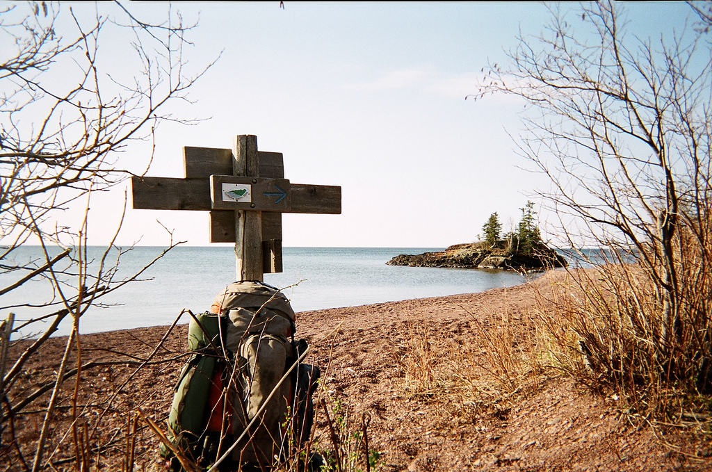
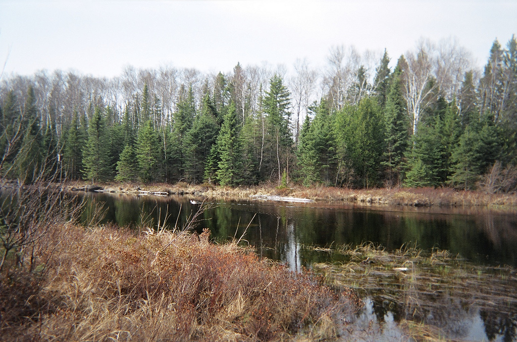
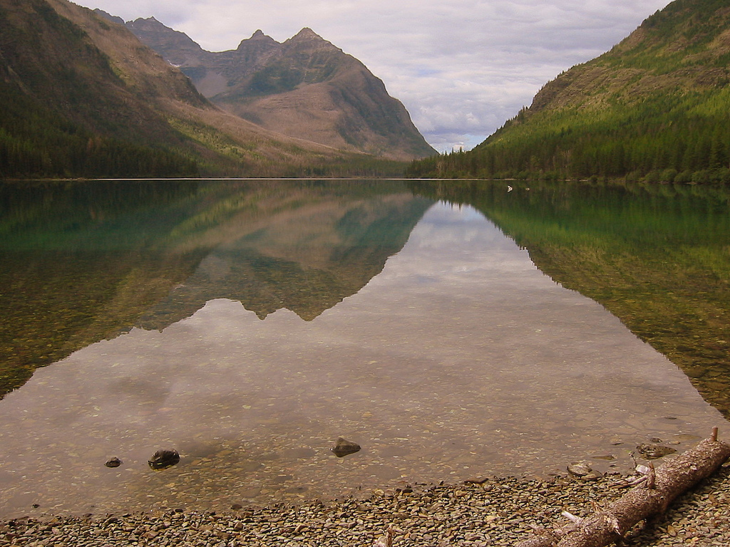
The Belly River Valley – Click picture to see full size
[This marks the official start of the PNT]
Ran into Lisa and the Belly River trail crew as well as Tony the Goat Haunt BC ranger. Stoney Indian Pass was snowy and I used my ice axe once but could’ve gotten away with only the trekking poles.
Saw more than a dozen people today.
Time: 9hr 30min
Ascent: 2830
Descent: 2610
Saturday, June 23, 2007
Destination: Upper Kintla Lake
Starting Location: Lake Janet
Today’s Miles: 16.30
Trip Miles: 55.30
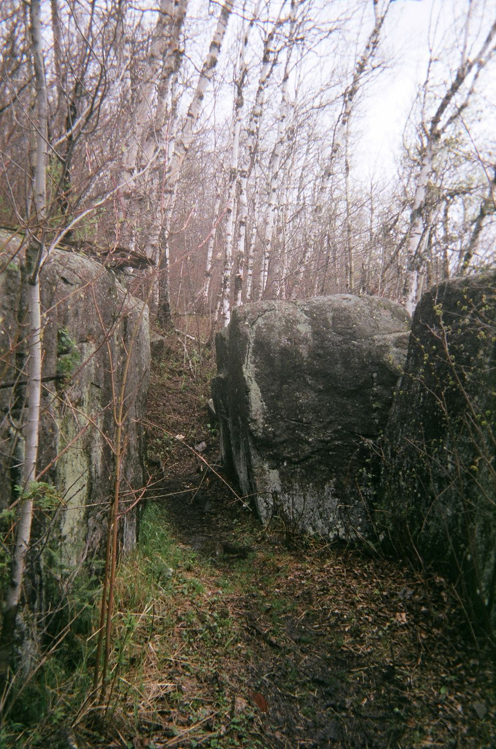
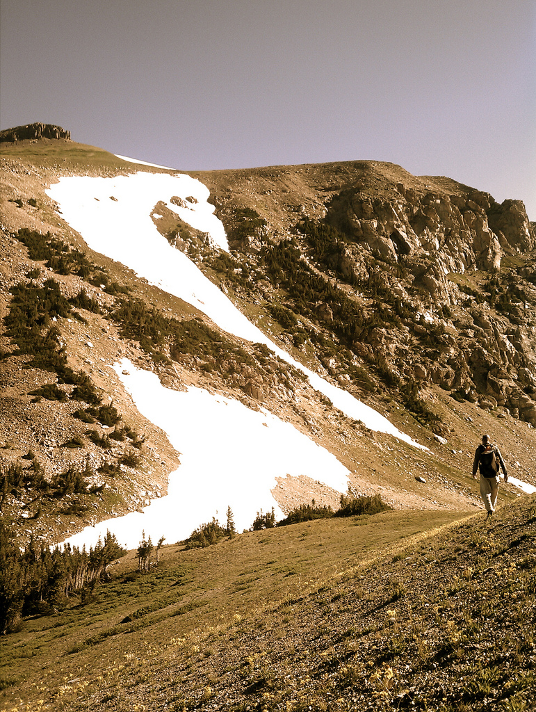
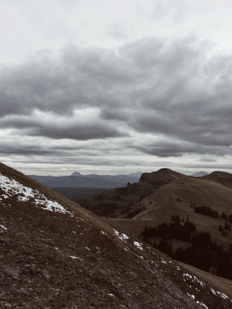
Nearing Boulder Pass – Click picture to see full size
Route around Hole-in-the-wall and over Boulder Pass was incredibly trying. Well worth it. Spent over two hours just traversing Hole-in-the-Wall cirque. Got lost coming off Boulder Pass ad bushwhacked some steep cliffs. All is well.
Saw no one today.
Time: 9hr 10min
Ascent: 2740
Descent: 3290
Sunday, June 24, 2007
Destination: Kintla Car Camp
Starting Location: Upper Kintla Lake
Today’s Miles: 12.90
Trip Miles: 68.20
My Gear – Click picture to see full size
Upper Kintla to Kintla car camp. Slept in, moved slow. Chatted all afternoon/evening with an unnamed fella whom has very deep understanding of the universe… more on this later I hope.
Saw more than a dozen people today.
Time: 4hr 50min
Ascent: 260
Descent: 600
Monday, June 25, 2007
Destination:
Starting Location: Kintla Car Camp
Today’s Miles: 0.00
Trip Miles: 68.20
Mom at Kintla Lake – Click picture to see full size
Zero Day – Awaiting Supplies
Tuesday, June 26, 2007
Destination: Weasel Cabin
Starting Location: Kintla Car Camp
Today’s Miles: 27.40
Trip Miles: 95.60
Moon over Kootenai N.F. – Click picture to see full size
Outside Glacier N.P. now. Late start (12:30). Late finish (10:45). Killer bushwack off Tuchuck Mtn.
Saw no one today.
12hr 15min
Ascent: 3460, Descent: 5480
Wednesday, June 27, 2007
Destination: Wigman Creek
Starting Location: Weasel Cabin, Kootenia N.F.
Today’s Miles: 16.70
Trip Miles: 112.30
Cooking near Wigwam Creek – Click picture to see full size
Flathead and Kootenia N.F.’s Lost route and side hilled – probably lost 2 hours. Camped at Wigman Cr.
Saw no one today.
Time: 7hr 30min
Ascent: 2450
Descent: 2370
Thursday, June 28, 2007
Destination: Riverside Park, Eureka, MT
Starting Location: Wigman Cr.
Today’s Miles: 21.50
Trip Miles: 133.80
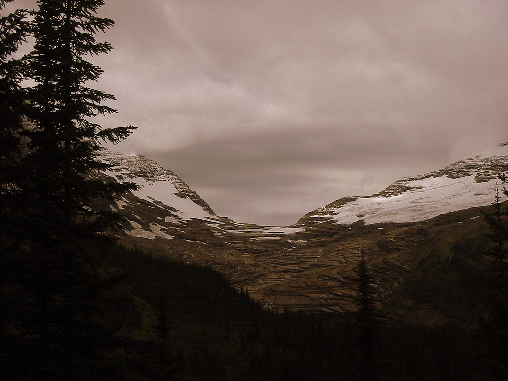
Snow in Ten Lakes Scenic Area – Click picture to see full size
Did probably 24 miles today, plus or minus one or two. Got lost coming out of Kootenia N.F. stumbled upon Sharon and Jeff Stensmen? Stengleman? at their home and they gave me a Coke and some fresh caught Kokanee salmon. Camped in Riverside Park Eureka. Five dollars with free shower. Had biscuits and gravy and borrowed dude’s laptop on hood of car for e-mail.
Saw more than a dozen people.
Time: 7hr 30min
Ascent: 2450
Descent: 2370
Friday, June 29, 2007
Destination: Webb Mtn Trailhead
Starting Location: Riverside Park, Eureka, MT
Today’s Miles: 12.30
Trip Miles: 146.10
Camp spot at Webb Mt. Trailhead – Click picture to see full size
My feet officially hurt now. Seven miles on pavement this noon didn’t help. Got town stuff taken care of, phone, email. Huge storm minutes before camp. Magically cleared up. Camped at Webb Mtn trailhead.
Saw more than a dozen people today.
Time: 8hr 0min
Ascent: 800
Descent: 860
Saturday, June 30, 2007
Destination: Gypsy Meadows
Starting Location: Webb Mtn Trailhead
Today’s Miles: 14.10
Trip Miles: 160.20
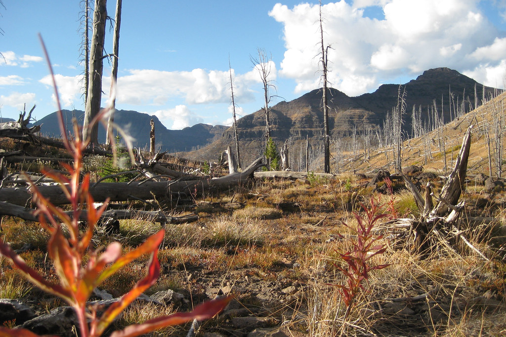
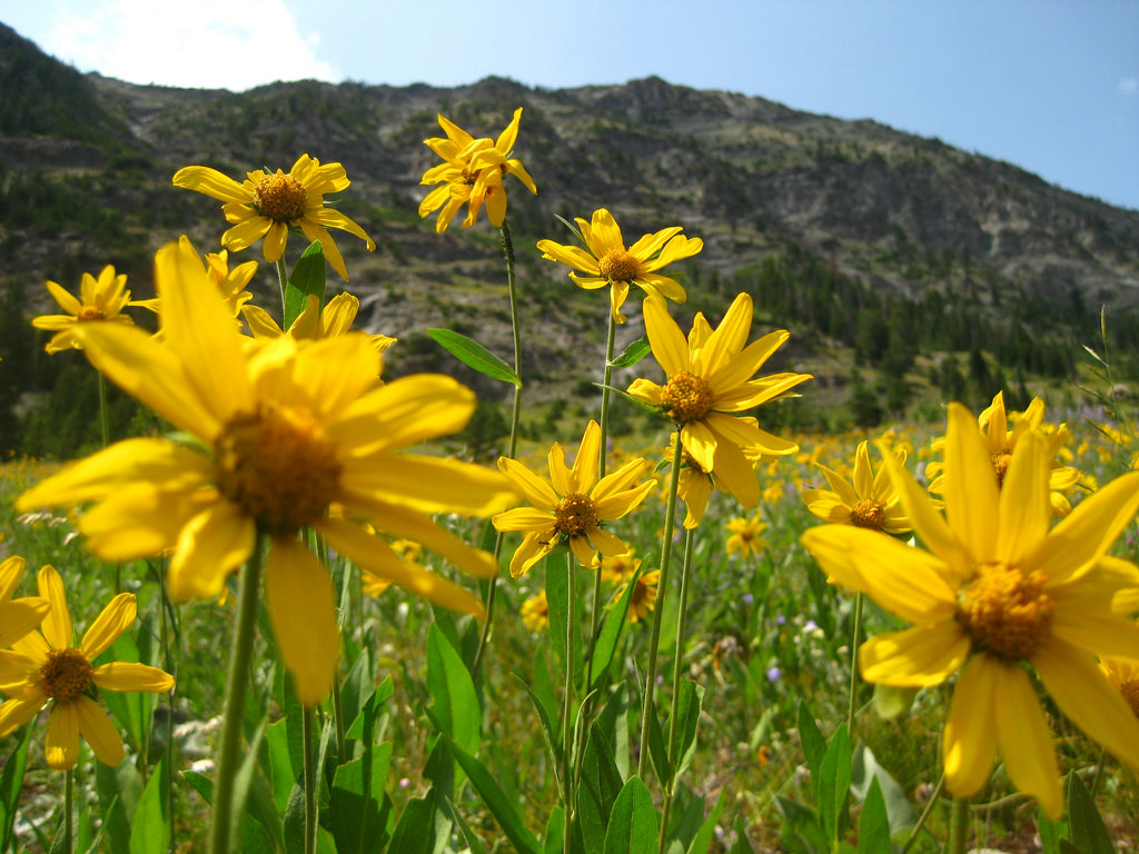
Indian Paintbrush – Click picture to see full size
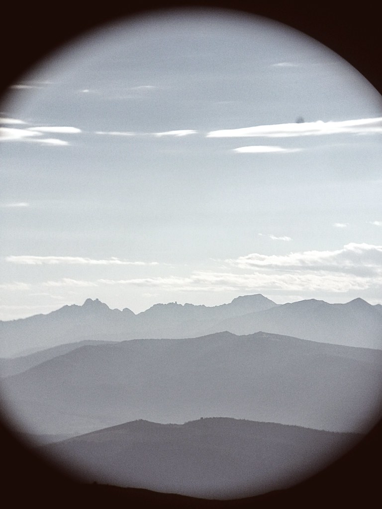
Long day, feet very sore. Webb Mtn lookout quite pretty. Used dude’s binoculars to see Stonehill [sport rock climbing area along Kookanusa Resevoir]. Camped at Gypsy Meadows.
Saw more than a dozen people today.
Time: 10hr 40min
Ascent: 5030
Descent: 1900
Sunday, July 01, 2007
Destination: Vinal Lake Road
Starting Location: Gypsy Meadows
Today’s Miles: 20.40
Trip Miles: 180.60
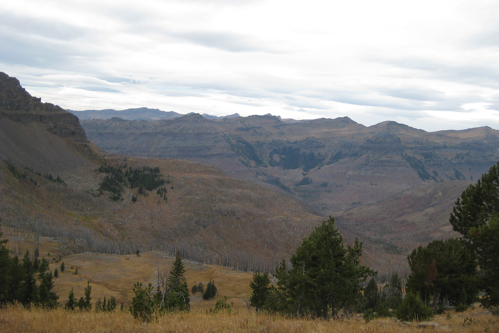
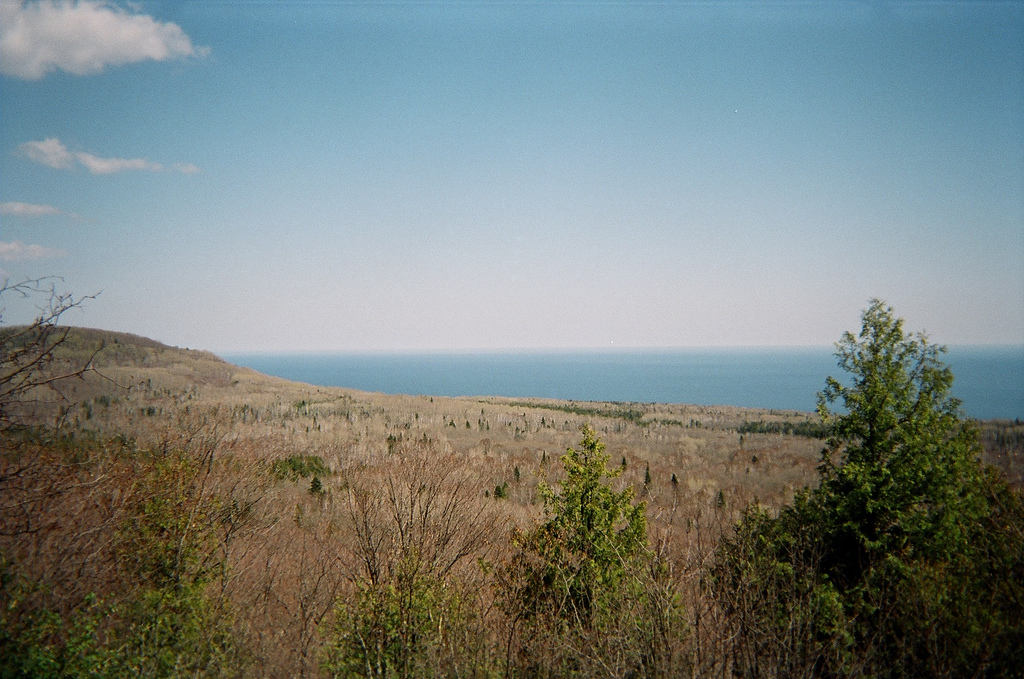
Montana Clear cuts – Click picture to see full size
Took Ibuprofen today – hiked like a champ. Lots of clear cuts up in these parts. Faint trails, but easy enough to follow with cairns and saw cuts. Saw no one today. Camped above Vinal Lake Road.
Saw no one today.
Time:10hr 30min
Ascent: 3010
Descent: 5270
Monday, July 02, 2007
Destination: West Fork of Yaak River
Starting Location: Vinal Lake Road
Today’s Miles: 14.60
Trip Miles: 195.20
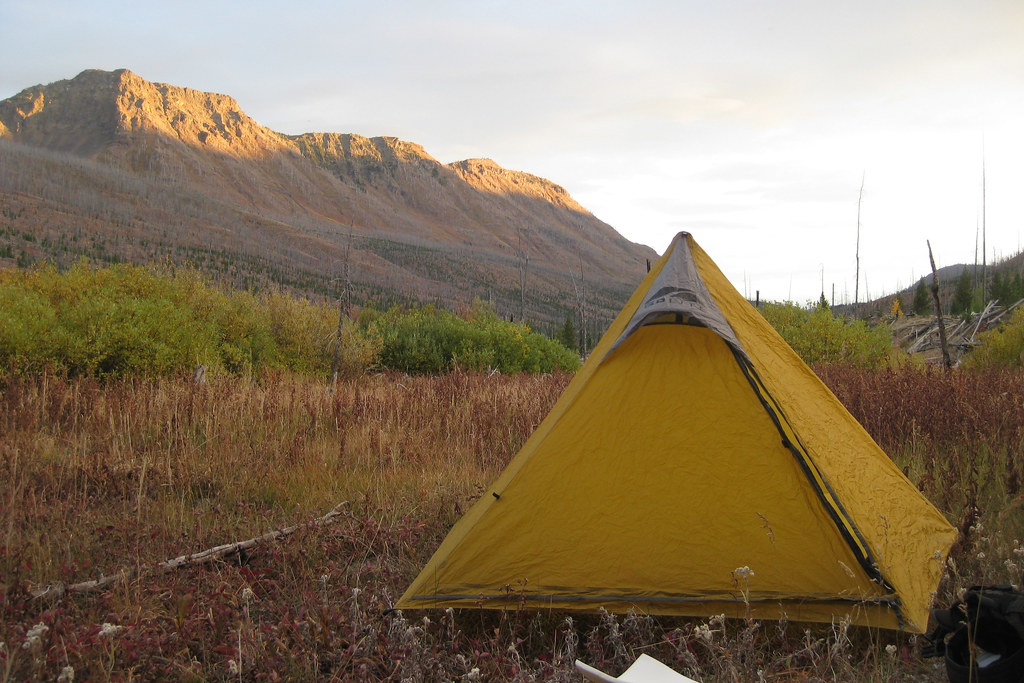
Tarp at West Fork Yaak River – Click picture to see full size
Saw two moose yesterday, forgot to mention. Put in good miles today over Garver Peak. Beautiful view of tomorrows NW Scenic area traverse. Camped at West Fork of Yaak River.
Saw less than a dozen people today.
Time: 11hr 30min
Ascent: 3200
Descent: 2170
Tuesday, July 03, 2007
Destination: Big Boy Meadows
Starting Location: West Fork of Yaak River
Today’s Miles: 28.10
Trip Miles: 223.30
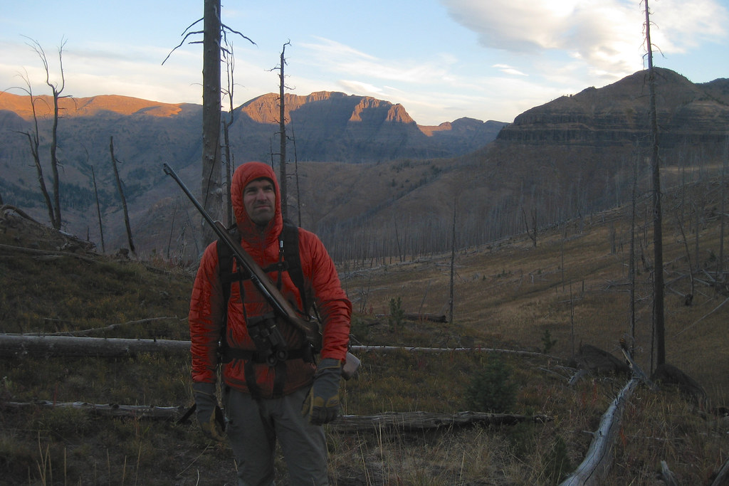
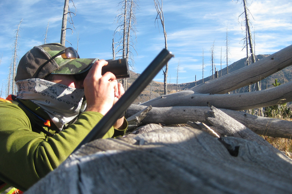
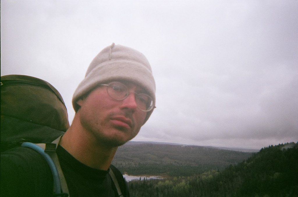
Sam atop Northwest Peak – Click picture to see full size
Excellent off-trail traverse of Northwest, Davis and part of Ewing Peaks in the NW Scenic Area of Kootenai N.F. I’m camped at “Big Boy Meadows” on the MT/ID border.
Saw no one today.
Time: 11hr 10min
Ascent: 4350
Descent: 2870
Wednesday, July 04, 2007
Destination: Fairgrounds, Bonner’s Ferry, ID
Starting Location: Big Boy Meadows
Today’s Miles: 28.70
Trip Miles: 252.00
Fairgrounds at Bonner’s Ferry – Click picture to see full size
4th of July. Busted ass and got into Bonner’s Ferry tonight (thanks to ride from Chad and Reagan). I am at Fairgrounds awaiting fireworks to begin. Now on Pacific time. Talked to Sarah on phone from a hill-top today. I am a lucky man to have her.
Saw more than a dozen people today.
Time: 14hr 0min
Ascent: 4090
Descent: 8140
Thursday, July 05, 2007
Destination: The Spring on Trail 122
Starting Location: Fairgrounds, Bonner’s Ferry, ID
Today’s Miles: 11.30
Trip Miles: 263.30
Resuppy Shipping Label – Click picture to see full size
Pleasant day in town, good breakfast and lunch. Sewed rip in pants leg. Three ride hitch hike to trailhead. At 15:00 105 degrees!!! Set up camp at 21:30 (“The Spring” on Tr. 122).
Saw more than a dozen people today.
Time: 6hr 0min
Ascent: 3180
Descent: 330
Thursday, July 5th, 2007
Pacific Northwest Trail Report No. 1
Firstly, my apologies if this arrives in your inbox twice as I’d rather you got this twice than not at all. Secondly, many of you haven’t heard from me in months or years so read on to find out what I’m up to nowadays. For those of you who are in-the-know, read on as you’re probably interested in hearing how things are going.
On Thursday, June 21st I set off from Chief Mountain Ranger Station at Glacier National Park, embarking on the 1200 mile Pacific Northwest Trail ( http://pnt.org ). At that time all my research and planning was put behind me and it was time to walk. I’m am currently one day ahead of schedule but will more than likely end behind schedule as I come across an interesting place or two to stop and spend a day. I plan to be done hiking sometime after August 24th.
As of today, July 5th, 2007 I have reached the small town of Bonner’s Ferry, Idaho approximately 225 miles from where I started. I have been averaging roughly 18 or 19 miles of hiking per day. Primarily I hike on hiking trails, secondly, Forest Service logging roads and thirdly (but rarely fortunately) asphalt highways.
The gear I’ve chosen to carry with me was all selected (and some handmade by my girlfriend and I) for both it’s durability and lightweight. Thusfar I am quite happy with my choices in gear as all is holding up well and not weighing me down. For those amongst you whom consider yourselves gear heads, you can view my gear list at my
Web site ( https://samh.net/backpacking ).
I have mailed one memory card of digital pictures home and my brother has kindly offered to put those up on my Web site for viewing. Perhaps he will copy all the e-mail addresses to whom I’ve sent this message and let you know when those are available for viewing.
I’ve seen very few people on the trails thusfar as Northwest Montana (where I’ve spent 99% of my time) is not very populated. I get my share of socializing however when I come down out of the mountains and have to walk through a town to pick up another package of food from the post office. Last night I even hiked a bit extra to get into town to watch the Independence Day fireworks (and more importantly eat a couple double cheeseburgers).
I won’t be checking my e-mail again for quite some time so if your comments can wait until after I’ve complete my journey it would be most appreciated as my Internet time is limited at public libraries. Although if you’d like to comment quickly I do like hearing how everyone is doing. Feel free to reply to this message or use the Contact Form on my Web site ( https://samh.net/backpacking )
To close I’ll quote an individual whom I met one night camping, “Don’t live life – experience it.â€
Sincerely,
Sam Haraldson
Friday, July 06, 2007
Destination: Lower Ball Lake
Starting Location: The Spring on Trail 122
Today’s Miles: 12.30
Trip Miles: 275.60
Exposed Rocks on Parker Ridge – Click picture to see full size
Awoke early, decided to only do twelve miles to allow the bushwhack to Salmo-Priest the entire day tomorrow. Finally starting to see others in the backcountry. Had nice chat with Bob today. He’s been backpacking for like thirty years. Lives on whey protein, prunes, oats and olive oil.
Saw less than a dozen people today.
Time: 8hr 40min
Ascent: 3560
Descent: 2110
Saturday, July 07, 2007
Destination: Geisinger Camp
Starting Location: Lower Ball Lake
Today’s Miles: 16.30
Trip Miles: 291.90
Lion Creek Bushwhack – Click picture to see full size
July 7th, 2007 – 777 – that’s Tom’s favorite number. Got off track today, missed Lookout Mtn. got back on at Floss Cr. Trail. Bushwhack today went flawlessly. Hit all the marks no problem. Lots of people out and about. Camped at Geisinger on Upper Priest Lake.
Saw more than a dozen people today.
Time:11hr 20min
Ascent: 490
Descent: 4340
Sunday, July 08, 2007
Destination: Junction Tr. 512 and 315
Starting Location: Geisinger Camp
Today’s Miles: 24.30
Trip Miles: 316.20
Large Cedars near Upper Priest Lake – Click picture to see full size
Everyday it seems I overcome another challenge, never ceasing to amaze myself. Tr 349 to Snowy Top was closed by a 2006 fire so I found an alt. route. I figured it would be nice getting to avoid the 89 switchbacks on tr. 349. Little did I know that my choice, Tr 315 would be an absolute jungle of brush and blowdowns. Ugh. This camp is gorgeous and a good relax after a long day. Camped just past Jct of Tr 512 and 315.
Had chat with Craig. Old car camper comin’ to same spot 40 years. Had roast oysters and a swig of Old Idaho whiskey with him. Truly a nice man. I’m in Washington now. GRD.
Saw less than a dozen people today.
Time: 12 hr 10min
Ascent: 3790
Descent: 450
Monday, July 09, 2007
Destination: Jct. Tr. 507 and 525
Starting Location: Junction Tr. 512 and 315
Today’s Miles: 16.10
Trip Miles: 332.30
Camp past Crowell Ridge – Click picture to see full size
After yesterday’s slog thru the alder choked tr. 315 I didn’t think it could get worse… then it did. Four miles of absolutely swimming through that god-forsaken plant. Upon topping out that trail though, all frustration was gone. Bald, boulder and sub-alpine fir strewn Crowell Ridge was an absolute delight.
Saw no one today.
Time: 1hr 20min
Ascent: 3250
Descent: 4910
Tuesday, July 10, 2007
Destination: Flume Cr. Road 305
Starting Location: Jct. Tr. 507 and 525
Today’s Miles: 25.30
Trip Miles: 357.60
Power Lines from the Boundary Dam – Click picture to see full size
Arose to scads of mosquitoes – actually put on some DEET (tough for a Minnesota native to admit that kind of defeat). Had a good walk out of the woods then quite a few miles of pavement to the Boundary Dam. The personnel there were a charm. They invited me to a personal tour, cold water and we even checked out the PNTA Web site (which they check often). Dave there and Robin were both great.
Saw more than a dozen people today.
Time: 10hr 0min
Ascent: 1730
Descent: 2960
Wednesday, July 11, 2007
Destination: Park in Northport, WA
Starting Location: Flume Cr. Road 305
Today’s Miles: 37.90
Trip Miles: 395.50
PNT Blaze at the Historic Lind Ranch – Click picture to see full size
Long day. Summited Abercrombie Mt. pretty early and could see Northport off in the distance. My legs were feelin’ it, my pack weight was at a minimum, so I set off setting 22:00 or 22:30 as my goal [for arrival in Northport]. Got in town at a few minutes after 22:00 and was sipping Red Hook with the locals in no time.
Saw more than a dozen people today.
Time: 15hr 0min
Ascent: 6560
Descent: 180
Thursday, July 12, 2007
Destination:
Starting Location: Park in Northport, WA
Today’s Miles: 0.00
Trip Miles: 395.50
– Click picture to see full size
Awoke around 6:00, struck camp and went to The Mustang for biscuits and gravy. Got mail then sat in shade outside for Clifford the Librarian to show up. Visited with him extensively, leaving and coming back two times. They just got broadband in town last week! Enjoyed a dip in the Columbia River then had a bacon cheeseburger at the Whitebird. After wonderful phone calls to Sarah and the folksI enjoyed a couple micro brews at Northern Ales bar and organic grocery. Clifford was there and he and owner/brewmaster (along with wife Andrea) Steve jammed on guitar and mandolin. Steve and Andrea offered a shower and bed but I declined. He then sent me off with a twenty-two ounce bottle of his IPA which I will enjoy tomorrow.
Zero day.
Thursday, July 12, 2007
Pacific Northwest Trail Report No. 2
Folks,
Day twenty-two on the Pacific Northwest Trail ( http://pnt.org ). I’ve been averaging somewhere near twenty miles per day. My shortest day was thirteen miles and my longest was thirty-seven.
It’s only rained on me once so I’m awaiting some kind of torrential downpour. It would be a welcome respite from the temps which have topped 105 deg. F. Early morning hiking has been a necessity to keep cool and I’ve been consuming upwards of two gallons of water a day.
The snow that plagued my weary ankles in the high country of Western Montana and into Idaho is gone in all but the smallest little patches now. With the disappearance of the snow will also come the disappearance of some of the small snow-melt creeks which made stocking up on water so easy. I’ll have to pay close attention to “tanking up†with water when the chance arises and have made notes in my trail guides as to where the best water resources are in the
upcoming miles.
I’m now in the sere brown hills of Eastern Washington which albeit not the tremendous peaks and valleys of Montana’s Rocky Mountains or Idaho’s Selkirks still hold their own in elevation gain/loss (especially compared with my homeland of Minnesota). The area I am about to embark into is not as highly developed from a recreational standpoint so more of my immediate travels will be on Forest Service roads than on trails. The roads provide good grade and level walking and typically are closed to vehicular traffic so they still provide for quality walking.
I’ve seen some diverse landscapes, from the rocky balds and snow packed heights of Boulder Pass in Glacier National Park to the old growth cedar forests, complete with trees in excess of eight feet in diameter of the Salmo Priest Wilderness. Next is the drier hills of Easter Washington’s Kettle Crest with the deep canyons of the Paysaten Wilderness and the lush expanses of North Cascades National Park to follow. Alas, I get ahead of myself. I’ve much country to explore in Colville and Okanagan National Forests first and you’ll hear from me again mid-exploration of those lands.
Tomorrow morning I set off with eight days of food in search of Bonaparte Lake Resort (NE of Tonasket, WA) where I’ll pick up three more days supplies for a quick jaunt up to Oroville, WA. From Oroville I expect to make my next correspondence with the world. Until then I bid you adieu.
Sincerely,
Sam Haraldson
p.s. In my last correspondence I mentioned I might be too busy to respond to any replies to my mail. I don’t believe this will be the case so feel free to comment or question whatever you fancy. My response may be short but will be heartfelt.
Friday, July 13, 2007
Destination: Section 36 on Fisher Cr. Trib.
Starting Location: Park in Northport, WA
Today’s Miles: 18.00
Trip Miles: 413.50
Microbrew on the Trail – Click picture to see full size
Less than twenty miles today. Groggy from three excellent beers last night, lack of sleep and ninety-plus deg. temps. Lots of logging activity today and very dusty. All of todays walk was blazed though – that’s a first.
Saw more than a dozen people today.
Time: 8hr 40min
Ascent: 2190
Descent: 460
Saturday, July 14, 2007
Destination: Jct. Tr. 450 and Goat Cr. Rd.
Starting Location: Section 36 on Fisher Cr. Trib.
Today’s Miles: 22.40
Trip Miles: 435.90
Dusty Roads and Sprinklers – Click picture to see full size
Day nine of heat at or near 100 deg. F. Ugh. Ninety-five percent of travel was on full-on gravel roads today. Move to Kettle Crest Trail sometime tomorrow morning.
Saw more than a dozen people today.
Time: 10hr 30min
Ascent: 4360
Descent: 3020
Sunday, July 15, 2007
Destination: Copper Butte
Starting Location: Jct. Tr. 450 and Goat Cr. Rd.
Today’s Miles: 20.70
Trip Miles: 456.60
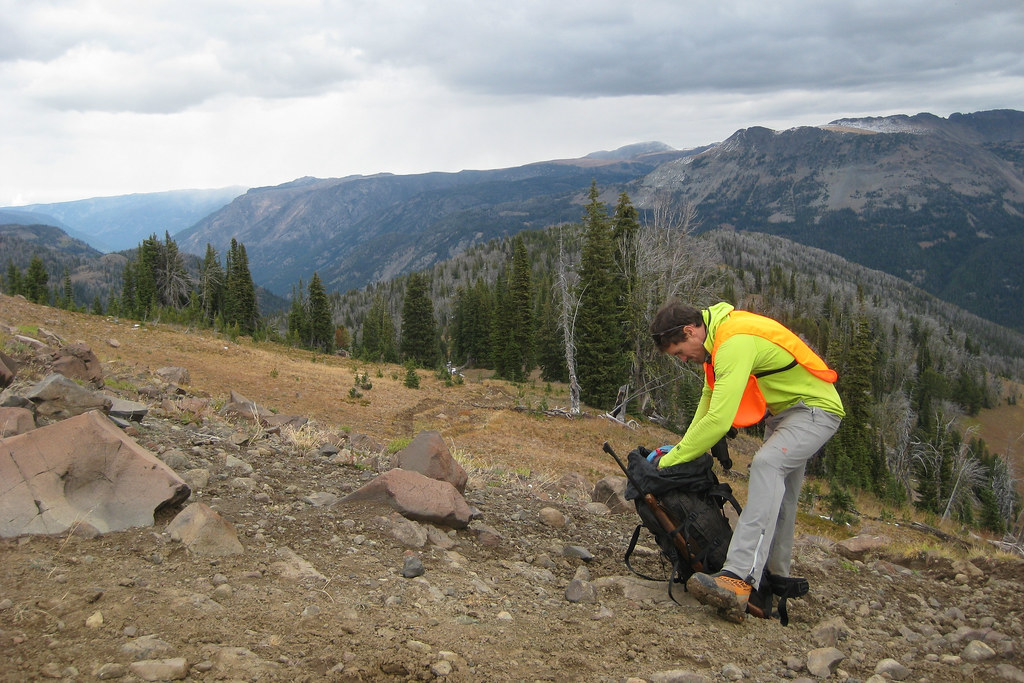
Kicking back on the Low-rider – Click picture to see full size
Did my twenty-plus miles easy enough today. Arrived at camp atop Copper Butte around 15:45. It felt great to be off the Forest Service roads and on the well graded/maintained F.S. Tr 13 Kettle Crest. A few more miles of it tomorrow too. I fashioned a chair out of the old lookout cabin’s low-rider latrine. It’s quite comfy.
Saw less than a dozen people today.
Time: 8hr 50min
Ascent: 3830
Descent: 1690
Monday, July 16, 2007
Destination: Lower Hall Cr. Pond
Starting Location: Copper Butte
Today’s Miles: 21.20
Trip Miles: 477.80
Hiking through the Grass – Click picture to see full size
The wind was howling this morning but my tarp held up. It woke me early to find the hazy sunrise from a smoky sky. Not sure exactly where the big fire is, but I could see a small one last night. The bushwhack today went well even if the guidebook’s directions were wonky. I ended up right on the mark (YES!).
Saw less than a dozen people today.
Time: 12hr 10min
Ascent: 2830
Descent: 5190
Tuesday, July 17, 2007
Destination: 10 Mile Camp
Starting Location: Lower Hall Cr. Pond
Today’s Miles: 16.50
Trip Miles: 494.30
Cooking at Ten Mile Camp – Click picture to see full size
These are some hot, dry hills I’ve been walking through. Found enough water though. Paid for camping tonight, but worth is as Steve offered me libations, conversation and some Neil Young on the tailgate of his rig. Vet, hard-laborin’, long-haired individualist. 51 years old, I don’t think he’ll ever feel old.
Saw more than a dozen people today.
Time: 9hr 50min
Ascent: 1950
Descent: 4300
Wednesday, July 18, 2007
Destination: Sweat Cr. Picnic Area
Starting Location: 10 Mile Camp
Today’s Miles: 24.70
Trip Miles: 519.00
Too Short on the Trail – Click picture to see full size
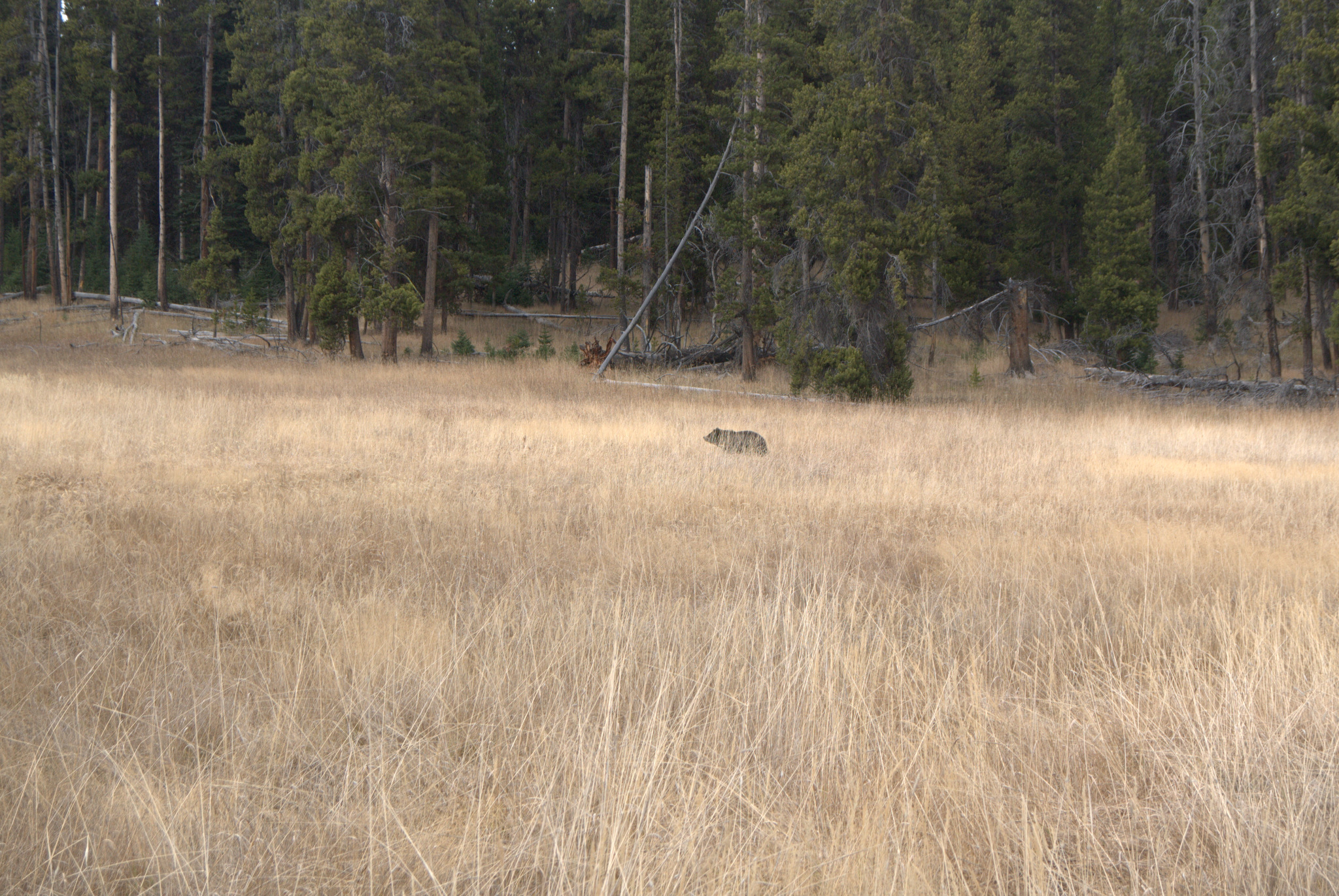
The temps have finally cooled off. I awoke refreshed, packed and had breakfast. 1/2 hour into the hike a light rain started. This kept up all morning and really helped the heat. Road walk most all day. Made wrong turn and got to see bear. Got to Sweat Creek Picnic Area and chatted with Bill Mell? Mount? who had tales to tell. He’ll be president of a fraudulent, made-up country by later next week. Hmm…
Saw less than a dozen people today.
Time: 11hr 10min
Ascent: 3240
Thursday, July 19, 2007
Destination: Bonaparte Lake Resort
Starting Location: Sweat Cr. Picnic Area
Today’s Miles: 19.60
Trip Miles: 538.60
Ranch Gate and Big Sky – Click picture to see full size
Awoke, broke camp and purified water before the rain. Also had nice chat with the lovely Sarah and my brother. Trail over Clackamas Mtn. was a bear of a route find. Cattle trails (and shit) were everywhere. Guidebook definitions horribly lacking. Ended up bushwhacking final slope and found road no problem. Made great time after that. Arrived at Bonaparte Lake Resort at 17:30, got hamburger (yum) and a couple tall boys. Looooong hot shower followed by (free) laundry. I am human again.
Saw more than a dozen people today.
Time: 8hr 20min
Ascent: 3430
Descent: 3410
Friday, July 20, 2007
Destination: Okanogan NF Boundary
Starting Location: Bonaparte Lake Resort
Today’s Miles: 14.20
Trip Miles: 552.80
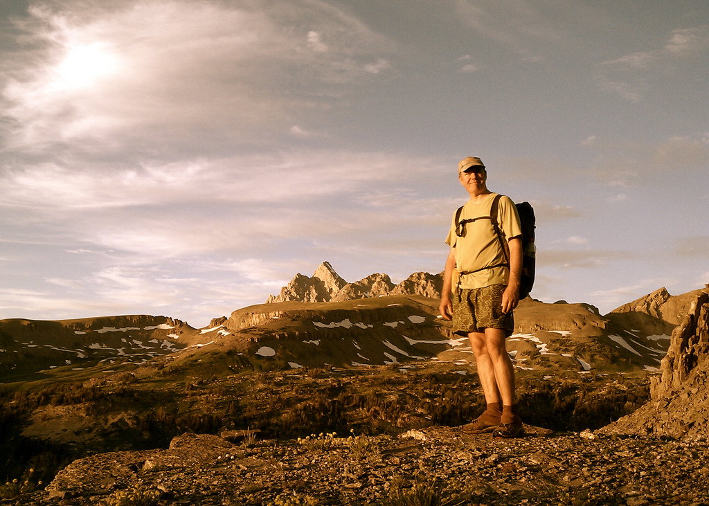
Sam at Mt. Bonaparte Fire Lookout – Click picture to see full size
Day number 30! Awoke to fishermen going out, broke camp, had coffee and breakfast at cafe. Slowly left by 9:45. Climbed to Mt. Bonaparte Lookout and chatted with Lee the lookout who hadn’t seen anyone in a week. He gave me a beer, I gave him some cookies. Came a few more miles to the NF boundary and camped.
Saw more than a dozen people today.
Time: 9hr 10min
Ascent: 3700
Descent: 3380
Saturday, July 21, 2007
Destination: Summit Lake
Starting Location: Okanogan NF Boundary
Today’s Miles: 15.10
Trip Miles: 567.90
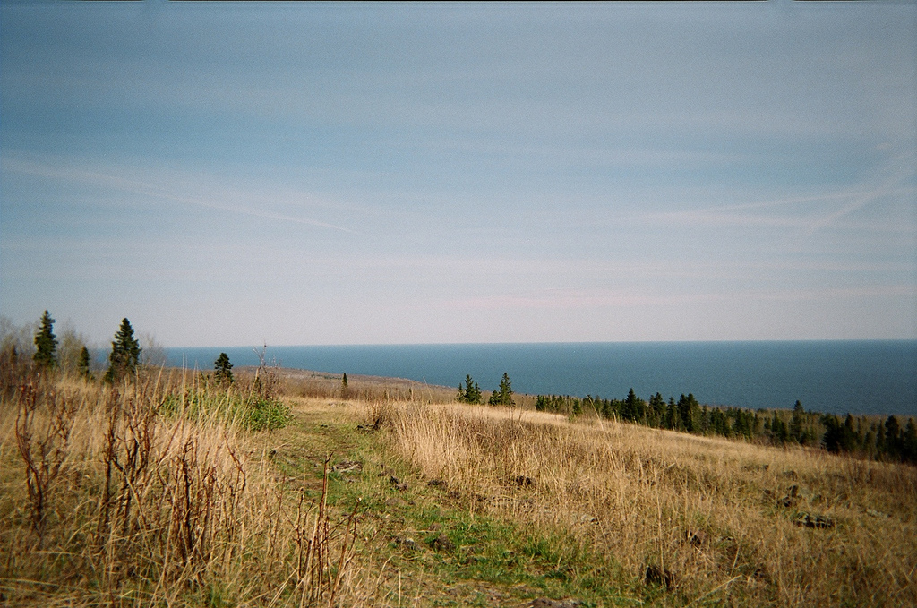
Summit Lake – Click picture to see full size
Left the forest this morn and came out into the open, hilly ranges of the Okanogan. Wandered up Dry Gulch and Ray Visser (Havillah, WA) stopped his truck and chatted with me a little about the trail. He was in the know and this was refreshing. Short day as there’s no need to hit town ’til the Post Office is open Monday.
Saw less than a dozen people today.
Time: 6hr 20min
Ascent: 1520
Descent: 1160
Sunday, July 22, 2007
Destination: City Park, Oroville, WA
Starting Location: Summit Lake
Today’s Miles: 14.80
Trip Miles: 582.70
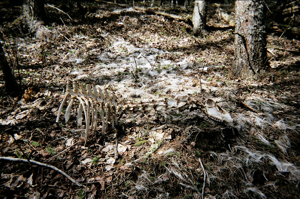
Cow Carcass – Click picture to see full size
Saw a coyote as well as a carcass of a cow on the lovely Whistler Canyon Trail. Camped (illegally) in the city park.
Saw more than a dozen people today.
Time: 6hr 0min
Ascent: 330
Descent: 3490
Monday, July 23, 2007
Destination: Similkameen River
Starting Location: City Park, Oroville, WA
Today’s Miles: 8.40
Trip Miles: 591.10
Fresh Supplies – Click picture to see full size
Good breakfast, lunch and phone conversation with Mom, Dad, Grandma and Sarah. Got and sent mail, had quick Internet session. Left town around 14:30. Short walk in 100 deg. F heat. Camped along Similkameen River.
Saw more than a dozen people today.
Time: 3hr 0min
Ascent: 620
Descent: 360
Monday, July 23, 2007
Pacific Northwest Trail Report No. 3
Folks,
I’m in Oroville, Washington and am paying for internet time so this update will be unfortunately short. The public library (probably thanks to our current administration) is closed on Mondays.
I’ve made it most of the way across the hot, dry desert-like hills of the Okanogan Valley of Eastern Washington. Next up is the high country of the Paysaten Wilderness and North Cascades National Park. This is the part of the trip I’ve most anticipated. Between these two wild areas I will get to cover literally hundreds of miles of roadless area, broken only by a short ferry trip across Ross Lake.
My pack is at its heaviest right now with 8+ days of food and enough water to get between streams and lakes. I’m in great shape though and can put down twenty plus miles without too much thought now. I still enjoy getting to town and enjoying a cheeseburger and beer though.
A new batch of photos should be ready in the near future and my at-home-tech-support brother will be letting you all know when they’re available. It’s certainly good having folks such as him, my parents and girlfriend helping out on the home front.
Sincerely,
Sam Haraldson
Tuesday, July 24, 2007
Destination: Cold Springs Campground
Starting Location: Similkameen River
Today’s Miles: 26.60
Trip Miles: 617.70
ULA Conduit at Cold Springs Camp – Click picture to see full size
Today marks roughly the halfway point of the hike. I put the Okanogan guidebook section to rest today and start into the Paysaten Wilderness tomorrow. If I include my twenty some odd miles of pre-PNT hiking in Glacier Nat’l I’m looking at six-hundred plus miles so far.
Saw more than a dozen people today.
Time: 11hr 10min
Ascent: 5310
Descent: 340
Wednesday, July 25, 2007
Destination: Dome Camp
Starting Location: Cold Springs Campground
Today’s Miles: 15.10
Trip Miles: 632.80
Entrance to the Paysaten Wilderness – Click picture to see full size
Got lost today. Couldn’t find the Goodenough Trail so took alternate route. Got onto cattle trail and spent roughly five? hours bushwhacking – ultimately getting back on route. Entered Paysaten Wilderness, kissed the sign and busted ass. Gorgeous country. Camped at Dome Camp.
Saw less than a dozen people today.
Time: 9hr 0min
Ascent: 2840
Descent: 2220
Thursday, July 26, 2007
Destination: Ashnola River
Starting Location: Dome Camp
Today’s Miles: 25.20
Trip Miles: 658.00
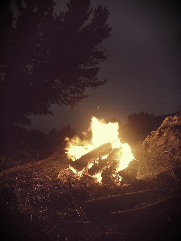
Cathedral Lake – Click picture to see full size
Saw six backpackers; one gal, her dog and two horses. Arrived at Cathedral Lake my planned camp at 13:30. This was much too early and the bugs were at their worst. Hiked eleven more miles to Ashnola River. Had first campfire of the trip to try to minimize bugs.
Saw less than a dozen people today.
Time: 10hr 0min
Ascent: 2150
Descent: 3930
Friday, July 27, 2007
Destination: Paysaten Airstrip Cabin
Starting Location: Ashnola River
Today’s Miles: 24.20
Trip Miles: 682.20
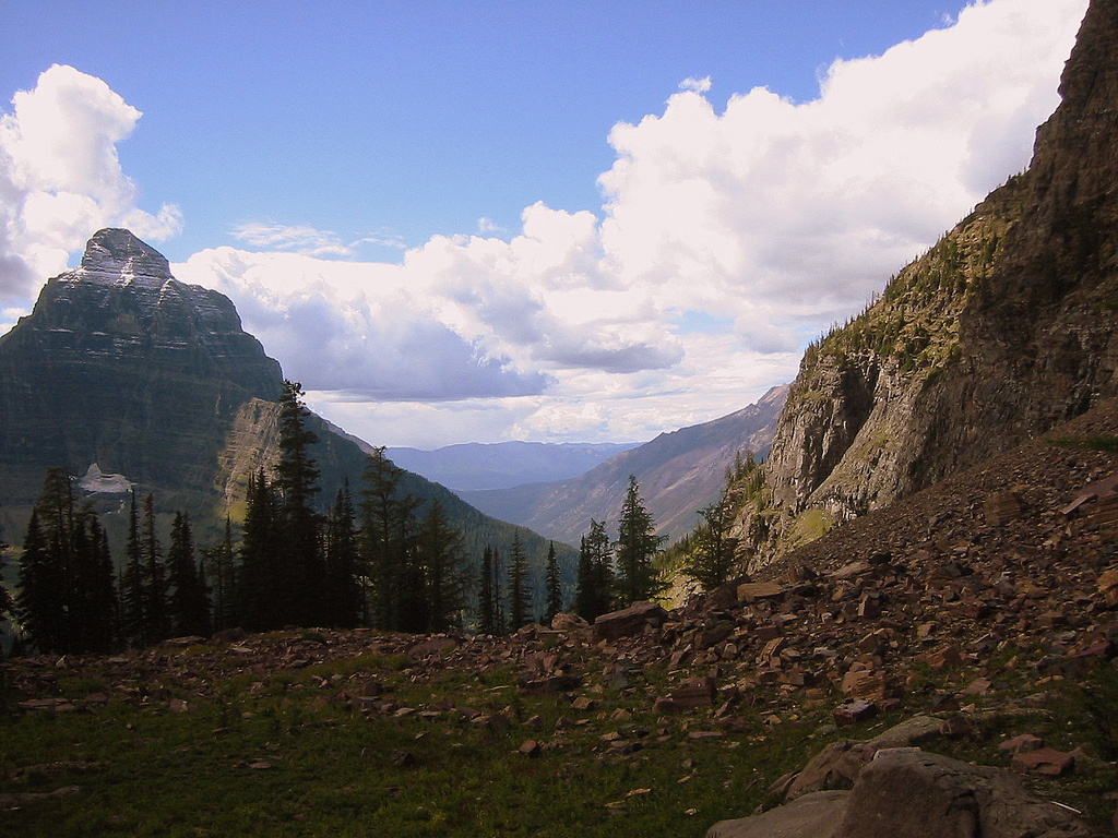
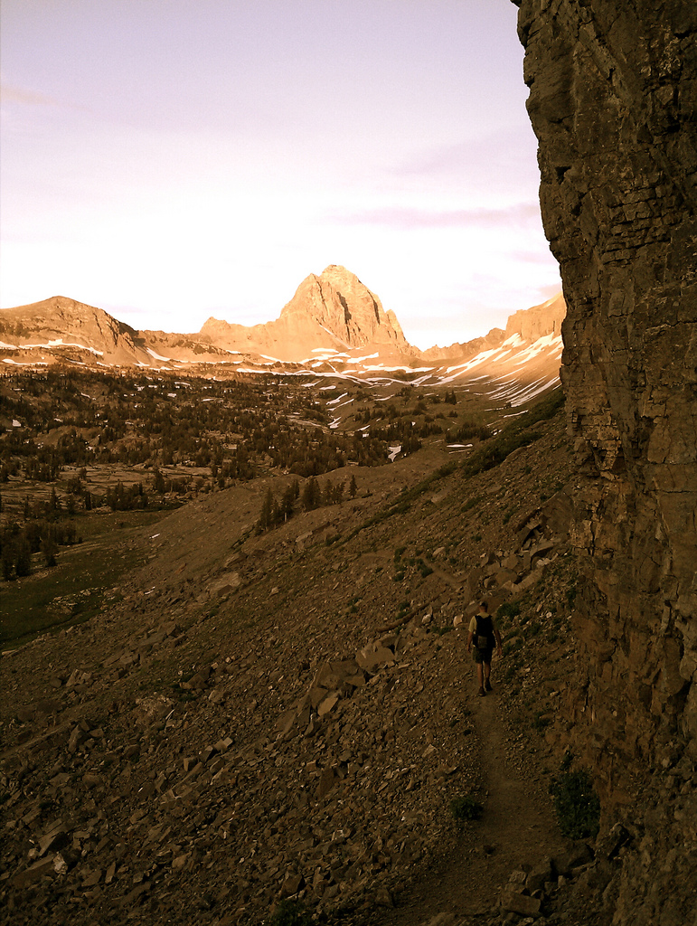
Quartz Ridge, Paysaten Wilderness – Click picture to see full size
Today was possibly the most glorious of the whole trip, Quartz Ridge and Bunker Hill provide a view of peaks as far as the eye can see. Dropping into and moving along the Paysaten River was hell however. A 2006 burn charred and blew down scores of trees. I made less than a mile an hour for those four miles.
Saw less than a dozen people today.
Time: 12hr 10min
Ascent: 3840
Descent: 4490
Saturday, July 28, 2007
Destination: Devil’s Pass
Starting Location: Paysaten Airstrip Cabin
Today’s Miles: 24.00
Trip Miles: 706.20
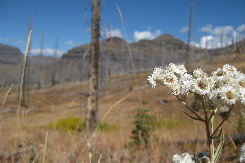
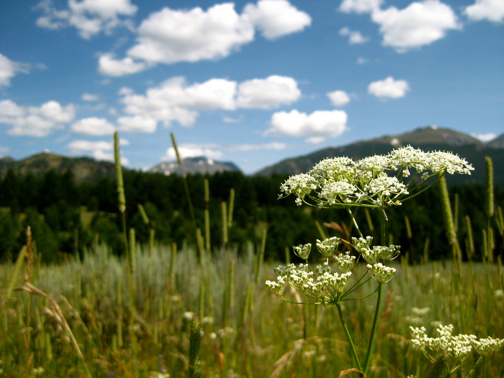
An Unknown Flower – Click picture to see full size
Hoping to avoid more of yesterday’s fire-ruined trail slogging I took an alt. route. Once atop (of all places) there was a map showing the closed trails in the area. Both the one I skipped as well as the alternate I took were included. Amazing views today. The Cascades are looking beautiful and still quite snowy.
Saw no one today.
Time: 10hr 40min
Ascent: 4770
Descent: 3340
Sunday, July 29, 2007
Destination: Ross Dam
Starting Location: Devil’s Pass
Today’s Miles: 28.50
Trip Miles: 734.70
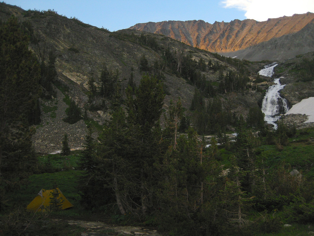
Last Day for the Inov8 Flyrock 310 – Click picture to see full size
Easy climb to the top of Devil’s Dome this morn. All peaks clouded in up top but good view none the less. Mega downhill to Ross Lake followed by fast, well-maintained shore walk. No need for Hwy 20 walk as NPS has built trail parallel to it. Camped at super stealth location about a hundred feet above Ross Dam.
Saw more than a dozen people today.
Time: 11hr 10min
Ascent: 2480
Descent: 6460
Monday, July 30, 2007
Destination: Stillwell Camp
Starting Location: Ross Dam
Today’s Miles: 11.00
Trip Miles: 745.70
Giant Old Growth Cedar – Click picture to see full size
Ferry from Ross Lake Resort to Ideal Route at Little Beaver was only $20 when shared with other backpackers so went with it. Sharing camp with Max and Brian. Met Gabriel, NPS backcountry ranger who kindly issued me a permit. Wish I got to talk to Sarah on phone today.
Saw more than a dozen people today.
Time: 5hr 30min
Ascent: 2000
Descent: 490
Tuesday, July 31, 2007
Destination: Copper Creek
Starting Location: Stillwell Camp
Today’s Miles: 16.70
Trip Miles: 762.40
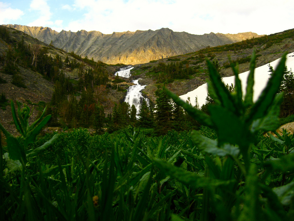
Challenger Glacier – Click picture to see full size
Incredibly steep climb up to Whatcom Pass. Trail crews had trail in great shape though. Whatcom and Challenger glaciers a site (and sound) to behold. Still tired from Paysaten push. Only did sixteen some odd miles today.
Saw less than a dozen people today.
Time: 5hr 30min
Ascent: 3380
Descent: 2770
Wednesday, August 01, 2007
Destination: Jct with Tr 607
Starting Location: Copper Creek
Today’s Miles: 24.90
Trip Miles: 787.30
Catch-23 and Scavenger – Click picture to see full size
Tons of people on trail to Hannegan Pass. Tons of cars on Baker Hwy. Met Toby (Catch-23) and Brandon (Scavenger) former AT and/or PCT thru-hikers as they were preparing to conquer Shuksan. Had a tall boy with them and a two mile hike. I stopped to camp at the jct of Tr 607.
Saw more than a dozen people today.
Time: 13hr 0min
Ascent: 4620
Descent: 3750
Thursday, August 02, 2007
Destination: Noisy Creek
Starting Location: Jct with Tr 607
Today’s Miles: 19.00
Trip Miles: 806.30
Mt. Baker and Baker Lake – Click picture to see full size
Awoke early to beautiful alpenglow on Mt. Baker. A sight that makes life worth living. 07:30, ran into Chuck, Jerry, Doug and Dave of PNTA on a three-day work outing! Amazing stuff they had done. Talked to each for around twenty min. Visited Baker Hot Springs for a solo soak. Tonight camped at Noisy Creek on Baker Lake. Had beer and good words with a group of guys livin’ it up boat camping.
Saw more than a dozen people today.
Time: 11hr 30min
Ascent: 740
Friday, August 03, 2007
Destination: Grandy Lake
Starting Location: Noisy Creek
Today’s Miles: 19.60
Trip Miles: 825.90
Olympic Snoqualmie National Forest Sign – Click picture to see full size
Had coffee and words of parting with my kind neighbors. Good trail along East side of lake followed by eight-plus miles of asphalt. Five dollars for camping at Grandy Lake. Neighboring group of gals on a church outing gave me a sandwich and some vegetables.
Saw more than a dozen people today.
Time: 8hr 20min
Ascent: 1110
Descent: 1040
Saturday, August 04, 2007
Destination: Jones Creek
Starting Location: Grandy Lake
Today’s Miles: 21.50
Trip Miles: 847.40
PNT Blazes on Mt. Josephine – Click picture to see full size
Awoke quite early, a surprising number of other campers were also stirring. Began climb of Goat Mtn. and had nice phone conversation with Sarah. Found PNT blazes on trail to summit of Josephine Peak. Took wrong turn in mess of DNR roads at end of day. Only maybe a mile or two out of my way and am now camped (possibly illegally) at Jones Creek on Rd. 110 on Sierra Pacific Timber land.
Saw more than a dozen people today.
Time: 11hr 50min
Ascent: 4050
Sunday, August 05, 2007
Destination: Near Wickersham, WA
Starting Location: Jones Creek
Today’s Miles: 18.60
Trip Miles: 866.00
Inversion over Sedro Wooley, WA – Click picture to see full size
Climbing uphill and inversion was taking place in the valley below. A beautiful sea of clouds below me all morning. Later I got some expansive views west – I believe of the Olympics. No clear view of Puget Sound yet though. Camped under power lines just SE of Wickersham, WA.
Saw no one today.
Time: 9hr 20min
Ascent: 4100
Descent: 3660
Monday, August 06, 2007
Destination: Lizard Lake
Starting Location: Near Wickersham, WA
Today’s Miles: 27.70
Trip Miles: 893.70
PNT Sign in County Park – Click picture to see full size
Awoke at 05:00 to be sure to be off logging property before they started working. I heard the first of their trucks fifteen minutes later though! I was able to hike down and out without anyone seeing me anyway. Roadwalk, more logging roads, good PNT built trail, double cheeseburger, more roads and trail and here I am at Lizard Lake DNR campground.
Saw more than a dozen people today.
Time: 12hr 0min
Ascent: 5250
Descent: 4180
Tuesday, August 07, 2007
Destination: Bayview State Park
Starting Location: Lizard Lake
Today’s Miles: 16.50
Trip Miles: 910.20
PNT Stone Marker on Chuckanut Drive – Click picture to see full size
Slept in a bit and took my time in the morning. I borrowed a book from a lending shelf in Algers. Reading has been fun. Stopped in Edison for lunch and am now camped at Bayview State Park. Paid a dollar for a shower and charged my phone and camera batteries in the bathroom.
Saw more than a dozen people today.
Time: 8hr 0min
Ascent: 340
Descent: 2160
Wednesday, August 08, 2007
Destination: Deception Pass State Park
Starting Location: Bayview State Park
Today’s Miles: 26.90
Trip Miles: 937.10
Drinking High Life at Sunset – Click picture to see full size
Went into Anacortes for lunch today to find out Sarah had called ahead and bought it for me! A most excellent treat. Watched sunset over the San Juan Islands after listening to the park rangers interpretive program at Deception Pass State Park. Walked down the beach aways and bivied.
Saw more than a dozen people today.
Time: 10hr 30min
Ascent: 1210
Descent: 1320
Thursday, August 09, 2007
Destination: Port Townsend, WA
Starting Location: Deception Pass State Park
Today’s Miles: 24.30
Trip Miles: 961.40
Port Townsend, WA Ferry – Click picture to see full size
Walked Whidbey Island pretty much in it’s entirety today. Many good beach miles, some good trail miles, but then high tide forced me onto the road. Arrived at Keystone Ferry at 18:00 and had microbrew in hand and burger on plate in Port Townsend soon after. Local gave me good info on a nice spot to lay my head near the city fountain. Probably illegal so awoke at dawn.
Saw more than a dozen people today.
Time: 12hr 30min
Ascent: 1110
Descent: 1120
Friday, August 10, 2007
Destination:
Starting Location: Port Townsend, WA
Today’s Miles: 0.00
Trip Miles: 961.40
Chalkboard-walled Bathroom – Click picture to see full size
Zero day. Walked all over Port Townsend, ate good food, drank coffee and microbrews, talked with people. Slept in garden outside Whole Foods Co-Op.
Friday, August 10, 2007
Pacific Northwest Trail Report No. 4
Fans and friends,
I’ve been walking the Pacific Northwest Trail for forty-eight days. Talk on two pleasurable days before that in Glacier National Park making my way to the official PNT start on the continental divide and that makes for an even fifty days. My mileage is somewhere in the 900 mile range thus far and my current location is Port Townsend,
Washington.
The past few days have been a flurry of official PNT signage and trail blazes proving that the trail has a good local following and that locals are supporting it. It is a polar opposite from the off-trail sections and route-finding nightmares of Montana, Idaho and E. Washington.
Since my last update I’ve walked a seven day stretch without walking a road, walked stretches of the pristine beaches along the Strait of Juan de Fuca and also pounded dozens of miles of tense, high traffic pavement.
The crossing of Ross Lake in between the Paysaten Wilderness and the North Cascades National Park was like awaking from a dreamless sleep and finding yourself in the middle of Times Square. Previously I had been able to make mental notes of all the people I’d seen on the various trails I’d walked. Once I arrived in the lands of Western
Washington it became apparent that people here really like to get out and after it in the woods as they were everywhere. I miss the solitude but am happy to see the trails getting good use. On a positive note it has given me a chance to spend time with some fellow campers – a number of whom will be receiving this update. The kindness and generosity of others (I love free beer, thanks, Gary!) in trade for nothing more than some backpacking stories or gear advice has been wonderful.
All the people out in the woods obviously live somewhere and the population density of the area shows. Finding places to camp in these lands which aren’t mile after mile of National Forest like in previous sections of the hike can be more difficult. As of late I’ve had to put some of my stealth camping techniques to the test and have even (gasp!) paid for some state park camping. I travel light and only require a small earth footprint so with a bit of advice from some locals in a pub a choice spot in the local park can be quickly revealed.
Ahead of me lies a nice chunk of state and federal lands encompassing the bulk of the Olympic Peninsula’s Olympic Mountain Range and the expansive coast of the Pacific Ocean. I’m ready to get back onto some entire days spent on trails and back to the true backpacking experience.
The latest batch of photos goes into the mail today so when my brother can find some time in his busy schedule he’ll put those online for everyone to peruse. My next trail report will probably come post-hike and at that time I look forward to expanding in detail on some sections and answering any questions folks might have.
It’s been great hearing people’s commentary along the way so feel free to keep that coming. In closing let me leave you with the remark my superstar girlfriend, Sarah leaves me with when we talk on the phone, “happy hikingâ€.
– Sam
Saturday, August 11, 2007
Destination: Gray Wolf River
Starting Location: Port Townsend
Today’s Miles: 28.50
Trip Miles: 989.90
No Photo Available – Click picture to see full size
Left Port Townsend at 07:30. Hitch hiking dangerous section of Hwy 20 as recommended by trail guide. Road didn’t seem that bad but small shoulders and lots of hi speed traffic nonetheless. Camped along Gray Wolf River.
Saw more than a dozen people today.
11hr 30min
Ascent: 2980, Descent: 1980
Sunday, August 12, 2007
Destination: Deer Park Campground
Starting Location: Gray Wolf River
Today’s Miles: 12.80
Trip Miles: 1002.70
No Photo Available – Click picture to see full size
Excellent hike on good trails. One cold ford at a washed out bridge. 3000 foot gain over five miles to reach Deer Park car campground and ranger station finally within the boundaries of Olympic National Park. The camp is located in a true alpine environment. Rainy and cold. Chatted with Wayne from Portland while he awaited his ride home after a few day solo trip.
Saw more than a dozen people today.
7hr 0min
Ascent: 4770, Descent: 570
Monday, August 13, 2007
Destination: Elwha River
Starting Location: Deer Park Campground
Today’s Miles: 24.00
Trip Miles: 1026.70
No Photo Available – Click picture to see full size
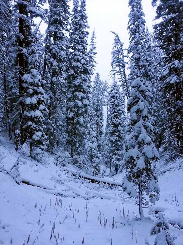
Last evening’s cold and rain in which I sat under the tarp in my bag to cook dinner and make tea broke this morning and I got my first panoramic view of the spine of the snowy Olympic Mountains. I cruised the trail to Obstruction Point and the road to Hurricane Ridge Visitor Center. Had some cafeteria food and made phone calls. Then it was off toward Hurricane Hill, the clouds rolling in and out giving peek-a-boo views. Pounded down to the Elwha River Valley (something like a mile of vertical descent) and camped under the road bridge over the Elwha River.
Saw more than a dozen people today.
11hr 0min
Ascent: 3300, Descent: 8220
Tuesday, August 14, 2007
Destination: Lunch Lake
Starting Location: Elwha River
Today’s Miles: 21.00
Trip Miles: 1047.70
No Photo Available – Click picture to see full size
Today the ocean came into view. I gave a loud holler of joy on first sight and laughed out loud. I thought maybe I’d tear up but I didn’t. It was very stunning as off to the south was a world class view of Mt. Olympus and it’s flowing glaciers. Also had nice soak in Olympic Hot Springs, chatted with three girls doing nineteen days in the park and Douglas Ray (Rey?) a BackpackingLight.com subscriber.
Saw more than a dozen people today.
12hr 0min
Ascent: 7470, Descent: 3280
Wednesday, August 15, 2007
Destination: Forks, WA
Starting Location: Lunch Lake
Today’s Miles: 35.90
Trip Miles: 1083.60
No Photo Available – Click picture to see full size
Walked out Hoh River instead of Bogachiel. Word from rangers was blowdowns were terrible. Did a feel good thirty-five miles to Hwy 101 and hitch hiked to Forks, WA. Met Brandon a bike trekker and fellow Web guy (freelancepartnership.com). We crashed in the dugout at the local baseball diamond.
Saw more than a dozen people today.
13hr 40min
Ascent: 1190, Descent: 5050
Thursday, August 16, 2007
Destination: Mouth of Hoh River
Starting Location: Forks, WA
Today’s Miles: 11.00
Trip Miles: 1094.60
No Photo Available – Click picture to see full size
Brandon and I awoke to rain this morn so we slept in another 1/2 hour. We had breakfast together then parted ways. Got re-supply, secured national park permits (and bear canister) and did quick Internet stop. Waited in rain forty-five minutes before Isaih finally picked me up hitch hiking. Chill fellow. Plays banjo, picks and sells Chantrelle mushrooms. Even invited me to an annual local family camping and music weekend. Put my bare feet in the Pacific Ocean today at long last. Camped amongst driftwood on beach near the mouth of the Hoh River.
Saw more than a dozen people today.
4hr 0min
Ascent: 390, Descent: 750
Thursday, August 16, 2007
Pacific Northwest Trail Report No. 5
Fellow Hiking Enthusiasts (and wanna be’s) –
My hike along the Pacific Northwest Trail grows near its end. I made excellent time across the Olympic Peninsula of Western Washington thus far, enjoying spectacular views of the the snowy peaked Olympic Mountains and (finally) the Pacific Ocean in all its glory. A near record setting day of 35 miles brought me into the town of Forks, WA last evening where I shared some floor space in a dugout of the local ball diamond with a fellow trekker who is making his way along a 1200 mile bike tour.
I secured permits to hike the Pacific Coast sections of Olympic National Park and set out toward that this afternoon. A few luxurious days hiking the beaches and headlands North and I will reach my final destination at Cape Alava. The excitement builds for the notion of completion but the dawning of an end to something amazing is also upon
me.
Look forward (or not) to a final trail report, statistics and photos upon my completion and return to civilization. It’s been fun sharing this all with you.
Sincerely,
Sam Haraldson
Friday, August 17, 2007
Destination:
Starting Location: Mouth of Hoh River
Today’s Miles: 0.00
Trip Miles: 1094.60
No Photo Available – Click picture to see full size
Although I moved my camp about a mile I’m calling this a zero day. I’m keeping with my scheduled camping permits within the national park at which I arrived at a day early. This morn the neighbors invited me over for coffee which ended up being coffee and pancakes (yay!). There were eight people there representing three generations and they all shared one tarp! I spent the sunny parts of the day relaxing on the beach and the rainy parts relaxing and napping under my tarp.
Saturday, August 18, 2007
Destination: Third Beach
Starting Location: Mouth of Hoh River
Today’s Miles: 12.70
Trip Miles: 1107.30
No Photo Available – Click picture to see full size
Good solid backpacking today. Beach walks, headland traverses, three stream fords, rain, sun, it was all there. I took it all in stride. Engineered a great sand tent pad. My camp site becomes nearly an “island” at high tide.
Saw less than a dozen people today.
5hr 30min
Ascent: 850, Descent: 850
Sunday, August 19, 2007
Destination: Cape Johnson
Starting Location: Third Beach
Today’s Miles: 13.00
Trip Miles: 1120.30
No Photo Available – Click picture to see full size
It rained from 17:00 until sometime early this morning. Nice and warm at 06:00 though. Made smooth receding tide miles past dozens of lazy Sunday morning backpackers. Got into La Push by I think 09:00. Bought some cheese, gravy mix and two tall boys of Rainier for that evening. Had biscuits and gravy at local restaurant then paid Buck Sampson a local Quillayute native $5 for a ferry ride across the river. He was the 1st person I asked and he said yes immediately. It’s been a brilliant sunny day and I think I’m finally going to see that sunset I’ve dreamt about.
Saw more than a dozen people today.
5hr 45min
Ascent: 500, Descent: 560
Monday, August 20, 2007
Destination: Cape Alava
Starting Location: Cape Johnson
Today’s Miles: 16.00
Trip Miles: 1136.30
No Photo Available – Click picture to see full size
Rather than camp at my scheduled location at which I arrived at around 10:00 I opted to instead continue hiking onward to the end of the trail. I arrived at Cape Alava the official end of the Pacific Northwest Trail at around 14:00. It was a meloncholy finish but still felt the power of success. I read the card Sarah had mailed me earlier and drank the last couple sips of whisky the folks back home wished me well with. I started the hike away from the beach to the ranger station and the highway out of the park when I realized I hadn’t taken a photo of myself so I just stopped there on the boardwalk where I was and snapped a photo. The ranger station was twenty miles from the highway so I just started walking with my thumb out. Luck was truly on my side as not only did I score a ride the twenty miles out to the highway, these fellow backpackers were actually driving the entire ninety some miles to the town of Everett, WA where I was planning to hitch hike to over the next few days!
Saturday, August 25th, 2007
Pacific Northwest Trail Report No. 6
To Those Fond of the Flora and the Fauna,
This is Sam again with the last of my trail reports in regards to my recent hike of the Pacific Northwest Trail. I arrived at Cape Alava in Olympic National Park, my final destination where the land and trail comes to a muted halt against the ebbing and flowing tides of the vast Pacific Ocean. The previous days hiking North along the coast I took at a slow pace, spending the morning hiking the beach at low tide and the afternoon relaxing in the sun (and rain) at gorgeous beachside campsites. Having never hiked an ocean coastline this was a top-five highlight of the trip for me. Taking the opportunity to slow down and savor my last days on the trail allowed much time for meditation and reflection.
Olympic National Park as a whole is contained within the confines of the Olympic Peninsula and plays host to a very diverse set of ecosystems from alpine peaks and ridges to sub-alpine meadows to low lying valleys of true rainforest. Due to a seriously damaging storm that took place within the past year the desired route out of the park along the Bogachiel river was now a place of hundreds of fallen tree tangles which the ONP trail crews have thusfar opted not to fix. I exited instead out the parallel Hoh river (a similar but busier rain forest trail). Seventeen miles of trail in the morning and eighteen plus miles of walking asphalt in the afternoon put me at the famous Highway 101 where I hitchhiked into Forks, WA (where I last sent out a trail report).
After attempting to hitchike in the pouring rain for nearly an hour I was finally picked up by a local fellow who was headed back down toward the Hoh river. If I didn’t have an agenda I would have joined him, his family and and a few hundred others for a local music and camping gathering they were having but alas I had permits for the National Park, a conclusion of a great hike and a train ride back to the loves of my life in my near future.
Arriving at the ocean for the first time at the mouth of the Hoh river was the most exciting and emotional time of the whole hike – even precluding the somewhat meloncholy finish. I sat upon a large driftwood log, removed my shoes and socks carefully, rolled up my pants legs, put my camera on a slow timer mode and gently walked to the water’s edge. I pondered the ocean for a second, looking out over it’s vastness at the setting sun, the great colums of rock protruding forth from it’s depths and the myriad pelicans and other shore birds before stepping forth into its chilled waters. I stood knee deep in the salty flow and felt my emotions welling up – contrasting the ebbing tide. I heard the camera flash behind me immortalizing that place and those feelings forever but I remained a bit longer, enjoying
the feel of the sand gently grating over my feet and legs as the ocean’s waves moved it’s debris in and out, in and out.
Awaking later than usual the next day I was waved over by the family camped upwind from me a short distance. Their offer of morning coffee turned into coffee, pancakes, fresh trout and much quality conversation. Their kindness was a reminder to me of all the other helpful and sanity-stabilizing niceties folks had provided me on the trail.
Upon completion of those days along the coast I was faced with the possibly difficult task of hitchiking or walking the twenty miles from the Ozette Ranger Station to the town of Everett, WA where I was to catch the Amtrak. My two-month long streak of luck held out and after walking only five or six of the miles of road I was treated to a ride with some backpackers I’d seen on the trail. This was the kind of ride that hitchikers dream about. Not only were the companions in the car excited to discuss their own trip as well as mine they also wanted to stop for burgers along the way and were driving not only to the end of the road I needed to get to, but ALL the way to my final destination of Everett! I couldn’t thank them enough and hope that paying most of the cost of the car ferry was at least a small token of my appreciation.
Arriving in Everett, WA I found the nearest hotels to be full which was a small letdown because I was finally ready to sleep under a roof after two months and have a long hot shower. Instead I at least found a dry and warm place to sleep in one of the garden sheds on display in the parking lot at Lowe’s. I was able to awake early, have breakfast
and check into a hotel early for a long bath and nap. After that it was a twenty-four hour wait for the next available Amtrak train.
I met some great folks with whom we shared great times and stories all the way from Everett to my exit at St. Paul, MN. Most of them were headed onward to Chicago and I wish them the best of luck in their pursuits at college, marriage and the other trials, tribulations and joys of life they were headed into and away from via the train.
That concludes the final report from the Pacific Northwest Trail. I will have more messages to send out as the last batch of photos are placed online as well as my journal entries and an extensive trip profile including all statistics and GPS datas I collected throughout the journey. These items will be available for perusal at your leisure by visiting https://samh.net/backpacking and clicking the links into backpacking and then Pacific Northwest Trail.
I have sincerely enjoyed both informing everyone of these pursuits as well as hearing your feedback. If at this time you wish to stop receiving my mailings please opt out by replying with a request to be removed from the backpacking listserv. If you don’t mind a random message from me at times I will send out in-frequent updates in regards to the progress of the trip profile.
Sincerely,
Sam Haraldson
Monday September 24th, 2007
Pacific Northwest Trail Report No. 7
Interested Parties –
It’s been some time since I last wrote with an update on my hike along the Pacific Northwest Trail. I’ve been done hiking for just over a month now, have settled back into city life in terms of apartment living, going back to work and spending time with family and friends. Life on the trail was minimal and straightforward but at the same time strenuous and consuming. I found time for little more than eating, hiking and sleeping. Re-entry into the swing of society in which time isn’t determined by the rising and setting of the sun but rather the whim of the individual I’ve found myself operating later into the night, sleeping past sunrise and generally doing the things normal
folks do.
City life has allowed me time to go over the images and words I captured to my camera and journal. I would like to share with you my fellow hikers, family and friends these words and pictures so that you may live vicariously through them, dream that you too may experience such things and relate them to your own adventures.
All my Web media is either available within the backpacking section of my Web site or via links there-in. Below are links directly to my photo galleries, (with many more photos than in previous releases), trail journals and videos at TrailJournals.com, Google Images and YouTube.
I would like to thank you all for the wonderful responses I received in regards to my mailings, the comments on my photos and questions of all sorts. In the coming months I will be presenting my thru hike in person at a number of locations such as W-Trek Outfitters in Duluth, MN, the Midwest Mountaineering Outdoor Adventure Expo in Minneapolis, MN and others TBA. If this is something you are interested please contact me for more information.