*Note – this was originally posted as a trip report on Summit Post. Also, View Trip Photos
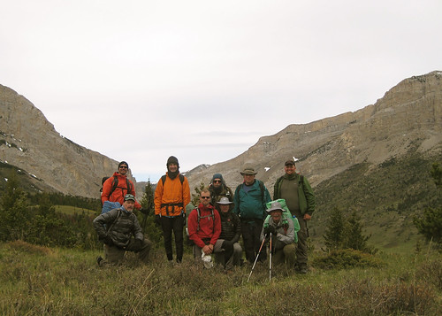
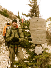
Jeff and Sam started at Fairy Lake USFS campground at 07:30 on 2008-08-24 with light packs, lots of food, water, maps and legs ready to be destroyed. We finished, eleven and a half hours later having ascended 5,170ft, descended 7460ft and traveled nineteen miles.

Preparation – Jeff has lived in Bozeman for two years and has had his eye on the route followed during the Bridger Ridge Run just about ever since. Sam has lived in Bozeman for about a month and a half but has had his eye on a Bridger Traverse since the first time he skiied Bridger Bowl in 2005.
In a passing conversation the week prior to the trip Jeff mentioned his 30th birthday was coming up and that he had a desire to do something meaningful, worthwhile and challenging before his twenties passed. Knowing that Sam was someone who thoroughly enjoyed backpacking, hiking and alpine scrambling he put forth the idea to him as well as some other Bozeman locals. Sam responded with a whole-hearted, hell yes I’d like to join you and the response from others was a bit milder.
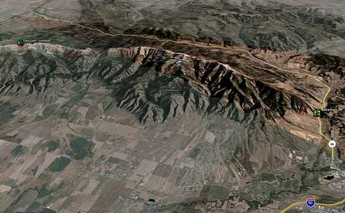
Sam and Jeff both did some independent research of the traverse using such tools as the excellent Bozeman Area topographic map, Google Earth and the Ridge Run maps located at the Big Sky Wind Drinkers Web site.
The Hike – Waking at 05:30 on Sunday morning a quick breakfast was consumed and the packs finally loaded. Sam brought Clif bars, salami, cheese, baguette, chocolate and four liters of water. Jeff brought sandwiches, M and Ms and nine and a half liters of water (having miscalculated thinking he was only bringing seven and a half). Driving Sam’s Subaru to the Fairy Lake trailhead they quickly hit the trail opting to change the Bridger Run route to their own liking by tacking on a summit of Hardscrabble Peak to the already big day of travel planned.
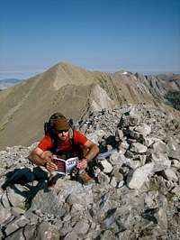
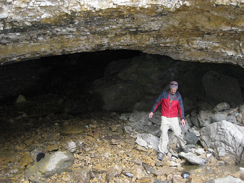
Descending from Hardscrabble the meat of the journey began with a climb of Sacagawea Peak, the high point of the trip at 9,665ft of elevation. A use trail exists along the entirety of the Bridge Range as described in this report but side-steps some of the summits in the range. Opting to bag most of these Sam and Jeff next climbed the few dozen extra feet to the summit of Naya Nuki wherein author Kenneth Thomasma has left a few copies of his novel, Naya Nuki, Shoshone Girl Who Ran, the story of the peak’s namesake.
The use trail is excellent for 95% of the route and is the majority of what is traveled in the traverse. The route called for in the Bridger Ridge Run skips a beefy section near Ross Peak which would call for a higher class of scrambling that most are prepared for in a running race. At this point the suggested route is to drop a thousand some odd feet to the National Scenic hiking trail which parallels the Bridger Ridge on the West side. A beautiful trail with excellent tread takes traversers to Ross Pass and then at a well-marked junction (large cairn and two blazes, one paint and one cut) hikers should turn left, head straight uphill on a well-worn use trail back to the summit of the ridge.
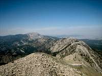
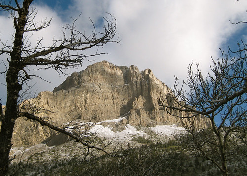
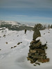
The rest of the day was spent hopping rocks, photographing amazing views and calculating mileages and hours. Along the way are great views of many mountain ranges, including the Crazy Mountains, Madison Range, Absaroka Range, Beartooth Range, Gallatin Range, and the Tobacco Root Mountains.
Other named peaks that are ticked off while hiking this traverse are Saddle Peak, Bridger Peak and Baldy Mountain .
Descending from Baldy Mountain to the Bozeman area “M” trail is a knee-pounding affair nearly straight down a few thousand some odd feet. After a grueling day in the sun, hiking on scree and rock it took it’s toll on Jeff and Sam’s knees. We met Jeff’s wife Shannon at the “M” and finshed at the “M” trailhead to shuttle back to Fairy Lake to fetch Sam’s vehicle.
Conclusions – Having hiked this partial section of the Bridger Range Traverse both Sam and Jeff would like to complete the remaining section from Flathead Pass southward to Hardscrabble.
Worthy of mention is the common thread on various Internet resources that the route is hard to follow and both Sam and Jeff agree that these statements are false. With minimal route-finding skills and keeping one’s eyes open anyone with the physical capabilities for big miles and big elevations should have little to no difficulty in completing this traverse.
 View Trip Photos


 The snowpack in Southwest Montana has been treacherous most of the winter which has kept me out of the backcountry and therefore out of backpacking or touring. I’m an active individual and I’ve been able to keep myself occupied snowboarding at the resort and doing a lot of cycling.
 A group of friends and I decided to take the cycling thing off the roads and onto the trails due to some unseasonably warm weather the area has been experiencing. This group of cyclists has been heading to this location for years for winter riding as there exists an interesting micro-climate in area that keeps the trails relatively snow-free most of the winter.
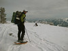
 We went riding on Sunday, January 18th, 2009 near Whitehall, Montana at a place referred to as Pipestone. It is known for it’s bike trails, ORV trails, as well as it’s rock climbing and bouldering. While riding we saw ATVs, dirt bikes, and even a couple climbers – all out to drink in the near tropical heat we’ve been having.
 We rode for a couple hours stopping often to fix various mechanical issues – a common problem on the first ride of the year I suppose. I have no idea how many miles we put on but I’d venture to guess ten or more miles. The trails we were riding (and wrenching) on were a combination of frozen sand, ice, snow, and mud. We all ended up nice and dirty which is a sign of a quality off road ride.
 Riders present were Casey, John, Katie, Sam, Seth, and Steve representing a varied cross section of abilities. I do not remember the last time I went off road cycling so I was very excited to be on the trail going fast (and very, very slow at times) through single track, dirt roads, and icy and snowy treads of all varieties.
 To better memorialize the trip I put together a video montage of the day’s riding. My photo are also available from the day at my Flickr page,


 I’ve been doing some reading about DIAD activities lately. DIAD stands for done-in-a-day. The idea behind the type of DIAD hiking activities I’ve been researching is to pick a hike that might take two or even three days for typical completion and finish it in one day.
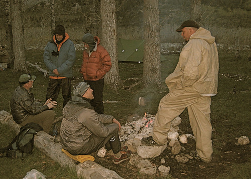
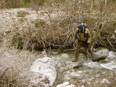
 During the waning part of August, 2008 I had my sights on the Crazy Mountains, a small range in Southwest Montana better known for it’s grazing cattle and timber land than for backpacking. Using a combination of Google Earth, digital 7.5 min. quadrangle maps and National Geographics TOPO! program I determined the route I was too take through the Crazies. My plan was to head up the Trespass Creek trail, over a pass, down into the Sweet Grass drainage, then up a different fork of the same creek, over another pass (one without a trail), and finishing by walking down and out the Cottonwood Creek trail back to my car. This trip was twenty plus miles and I was hoping to summit Conical Peak in the middle of it so I knew it was going to be a stout set of miles.
 I usually hike solo and because of this I prefer to be prepared, having no one to rely on in the event of an emergency or stranding. I decided I would attempt the hike in a one-day push but would carry a limited backpacking kit (shelter, insulation, cooking gear, et al) in the event the weather turned poor or I the terrain dished out more than my endurance could handle.
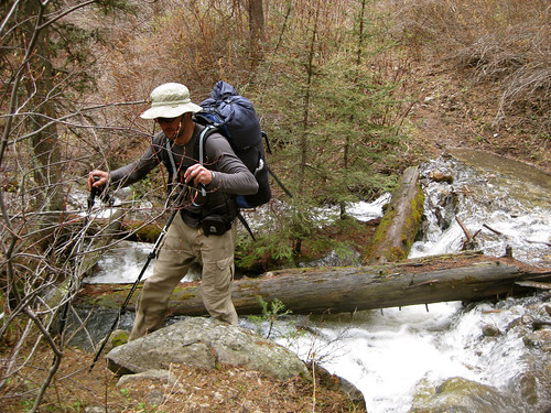
  I awoke at dawn, packed my bag and headed up the trail. I encountered a man and his son readying themselves for six days of mountain goat hunting, two groups of two backpackers, and a man as his four daughters outr backpacking. I didn’t expect much traffic but this was Labor Day weekend so then again it didn’t surprise me all that much. I made excellent time, hitting all the marks I was hoping to and as I approached Conical Peak I saw no reason I couldn’t summit it and still be back to my car before dark.
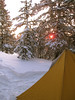
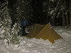
 The sky had been having trouble making up its mind as to what the clouds wanted to do. Big, ugly, black, menacing looking things had been rolling in and out all day and as I began the couple thousand foot climb to the summit of Conical it became very cold and began to rain. As I progressed another hundred feet the rain was turning to snow and a white, blinding fog was enveloping all around me. I realized very quickly that a summit of a mountain doesn’t mean a lot to me without a view so I turned around and headed back to lower ground. If it did start snowing seriously I knew I was going to either have to make a dash over the trail-less pass I needed to cross to get back to my car, or camp below Conical Peak and hope the next day was warm enough to melt the snow which would have made the off-trail crossing difficult.
 As I lost elevation the weather decided to be silly again and the sun came back out and warmed everything up. I made my way toward the steep, loose, rocky pass that from my vantage appeared to have some class 3 and 4 sections required for crossing. The group of backpackers consisting of the man and his daughters had told me they had made their way over this pass the day before (only in the opposite direction) and considering that these were kids aged in their pre to teens I figured I could probably do it successfully as well. I headed up the pass and made a couple poor route decisions which put me into about ten minutes of climbing that was a bit over the edge of safety. It wasn’t anything I’m incapable of, but it was certainly stuff that could lead to danger had I made a wrong move.
 Driving along the fifteen mile gravel road back to the highway the weather really decided to kick it up a notch. A heavy rain began to fall complete with thunder and lighting. I drove slowly home thinking how nice it was I’d finished the loop in a day and not having to deal with the weather. But all the while a parallel thought was coursing my synapses, and that was that I just knew the next morning would have provided me a brilliant covering of snow and I would’ve awoke to the glistening beauty of a snow-covered alpine lakeshore. Alas, the time will come soon enough for lots, and lots, and looooots of snow. I’m curious, what would you have done?