
ultralight backpacking, bicycling, splitboarding
After a strenuous multi-mile drive and an imposing walk of hundreds of feet we climbed the thirty-one foot summit “Friendship Tower” with ten cheeseburgers and a backpack full of beer. Â Celebrating our buddy Adam’s bachelorhood before he marries this summer made for a great opportunity to explore some of the “mountain” tops of the beautiful Black Hills in South Dakota.
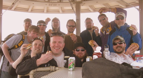
Derrick, Jerry, Nick, Adam, Jason, Matt, Mike (wotboy), Jon, Ben, Jason, Steve, and Sam (samh)

I ride my bicycle to work and for many of my errands year round and as such the potential for a mechanical is always in the back of my mind. Fortunately a few simple tools are all that are necessary for most repairs. The other key repair element not pictured is a telephone – because 9 out of 10 times you can just call a friend to come pick you up!
What items are you carrying that differ from mine? The gear pictured above differs when I’m on a trail ride, a road ride, or an overnight tour and lighter options of much this kit exist. I find a balance of weight, functionality, cost, and other factors come into play.

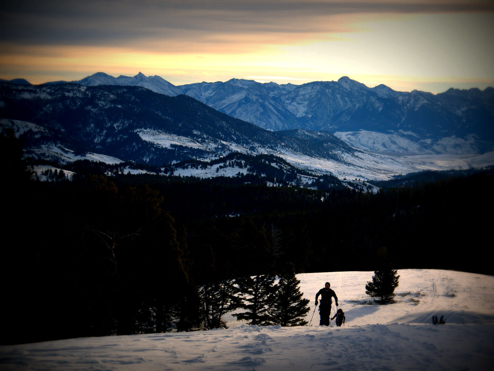
It’s been many months since I’ve taken the time to write or share photographs about my adventures of this summer or fall and now, as we’ve solidly moved into winter here in Bozeman I felt like sharing about an outing my fiancee and I took this past weekend. We loaded our workhorse of a pulk sled along with an axe, Swede saw, my GORUCK GR1 ruck, and a Christmas tree cutting permit into the back of the Landcruiser and headed up into the Hyalite region of the Gallatin National Forest to find our tree.
We have tall ceilings in our apartment so we set out to find a 10+ foot tree that had nice symmetry, even branch spacing, and the right height. We drove a snowy forest service road off the main paved road for a mile or so until we came a zone we felt would have the right tree. We then set out pulling the pulk sled strapped to the GR1 and walked about a mile and a quarter in a circle marking potential trees using a GPS app on my smartphone. After walking the loop we settled on the best of three trees we liked and set out to chop ‘er down.

I did the face cut with my axe and then came in for the back cut with my less-than-sharp Swede saw (I tend to buy things from thriftstores). After felling the tree we loaded it up onto my Otter sled complete with a DIY pulk system I built last year and pulled it up a nice, steep hill to the waiting Landcruiser.

We took the backroads home so we could drive nice and slow to avoid desiccating the trunk anymore than necessary. That evening we invited friends over for Elk fajitas, beers, and an ornament hanging session.
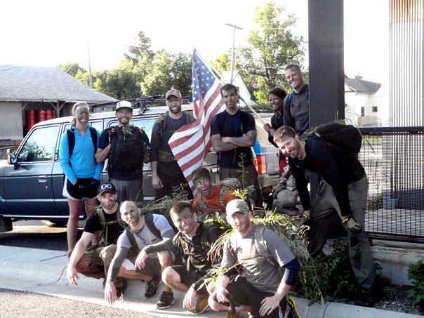
GORUCK Challenge Class 217 – Bozeman, MT
More photos:
http://www.flickr.com/photos/goruckchallenge/sets/72157630985676548/with/7746325974/
Participated in a 55 mile gravel road race/ride last weekend. @LotoMojo did a nice write-up post-race so I won’t bother with my own. Go check it out if you’re into that sort of thing over at our local cycling blog, “The Bozeman Fix” – Morganzo 55 Wrap-Up.
– – –

Yesterday morning after a very positive job interview (which I look forward to sharing more about in the near future) my buddy Mike sent me a text about going for a bike ride. We’d been talking about strapping our skis to our bicycles and heading up the most popular mountain access road in Bozeman – Hyalite Canyon. At this time of year the Forest Service gates the road to motorists for reasons based on impact but bicyclists are still allowed to enjoy the dry, clean pavement. The road winds about five miles (8km) and gains a few thousand feet of elevation which means its a great climb followed by an even better descent.
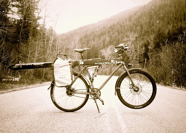
Mike and I planned this for the later afternoon so it wasn’t within our time constraints to ride directly from town and up to the mountains so we can’t claim pure smugness for this trip. We loaded bikes, skis, poles, boots, clothing, water, warm-temp ski wax, and panniers into Mike’s Suby and headed out.
Arriving at the trailhead and setting up the bicycles with ski gear is fun for a couple gear/bike dorks like Mike and I. The best part of it is living in a town like Bozeman doesn’t even proffer up a bunch of goofy what-the-hell-are-you-doing looks from other trailhead users. People just give you a nod of approval or a vocal ‘way to get after it!’

We had a great, albeit short ride up the asphalt road, then down a dirt and snow covered side road up to the snow line. Mike and I both chose to ride our “townie bikes” which have +/- 2″ MTB tires which made for a good choice given the multiple surfaces we rode upon.

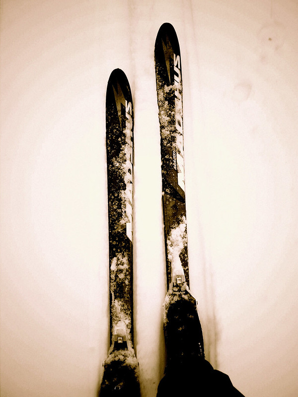
From here we transitioned to skis and other than having to walk three short sections of dirt we were able to ski about four miles of pretty decent corn snow. We applied some Swix warm-temp wipe on wax before setting out which kept the snow from sticking and provided good glide.

Mike and I both ski on Madshus Epoch skis and were really enjoying the control that the shape and edges provide. In the downhill sections of our ski we were both making alpine turns in the slush and whooping with enjoyment. Mike skis in a Fisher BC NNN boot and I ski in a Rossignol 3-pin boot.

A short drive North of my fair burgh of Bozeman is a sub-range called the Bangtails. It has been heavily ravaged by logging over the decades and is home to a diverse crowd of users in/on logging trucks, motorbikes, snowmobiles, bicycles, foot, and ORV. Along the crest of this length of earth rising around 2,000′ above the valley floor is a gem of a piece of singletrack stretching twenty-six miles – – yes, that’s right – – twenty-six miles of single-track trail. It parallels a stretch of asphalt highway so a trail user can drive to the end, drop off their car, pedal 8.25 miles along the highway to the start and then begin the knee-busting and back-ache-causing climb up switchback after switchback to the crest.
Nothing but delight follows upon reaching the top of the Bangtail Divide however as the rider is treated to glorious views of the Bridger Range immediately to the West, the Crazies to the East, the Gallatins and Madisons to the South, and a glimpse of the Absaroka-Beartooth to the Southeast.
But the views are only the beginning. Although the trail is shared with motorcyclists and can from time to time be pockmarked with the damage caused by how much power can be put to a wheel by a 2 or 4-stroke engine the riding is delicious. Long, open, sloping meadows of pedal-free sections of absolutely flowy riding appear in glorious .25 and .5 mile sections. Short climbs are followed by long, long sections of wooded downhill with sharp but bermed switchbacks and bumps and rolls that just flow by underwheel as you get over the back wheel and send the front into the air, sailing freeform.
You cross one dirt road in two places during the ride atop the crest but it’s a mellow, undisturbing crossing. You may see a 4×4 pickup full of guys with beers out shooting guns but this is Montana. Give a wave and if they’re shooting close-by perhaps you can finally get a chance to shoot that .50 caliber handgun you saw in “Snatch”. Riding past Olsen Creek road you’ve got one more climb before the Coup de grâce that is Grassy Mountain.
Grassy Mountain is a destination ride in and of itself. Many a Bozemanite drives to the terminus of the Bangtail Divide to climb the trail in reverse only to turn around a few miles later to ride this wonderful piece of flowing downhill. After having ridden more than a marathon’s distance and probably feeling pretty tired there is something pretty smashing about throwing your seatpost to it’s lowest and hammering out a few cranks up to speed for five-plus miles of sweet, sweet downhill singletrack. Thickly wooded trees swoosh past you as you wheelie over roots and holes, whip around switchbacks and slice natural, bermed wall-rides. Finish it all by crossing a small wooded bridge, compress your brakes to their fullest, layout a skid in the parking lot, and go fish out the beers you stashed in the creek. You just pwned a classic piece of SW Montana singletrack.

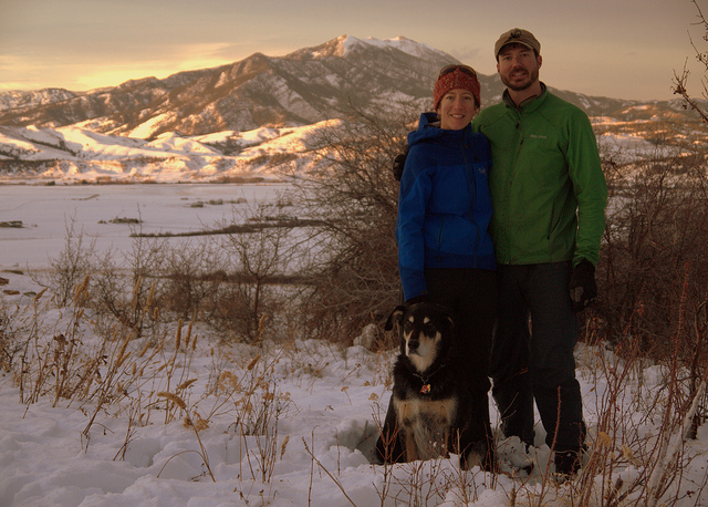
Having enjoyed a nice Saturday and Sunday relaxing but not having gotten out for anything epic (I know, I know, a potential waste of a three-day weekend) upon awaking on Monday morning I looked at my phone to see a text message announcing the automatic weather station at Bridger Bowl (now closed for the season) was announcing 6+ inches of fresh snow and that the previous 36 hours had been below freezing. This is the stuff that spring skiing dreams are made of so three of us quickly compiled our gear and were in the car headed North about an hour later.
The road travels nearly all the way to the base of the mountains and in a typical year would be completely snow-free at this time of the season. But this has not been a typical season and there was over six inches of slushy white stuff all the way into the parking lot. In typical Bozeman fashion there were dozens of cars there and skiiers and snowboarders dotted the face of the mountains, seen through patches of fog. We sipped our last drops of coffee, donned our boots, boards, and skins, and headed upward. The base of the mountains was just high enough in elevation and temperatures just low enough that it was snowing on us (and fortunately not raining). The temps were enough and the activity of skinning is steamy enough that we opted to skin in our base layers rather than rain shells and although the base layers were getting wet it was much more comfortable than the sauna created by a rain jacket.

The skin track was well-defined as there have been people skiing up in these parts everyday since the resort closed in early April. Â The precipitation has been full-on for the past week and new snow has been hitting the mountains like a deluge. Â The new snow of this day was perfect however as it came during a low temperature period that reached way down low in elevation allowing for a beautiful, creamy layer of snow that was upwards of 18″ in depth up high. Â This was not without problems however as it was sitting atop a very defined layer of hard, crusty snow that had little to no adhesion to the dense, heavy stuff sitting atop it. Â Wet avalanche activity was very prominent.

We gained the top of the Bridger Range in good time and with lots of energy. Â The snow continued to fall and without much discussion we headed to a point slightly south along the crest called The Nose. Â It provides for great fall-line skiing that’s not so steep that the wet avalanches would limit our descent and that also is home to a good quantity of trees which help ease the deception of skiing in foggy conditions with no point of reference between the snow and the sky.

The first turns were made in only a few inches of fresh snow. Â Wind must have moved most of the freshies downward off the ridge and into the trees because after the first half dozen turns we quickly moved into calf-deep, heavy powder that was an absolute delight to ride. Â We played leap-frog, taking turns skiing and watching. Â We were riding in terrain that is in-bounds at a ski resort but given the resort closed almost two months ago this terrain is now considered avalanche-prone. Â Mason is a former ski patroller and Mike and I are avid backcountry skiiers and the propensity for a wet slide to push one of us down the hill gave us caution. Â We came to the choke at “Exit Chute” toward the bottom of The Nose and Mason opted to ski it very cautiously. Â Small slides were pushing off his skis as he made his way through the choke. Â I went next and opted to ski directly toward the chute and then away and left to a parallel chute. Â In doing so I pushed off a massive slide of avalanche debris that although moving very slowly would have taken a skiier for a ride. Â Mike, who was above me communicated the activity to me and I communicated it to Mason who was below. Â Everyone was safe as we knew where each other were located and were able to communicate effectively.