Backpacking Light – Wilderness Trekking School – WS1-LWB 2010

Over a weekend in late July and early August Chris Wallace and I had the opportunity to instruct a group of excited students in the ways and (dare I say) art of ultralight backpacking.  We were working on behalf of the Backpacking Light Wilderness Trekking School and operated a three day course out of Jackson Hole Wyoming in the Bridger Teton National Forest. 

Chris and I have had the opportunity of backpacking together previously and regularly exchange gear-related chats via various Internet channels so I know what his strengths were.  He is a gear and nutrition nerd, plain and simple.  Ask him a question about a piece of gear and he will provide you a well-researched and fact-based explanation of it.  Ask him a question about caloric density of food or what he suggests as a ratio of protein to fat to carbs and he’ll have an answer for that as well. 

Chris provides a good balance to my style which is a bit looser.  I know gear also but from a more theoretical point of view basing my knowledge more on fabrics generalities and broad design elements rather than specific brands.  I’m also blessed with having spent myriad days in the backcountry of the Rocky Mountains and having walked thousands of trail miles with only a map as my guide.

I was able to offer up to our students a light-hearted, humorous attitude with an anecdote for just about every situation and Chris was able to provide qualitative, verifiable data for any and all serious questions posed by our more technical students.

The students who enrolled in our course were of a broad background.  We had semi-retirees from Florida, vagabonds from Wyoming, alpine enthusiasts from Oregon, and a solo-trekker from Quebec.  The students were well-versed in a good chunk of info regarding the ultralight backpacking ethos but all yearned for more and also particularly wished to put these techniques into practice in the backcountry and have help doing such from instructors like Chris and myself who’ve done so many times.  According to post-course feedback we were successful. 

But enough with all this writing – – let’s look at some photos because we all know they’re worth a thousand words.  For full photo set please visit my Flickr photo page.

Teton Mountain Range
Gossamer Gear Spinn Twinn

 Charlie and the rising sun.
Have you been hiking near the Tetons?  You really should you know.
 I can see your Tetons from here.

Splitboarding and Backpacking in July

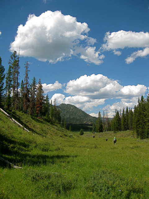
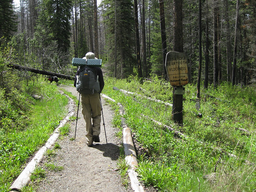
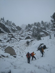
Friday, July 9th, 2010 I walked out of the office at 17:00, was home and had a lightweight gear set-up for both backpacking and splitboarding packed and in the trunk of my Subaru by 18:40.  My destination was the Pine Creek trailhead in the Northwest corner of the Absaroka Mountain Range and I arrived by 19:40.  I knew daylight would leave me sometime between 21:30 and 22:00 so I shouldered my load and high-tailed it onto the five mi. (eight km) Pine Creek Lake trail.

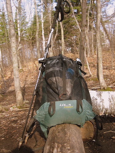
Being an ultralight backpacker it was strange to have the added weight of snowboard, boots, avalanche safety tools, and ice axe.  The moving was a bit slower but it felt good to be moving as day slowly turned to night, temperatures dropped, and I got further and further into the Absaroka Beartooth Wilderness.

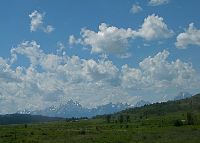
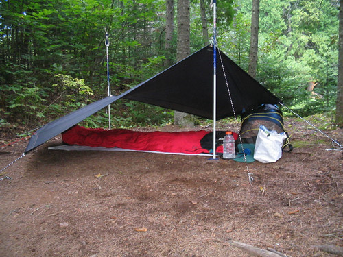
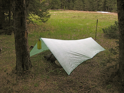
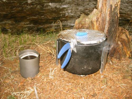
I hiked until 21:30 and stopped to make use of the last bits of daylight to set up my minimal camp consisting of an eVent bivy sack, synthetic sleeping quilt, and torso-length sleeping pad.  I strung my bear rope, set up my alcohol stove and prepared some instant mashed potatoes as the sun set over the Gallatin Mountain Range and Paradise Valley to the West.  Sleep came to me by 22:00. 

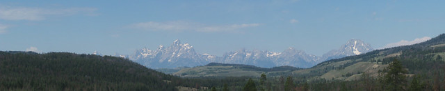
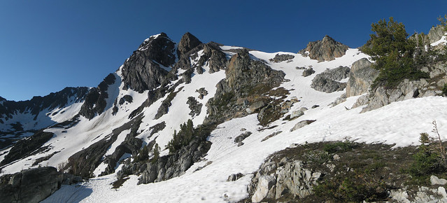
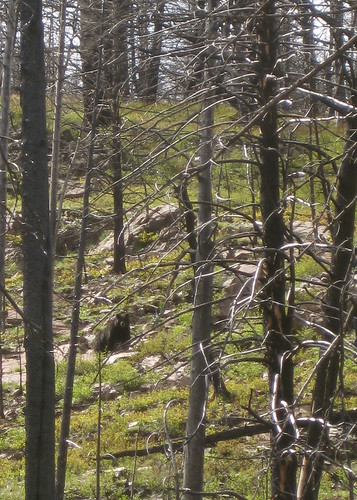
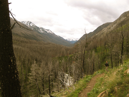
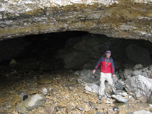
I awoke at 06:00 and was hiking within twenty minutes, chomping on an energy bar and sipping water from my hydration system.  About 30 minutes of hiking brought me to the end of the trail and into the snowy bowl that is Pine Creek Lake.  A large iceberg was still floating in the lake and the cirque held a fair amount of snow – – a soothing site for me as I had lugged many pounds of snowboard gear into terrain of which I knew little about the snow conditions other than my previous trip two years before.

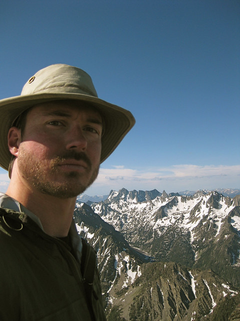
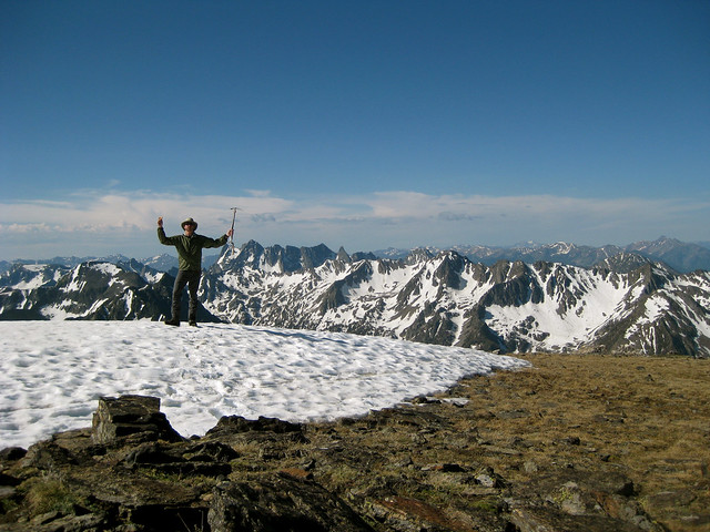
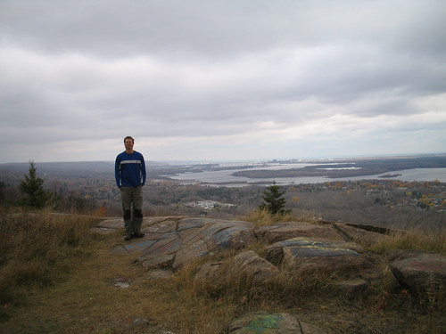
By 09:30 I had summited Black Mountain (read Summit Post profile) using methods of walking, skinning, and ski crampons.  I was slightly undernourished having had only one energy bar and one GU but I made decent time and was in great spirits.  I spent a few minutes on the relatively snow-free summit and then descended to the large snow bowl that I planned to ride.

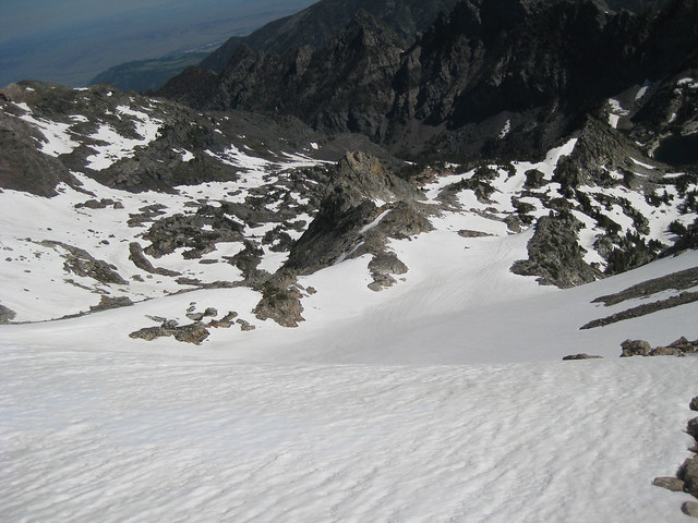
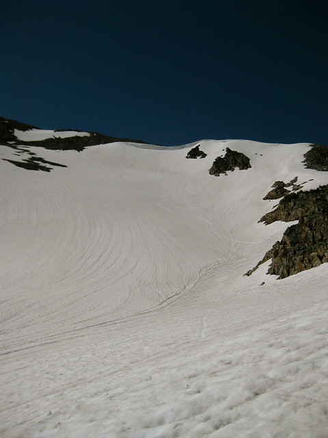
The snowboarding was quite delicious and I was able to get approximately 1,000 vertical feet (304 m) of riding in.  The top 800′ (244 m) was wonderful corn snow that didn’t grab the board in the least and allowed for me to arc some nice, large GS turns.

Proceeding past a flat spot at the bottom of the large bowl and sliding over a little roll put me onto a different aspect that consisted of some fun slaloming through large boulders in snow of a slushy quality for about 200′ (61 m) vertical.

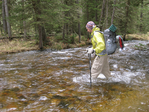
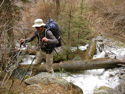
I swapped out the snowboard gear for shorts, trailrunners, sunscreen, took a few swigs of the refreshing snowmelt water that was all around me and headed down the trail.  Arrival back at my Subaru was around 13:30 leaving me plenty of time to return home and shower before heading into downtown Bozeman for the bicycle sprints portion of the Tour of Bozeman race series.

Summit Cheeseburger – Buck Hill, North Dakota


Mom and Dad chillin' by the grill at the "trailhead".
 
June 25th, 2010 – Theodore Roosevelt National Park, North Dakota
My parents were celebrating their 38th wedding anniversary with a camping trip to Medora, North Dakota. They asked me a few months in advance if I'd like to drive out to see them since it's much much more convenient to drive 400 miles to see them than 1000.

Before leaving I did the mandatory "I'm going on a trip so I'd best look up local summit cheeseburger opportunities" and found Buck Hill and it's location along the scenic drive through Theodore Roosevelt National Park. The opportunity to pack the Weber, some ground beef, cheese, and potato salad into the back of the truck was too juicy to pass up. Mom, Dad, and I grilled burgers at the trailhead and then carried them along with some Cokes up to the Summit, took a photo and then relaxed and enjoyed the view.


Sam, Mike and Ann conquering Buck Hill in Theordore Roosevelt National Park

Porcupine Mountains Wilderness State Park – Summit Peak Loop

This trip took place October 6th – 8th, 2007
IMG_1543.JPG

My buddy Mark and I have been backpacking together for the past seven years or so and in 2007 we planned a trip to Michigan’s Upper Peninsula (c’mon up to da U.P., eh!).  The Upper Peninsula or UP as it’s commonly referred to is home to some nice wildland – particularly Porcupine Mountains Wilderness State Park.  We planned for a four day weekend and did a great – albeit rainy – loop within the confines of the park. 

Our trip route was:

  • N. Mirror Lake Trail
  • Little Carp River Trail
  • Lake Superior Trai
  • Big Carp River Trail

I was very pleased with how the photos Mark and I took that weekend turned out.  The fall colors and wet landscape came together for some very soft and pleasing imagery.  Following are a few of my favorites.  View the entire set within the pages of my Porcupine Mountains set on Flickr. 

IMG_1595.JPG

Sam on a rock

Fall colors

Sun and water

Mark, Sam, jackasses

Silver Bay to Section 13 on the Superior Hiking Trail

This trip took place April 20-22nd, 2007.  Participants were Andy, Logan, and Sam

Logan, Bean Lake

April 20th – Friday night we arrived at the Silver Bay trailhead just before dark. We were able to move the 3.5 or so miles to the Bear Lake campsite with no difficulties. We ran into some fellow Duluthians at the trailhead but they were camping at a closer spot and we lost track of them.

Arrival at camp was quick and efficient as all three of us are experienced backpackers. Tents were erected, dinner prepared and a comfortable fire built just in time for the “alpine-glow” to be replaced with darkness.

Feet, Bear Lake

April 21st – Morning was just as efficient and gratefully so as the rain began to fall just as we were closing the tops of our packs. We hit the trail as the chilly drops of rain sent their wake up messages to our bodies. We hiked to Tettegouche State Park where Andy had to make his departure to meet some family members for a backpacking trip elsewhere along the trail but Logan and Sam continued on the rest of the sixteen odd miles to Section 13 camp.

Section 13 Cliffs

A chilly but relaxing evening found us cooking some warm grub and chatting about the old days back in Montana followed by an early bedtime. It had been awhile since either of us had done any real trail miles so we were feeling the sixteen miles.

ULA Equipment Conduit

April 22nd – Morning came with no real pain and we quickly packed for the short mile and a half back down to the highway and Logan’s waiting Jeep. We were in Duluth eating wild rice burgers at the Brewhouse by 11:30.

View entire trip photo set on Flickr.

Revisiting Old Trips – Superior Hiking Trail, MN, USA

Sam above Duluth, MN with Lake Superior in the background
Sam Haraldson above Duluth, MN and Lake Superior, October 2005

I’ve decided to take all the trips I’ve documented on samh.net/backpacking and create blog posts about them here so that I can have one all-encompassing trip reports website. The majority of these posts will be short and focus on photos but others such as my trip reports for my thru-hikes are quite lengthy.

This particular post you are reading now will cover two trips, one from July 2006 and another from September 2006 – both on the Superior Hiking Trail on the North Shore of Lake Superior in Minnesota.

I took an overnight trip in July 2006 into Crosby-Manitou State Park along the Superior Hiking Trail. I had really only begun practicing ultralight backpacking the year previous and was getting into the process of trying out new gear and techniques. In the photos below you can see my heavy nylon tarp, makeshift nordic ski poles, Equinox “About-a-Pound” pack, DIY Tyvek stuff sack, REI WPB bivy, and Gatorade water bottle.

Tarp and bivy camping, Crosby Manitou

In September of 2006 I had acquired a Golite Poncho Tarp but was still rockin’ the same nordic ski poles and bivy. I did a lot of volunteer trail maintenance and a lot of backpacking that summer. It was wonderful exploring the North Shore of Lake Superior and re-visiting the SHT again after having thru-hiked it on a visit there in 2005. On my hike into Sonju Lake I was surprised to find fellow trail-maintainer and friend, Kurt with two buddies who were out on a multi-day trip.

Poncho tarp and bivy camping Sonju Lake

West Fork Boulder River, Absaroka Beartooth Wilderness

Mike and I were poring over our the excellent Absaroka Beartooth from Beartooth Publishing looking for a trail of decent length that stayed below 7,000 ft. (2133 m) elevation as we expected this was the approximate snow line. We chose a trail along the West Fork of the Boulder River that could be hiked for over ten miles in all while staying below the magic 7k topo line. We were pretty certain this was snowline as we had hiked into the East Fork of Sage Creek the week before – a drainage that butts up against the West Fork and therefore should have represented similar weather systems.

June 5th, U.S. National Trails Day (and my brother’s birthday) we set off from Bozeman around 9:30 am stopping to acquire 375 mL of Jameson whisky on our way out of town. The weather was gorgeous and the 50 mi (80 km) drive relaxing.

Mike Absaroka Beartooth Wilderness

I had hiked this drainage in 2008 as part of the Backpacking Light Wilderness Trekking III expedition (a trip report I plan to finally write this summer) Up the Couloirso I was familiar with some aspects of the hike although my previous trip was in October and there was knee-deep snow covering everything. The sun was out but the previous week’s weather had created pretty muddy trails and the snowmelt and rain had the tributary creeks flowing like crazy.

We set off to a nice pace with Jax dog often running off to chase Elk, deer, marmot (one of which we’re pretty sure he mortally wounded), and the like. At one point in the trip Mike stopped and called out to me to stop and look up the hill. To our delight a black bear was walking across the hillside and very visible to us through the forest denuded of vegetation by a forest fire.

Black Bear

We hiked about nine miles to a spot on the map called Beaver Meadows which was situated just below 7,000 ft. It was a gorgeous, grassy, flat island in the middle of the river and although we’d forded four other fast flowing tributary creeks and had spent half the day walking through ankle deep, muddy trails we were wary of crossing the fast, cold, and deep water of the river.

Mike fords the West Fork Boulder River

Our shoes and socks had dried from walking to a state of warm dampness and as it was approaching 17:30 we weren’t about to completely soak ourselves again so we stripped our pants and shoes off and made the crotch-deep crossing swiftly in an attempt (a failed one) to stave off numbness. Upon reaching the other side we quickly did some calisthenics to warm up and then set off to hunt the island for fire wood.

West Fork of the Boulder River Drainage, Absaroka Beartooth Wilderness

Temperatures that evening only got down to 41 deg F (5 deg C) so we both slept soundly listening to the pitter patter of raindrops on Mike’s Oware Cat II and my BPL Stealth Nano tarps. We were camped only a stone’s throw from the soothing sounds of the rushing river.

Backpacking Light Stealth NANO Cuben Tarp

In the morning we found solace from the falling rain under the canopy of low hanging conifer boughs and cooked up breakfast and coffee on my trusty Whitebox Stove an AntiGravityGear Two Quart pot.

White Box Stove, Trapper Mug

After we began to warm up after re-fording the river back to the trail the sun ended up coming out making for a pleasant journey back down river to the trailhead, car, and waiting beer and potato chip stash.

West Fork Boulder River Drainage

Jax

Gorgeous glow

And Macro Lens...

West Fork Boulder River, Absaroka Beartooth Wilderness

East Fork Sage Creek – Absaroka Beartooth Wilderness, Montana, USA

Mike and I along with Coda and Jax dogs drove into Paradise Valley and up Mill Creek road to the East Fork Sage Creek trailhead on the afternoon of Sunday, May 30th. We planned to hike up river until we hit the snowline and then find a suitable place to camp. This ended up being about eight miles in at elevation 7,500 ft.

Mike

Our map showed a landmark called Crystal Cave which we found and explored before wandering around on a hillside for 30 minutes trying to find a place flat enough, dry enough, and suitable enough to pitch our tarps.

Mike at the mouth of Crystal Cave

We found a nice flat spot fifty or so meters off trail, pitched the tarps, laid out our bags/quilts and then headed into the woods aways off to find a suitable place for cooking, eating, and hanging our food. Upon finding a nice place I set about cooking some dehydrated chicken, beans, and rice left over from what Mike had prepared for a trip the previous fall. While I was cooking Mike set about building a nicely done “Leave No Trace” fire.

Cooking over the woodfire

We enjoyed some working man’s whisky and conversation around the fire while the dogs napped until about 23:00 when it was time to put on the headlamps and navigate back to our tarps. It’s always fun climbing over wet, downed logs in the dark after you’ve had a couple fingers of mediocre whisky.

Coda and some Early Times

Morning arrived with temps hovering around freezing (34 deg F / 1 deg C) and clear skies. With no schedule to keep we slept in ’til around 07:45 or 08:00, arose, made coffee and breakfast and were out of camp by around 09:45. The hike back to the car was lovely with Jax dog scaring up plenty of deer as well as getting a face full of porcupine quills. We arrived at the car around 13:00, enjoyed a can of Pabst Blue Ribbon and had a chat with the ranch owner (or caretaker, not sure which) of the Big Snowy Ranch located at the trailhead.

East Fork Sage Creek – Absaroka Beartooth Wilderness, Montana, USA at EveryTrail

Backpacking Light – Wilderness Trekking School – WS2-BSA 2010

Backpacking Light classroom training sessionCold, snowy, rainy, sunny, repeat. That is a Montana spring and this past weekend was no exception. Ryan Connelly, Sam Haraldson, Ryan Jordan, Mike Martin, and Chris Wallace of Backpacking Light’s Wilderness Trekking School came together with Doug Prosser, Phil Barton, and Pat Starich to instruct twelve Boy Scouts of America scoutmasters from around the country in the ways of ultralight backpacking.

The starting point of our trek was near Dupuyer, Montana on the Eastern edge of the Bob Marshall Wilderness and it’s 1,009,356 acres (4,085 km²). The focus of the weekend trip was mostly to instruct an already skilled set of scoutmasters in ways they can lighten their pack weights as well as ways for them to transfer these lessons to the scouts in their troop. This task was accomplished by a half-day of classroom instruction, two days and two nights in the field, and an indoor debriefing session.

Squirrel Patrol

The group split into two patrols consisting of nine members and set off into the Eastern front of the Rocky Mountains and the Bob Marshall Wilderness. Our starting point was the Theodore Roosevelt Memorial Ranch owned by the Boone and Crockett Club. SamThe first night was spent on the ranch followed the next day by travels into “The Bob” via the North Fork of Dupuyer Creek drainage.

A combination of ranch roads, trails, and off-trail routes was taken with the group exhibiting excellent skills in map and compass navigation. Both nights provided absolutely choice camping spots with excellent views, sources of water, and comfortable eating and sleeping options.

May in Montana requires quality gear choices as the group encountered nearly all possible weather types – – with warm and sunny being the least of our troubles. Blizzarding snow, cold rain, and sun were all to be dealt with at one time or another and most hikers wore a long-sleeve baselayer and windshirt or rain shell for the duration of the trip.

Side View of Walling Reef

All in all the views were superb and the weather was kept at bay with quality tarp and pyramid pitches as well as a warming campfire in the mornings and evenings. Although inquisitive the participants skill-set was no laughing matter as all in attendance were well-prepared with both gear and intelligence. The conversations amongst participants and the ideas shared between them became just as, if not more important than the formal instruction taking place.

View the entire Flickr photo set at Wilderness Trekking – WS2-BSA – 2010-05-21.

Students

Lance, Ryan, and DougRyan Instructs some packing techniques


Ultralight Shelters

StudentsLance