 I recently made a career change which has taken me away from the beautiful Arrowhead of Minnesota and placed me into the grandiose peaks and valleys of the approximately 4,000,000 acres of the Greater Yellowstone Ecosystem. Upon arriving into my new hometown of Bozeman, MT and unpacking my Subaru of my belongings I immediately dove into my new roomates map drawer to find a couple day backpacking loop to satisfy my lust to enjoy the freedom of the hills.
I contemplated heading back up to my old haunt at Glacier National Park but decided that can wait until I’ve explored my new area a bit. Next I considered heading down to Yellowstone National Park but decided against it because of how busy it would be as well as the hassle of the permit system. I had read about the Lee Metcalf Wilderness briefly in some outdoor blogs and it looked to be perfect for my needs – close to Bozeman and high in elevation.
 I opted to start hiking along the South Fork of Spanish Creek, head about ten miles up to Jerome Rock Lakes, spend the night, travel a short distance over a 9,000 ft. pass and down to Upper Big Brother Lake to spend the second night and then awake on the third day to descend a different drainage back to the trailhead and my waiting Subaru.
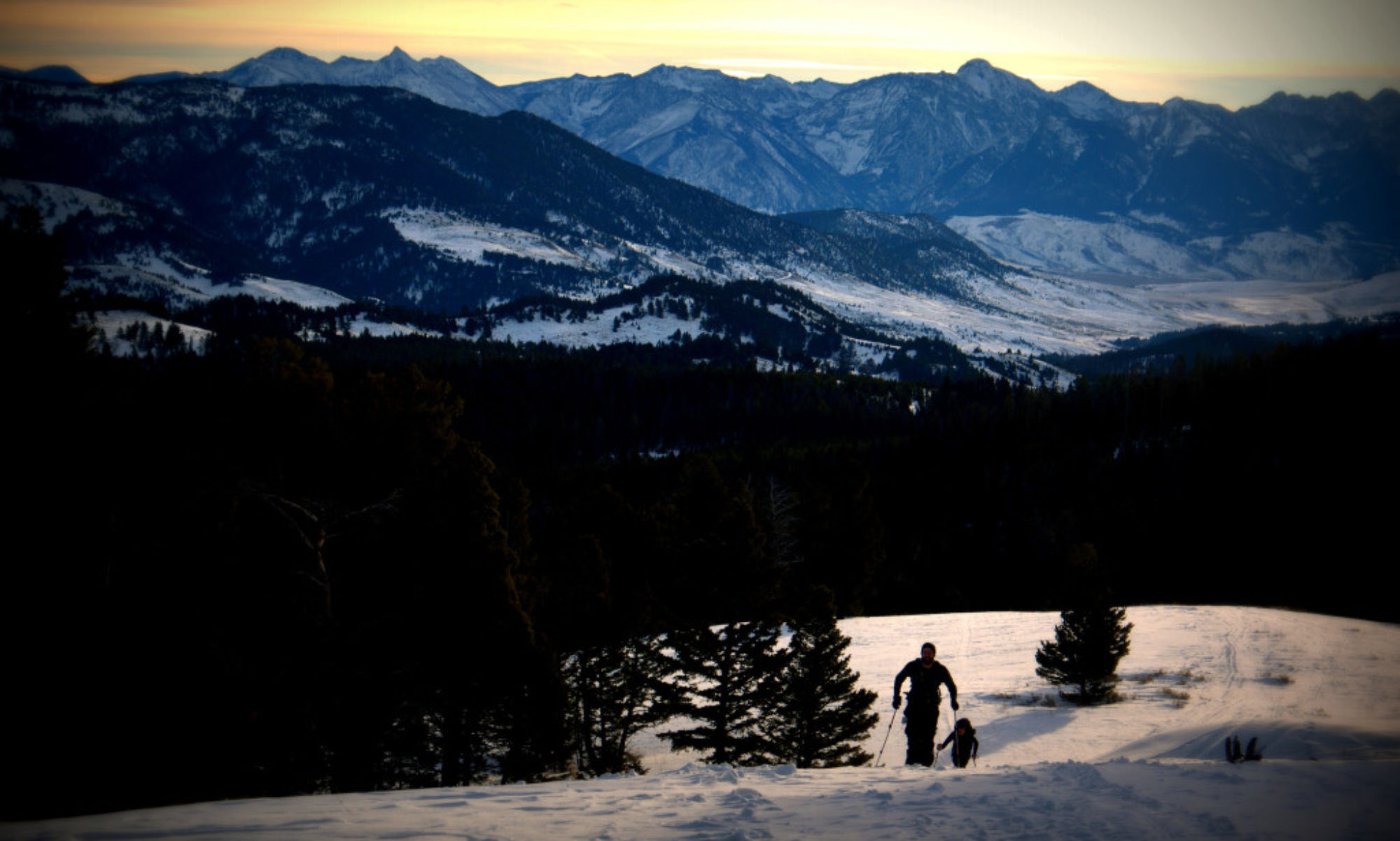
Montana welcomed me back with open arms. Although I’ve been a flatlander living in Minnesota for the past two years I was still able to climb the 2,400 ft to Jerome Rock Lakes and it’s 8,000+ ft elevation without too much light-headedness. Two bears along the trail reminded me I was back in very wild country again. I arrived at the lake just as a thunderstorm was moving in fast. I peered over the lake to see a Bald Eagle swooping low along the lake heading for cover. I had read the upper lakes were nicer than the lower so I quickly began bushwhacking upstream but reaching two plateaus and no lake I decided to head back down to attempt to set up camp before the rains came. I had my shelter laid out when it started pouring. All was well however as I got everything situated and myself under the tarp to hear the thunder rumbling overhead and the lighting crashing around me. The rain didn’t let up until much later so I spent the better part of twelve hours under the tarp that night.
The next day was short on miles but I awoke early and headed out hoping to arrive and do some exploring. This also offered me the opportunity to hike slow at these high elevations to be sure my un-aclimatized body could handle it all. I had my ice axe with me as the Forest Service reps couldn’t give me solid beta on what the snow situation would be at 9,000 ft. There was patchy snow but nothing with dangerous exposure so I never used the axe. The high alpine country of this area is stunning. Rugged peaks, broken scree slopes, raggedy old-growth conifers. Being that this is a wilderness area the trail maintenance is at a minimum. The trail disappeared and hikers are forced to follow rock cairns through the pass. Route-finding was moderate to difficult between finding the cairns and moving through the snow.
 I followed the cairns down to what I thought was Big Brother Lake, set up camp, had a snack and took a nap as it was still only 9:30 a.m. and I had plenty of time to explore later. Awaking from a wonderful slumber I headed out around the lake to climb the prominent knob in the cirque. Upon reaching the top I noticed there were three lakes in the drainage and not one as denoted on the map I was carrying. I determined that I was actually at an upper lake and that Big Brother was another .25 or .5 miles downstream. I lazied around the rest of the day and waded all over the freezing cold lake until anotehr thunderstorm came speeding in. I had to push my tarp walls out to keep them from blowing in for about ten minutes while the storm raged. When it let up a bit I went out, re-set all my tarp stakes and reinforced them with big rocks. This provided a bomber set up and the rest of the storm had nothing on my shelter.
 6:30 came and I awoke as my body seems to do lately. I packed up, ate some granola and began bushwhacking down to the other lake, hoping that upon arriving there I would be able to find the trail again. I was in luck and I was sailing downhill on good trail in no time. Aside from the 250 downed trees I encountered it was good hiking. I arrived back at the Subaru around 11:00 and was back in Bozeman by 12:00.


 Chad and Sam headed up to the Split Rock Wayside, Sam with his pack and Chad with his pulk sled and hiked the six miles to the Gooseberry State Park headquarters. They arrived around 14:30 with plans to meet Jim, Kat and Todd at 15:00. Food was consumed outside the headquarters in the sun and the rest of the group arrived in a timely fashion. Everyone quickly gathered their gear and hit the trail for the 2.7 mile jaunt to the campsite.
 Arrival in camp was around 16:30-ish and everyone immediately set up their camps. Kat and Todd put up their respective tents, Jim rigged up his tarp and Sam and Chad laid down their bivies. All was set before dark and next, out came the cooksets. Food was warmed and snow melted for the evening and next day’s water. Chad and Todd masterfully created a fire around which everyone sat, warmed and conversed for a couple of hours.