I love a challenge. Â Even if that challenge is completely and totally contrived and pretty much no one else cares about the results of said challenge. Â I also enjoy walking through the woods, sleeping outdoors, and subsisting using only a handful of necessary things. Â As such the notion of the superultralight backpacking trip is right up my alley. Â Take some lightweight gear, put it on a scale, and if it weighs in around five pounds or less then you’re doing it right.
We’ve had a family trip to visit my wife’s homeland in Northern Michigan on the calendar for a few months and at some point in time it occurred to me that I could easily throw one of my frameless rucks, a lightweight quilt, tarp, and basic sundries for a SUL backpacking kit in along with my carry-on with little to no difficulty. Â So I mentioned to my wife that I thought a quick sub-24 hour trip on the North Country Trail nearby would be appreciated and she said, ‘why not’. Â It is vacation after all.
I spent some time looking over the NCT map to find a nice section. Â Not too short so it wouldn’t be worthwhile, but not too long so that it would require more than one night. Â I had day hiked some of the NCT while visiting the area on previous trips but wanted to see something completely different so I picked a spot, determined a drop off and pickup location and started spec’ing a gear list.
I get a big thrill out of putting all my gear on a scale, weighing it, and then trying to make it lighter. Â Say what you will about trying to carry five pounds of gear or less, or three pounds of gear or less, or whatever threshold you might have, but I cherish the challenge. Â And when planning a backpacking trip in the balmy Midwestern United States where roads and cell phone reception are prevalent you’d damn well better know I’m going to see about getting away with about as little stuff as I possibly can.
And so my spreadsheet with all the things I was going to bring added up to a smidge over three pounds and the clothing on my person about the same. Â I mailed a mini BIC lighter, some matches, and a few cubes of Esbit stove fuel ahead to my mother-in-law’s house to avoid taking them on the plane (our family travels carry-on only ’cause we’re always packin’ light).
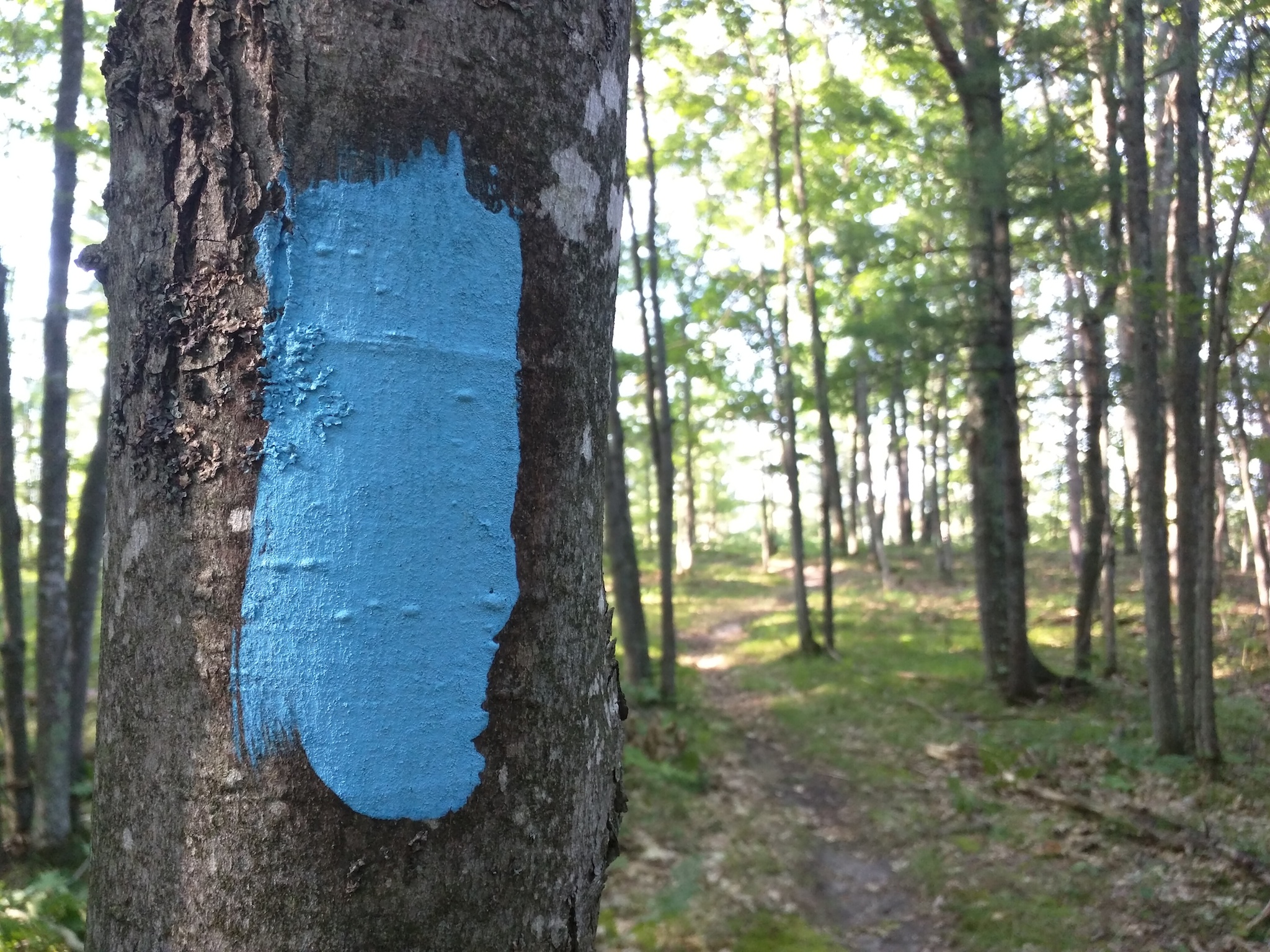
We arrived in Northern Michigan to warm temperatures and on-and-off threats of rain but the night I was looking to camp remained clear in the forecast. Â Th morning of my hike we spent a lovely few hours at the beach relaxing, swimming, and watching the kids play. Â This was the same beach my wife and I were married at four years previous so it was a pretty joyous day. Â That afternoon on the drive home we detoured a 1/2 hour out of the way onto a little, sandy two-track in the thick Michigan woods. Â The North Country Trail Association in Michigan keeps a very tidy trail and sure enough down the road appeared a blue blaze and a parking spot in which, surprisingly, was another vehicle.

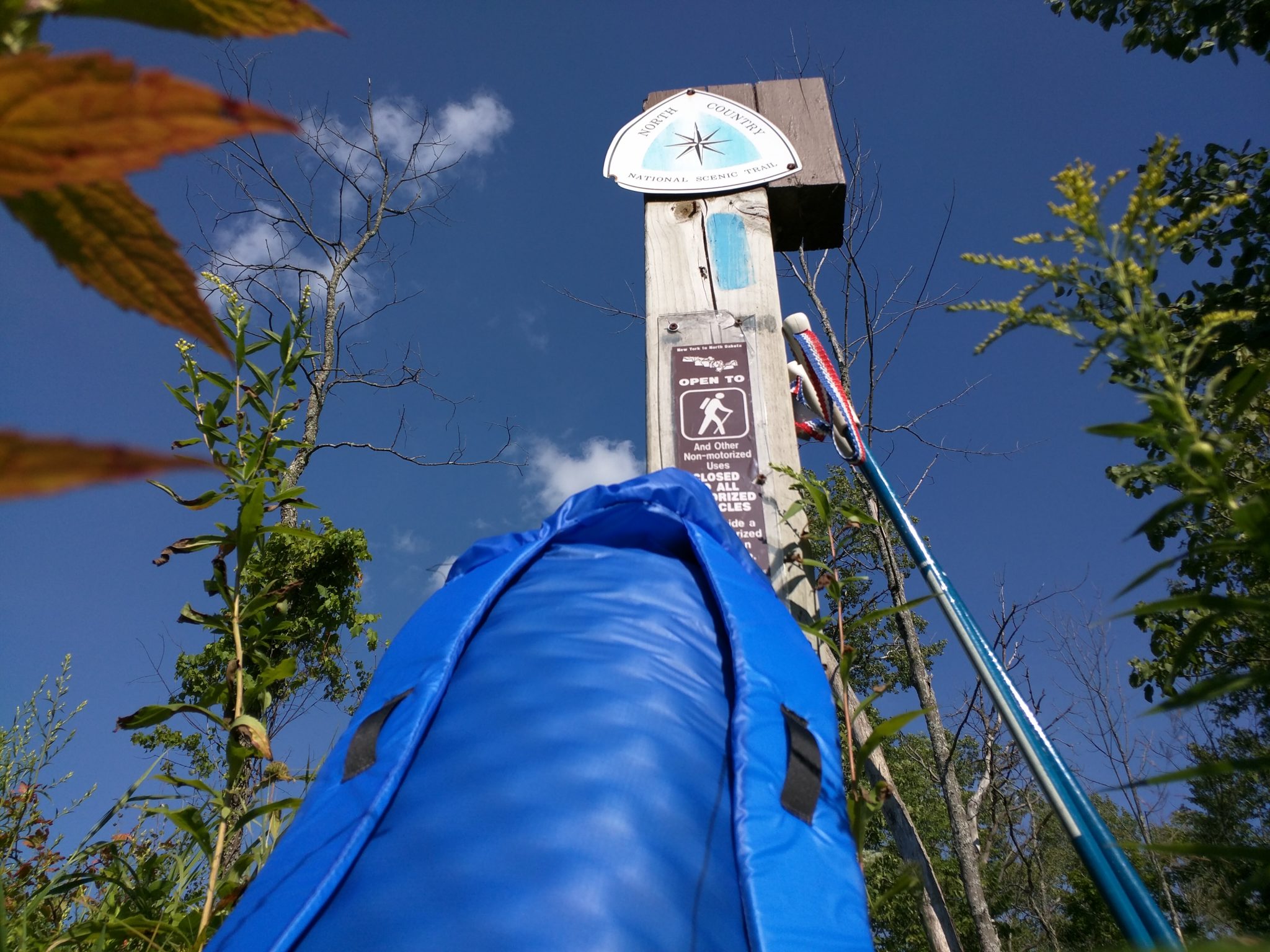
I did a quick parking lot shuffle changing out of my swimsuit and into hiking clothes, gave my wife and daughter a kiss, grabbed my pack and was very pleased to see a well-signed trailhead denoting distances both forward of my position as well as aft including the spot I was aiming to camp at about 7.5 miles up the trail.
I haven’t been on a backpacking trip at all this summer so when I hit the trail I was feeling like a million dollars. Â It was around five o’clock in the evening and I although I had three or more hours of daylight I still knew it would be best to do some quick hiking. Â Besides I love a very fast-paced hike over mildly hilly terrain and along well-groomed paths through knee-high ferns. Â Due to travel restrictions I had left my trekking poles back in Montana but as I’d hoped, my mother-in-law, like any good Michigander had a stack of XC ski poles in the garage. Â I found a set of old fiberglas Jarvinen poles that were quite light and airy and they ended up suiting me very well for the 16 or so miles I put down over the two days.
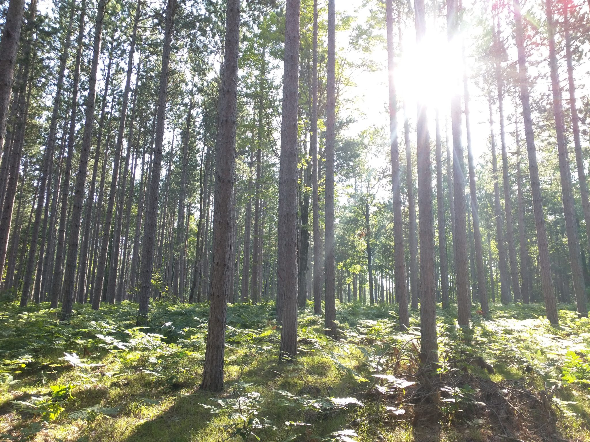
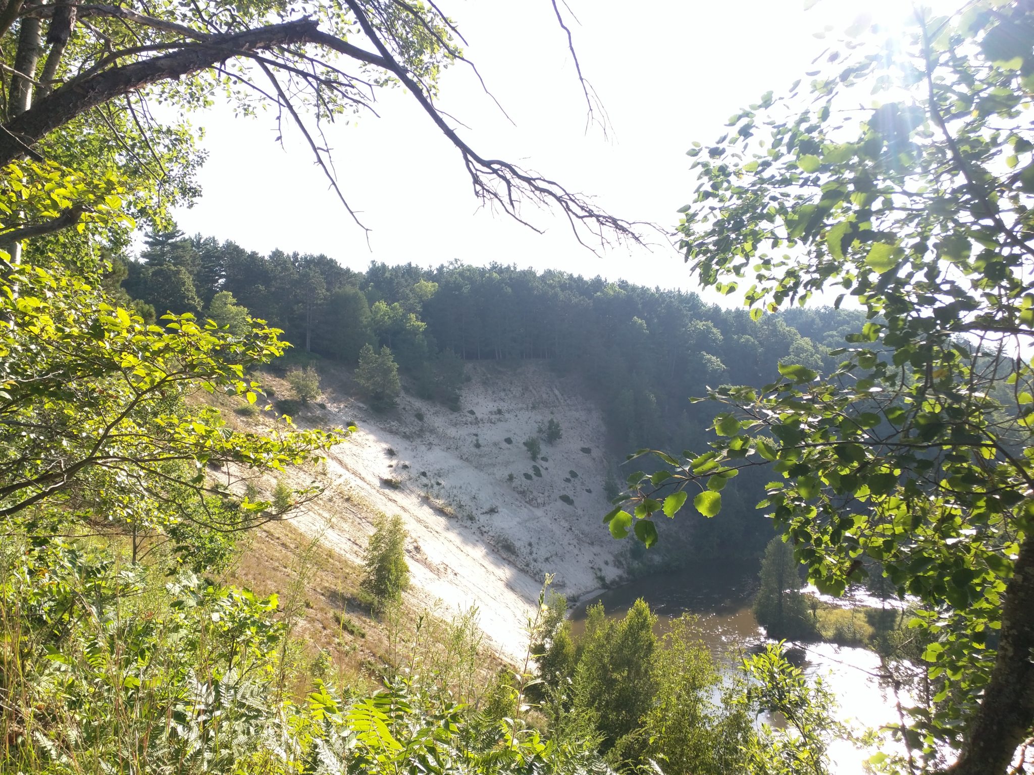
Stretching my legs and settling into a nearly four mile per hour pace I immediately began to make good time. Â My eyes, ears, and nose were operating just as quickly as I took in the sight of thick hardwood forest, low lying boggy sections and their dank, dark wood, gently rising hilly knobs, and then the view that would dominate the majority of the remainder of the hike, the first view of the Manistee River as seen from atop a steep, sandy bank.

I’m a shutterfly and my telephone’s camera was clicking wildly as I walked. Â I was also using the GPS on the unit and although my moving average speed was close to four mph I lost about a 1/2 mph due to stopping and photographing plants, the trail, the river, and all of the aspects of hiking in the Midwest that I’ve missed so dearly since I moved away from Minnesota nearly ten years ago.

The trail made a handful of crossings of sandy backroads but I only encountered a few cars – and those were all off in the distance through the woods. Â I came across one group of people who were standing atop one of the highest vistas of the entire hike, an open view of the surrounding landscape situated a hundred or so feet above the Manistee up an incredibly steep bank of sand. Â We exchanged a few words but the light of the day was beginning to fade so I kept up my pace. Â I couldn’t help but stop when I left that developed area and came to another clearing a bit farther down the trail to attempt to photograph the exceptional view of the distant Michigan landscape.

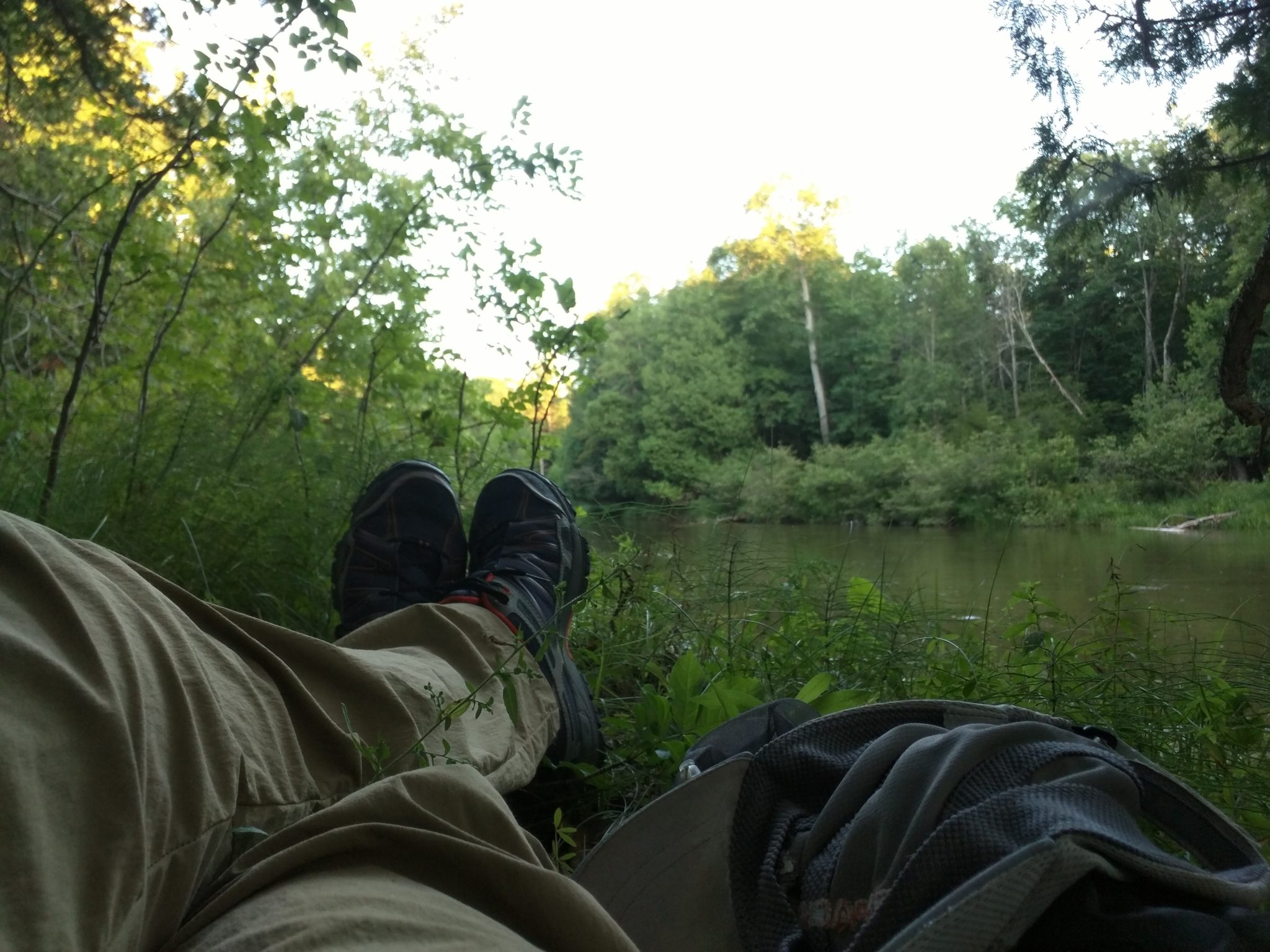
I took my phone out of airplane mode since I was on a high bench and noticed there was cell reception. Â I took the opportunity to send off an “all’s okay” message to my wife before descending the trail down into the river valley where I was doubtful there’d be reception. Â Sure enough the signal went away and I made my way to where an official NCT campsite was located along a small feeder creek. Â The location was nice and flat, the creek flowing strong and clear, but the vegetation was dark, damp, and not conducive to a relaxing evening as the light faded nor for viewing the moon nor stars. Â I quickly sucked down the remaining water I had in one of my water bottles, saving the 1/2 of the other for use while hiking further, and filled the other from the creek. Â I had my Aquamira solution at hand and did the ol’ A+B drip drop dance, packed that bottle away, and hit the trail again. Â I came across a few locals in a jeep and side by side just up and out of the dark creek draw. Â I snuck past as they were having a nice time by the river and left the short section of road the trail was sharing and then back onto wooded singletrack. Â I didn’t need to hike particularly far when I spotted a wide, low flat spot immediately adjacent to the river just a stone’s throw off the trail. Â I schwacked down to it and found a small firepit and plenty of soft, flat ground where to set myself for the evening.

Traveling light means camping with nary a footprint. Â Although I spent twelve hours at this spot I’d say when I left there it was in no worse shape that it was when I arrived. Â It’s nice to be able to spend a good amount of time in a place and to be able to leave with very little trace of even being there. Â I dumped the contents of my pack, grabbed my poncho tarp, stakes, and poles and set about finding the best combination of a flat spot that had good tree coverage should a rain decide to start overnight. Â My poncho tarp is only five feet wide which means when pitched in an a-frame style is quite narrow. Â I got it rigged up in no time and next started scanning trees in the area that looked the most comfortable for leaning against. Â I found the perfect one that forked low to the ground, had a nice soft blob of moss in the fork, and just the right upward curve to fit my back, and provide a place to lean my head. Â I set my little foam sleeping pad down in the curve and settled into an almost immediately comfortable position.

I heated up a packet of ramen noodles and added part of a pouch of powdered sausage gravy. Â This is a delicious backpacking dish that I think was shared with me by my former employer, Ryan J. at BPL. Â I remember him mentioning it offhandedly to me as a quick and easy meal that you can find ingredients for at just about any grocery store and it’s stuck with me ever since. Â I was using a free, long-handled ice cream spoon that I’d picked up at a soft serve place we’d visited a few nights before. Â This was in an effort to further cut as much weight from my gear list as possible but it proved to have a flaw in that it became quite soft in the boiling water and was hard to eat with. Â I may choose to not sacrifice the strength of my trusty titanium spoon the next time I attempt to camp with as minimal of gear as possible.
The spot I had found to sit was so comfortable that I decided to simply stay there as day turned to night. Â The mosquitos had heightened their presence and the temperatures dropped slightly so I put on my windshirt, toque, and headnet but left my sleeping quilt in the pack. Â I laid back against the tree and closed my eyes, falling asleep to the sound of water moving swiftly by in the Manistee just feet away from my position. Â I slept nicely for an hour or two until the slight chill of the evening woke me and I decided to wrap up in my quilt. Â The spot I was in remained comfortable and I found I was able to sleep on my back or either side conveniently using the mossy tree as a pillow. Â The moon was one day waned (waxed?) past full and was distinctly framed above the river between the trees on either side. Â It was so gorgeous that I couldn’t bring myself to fall back asleep right away but rather just sat staring, taking it all in. Â The slight temp change had put the mosquitos to rest so I pulled the headnet up off my face and enjoyed the view until I finally fell back asleep.
I awoke sometime in the dead of the night to a large critter approaching camp. Â It was making quick deep snorts of breath and pawing at the ground. Â I expect it was probably a large deer but perhaps could have been a bear. Â I’m not Midwest naturalist however so can’t be sure. Â I shouted at it to let it know I already had this campsite taken and it begrudgingly responded. Â It moved off in the opposite direction snorting and rooting at the earth but didn’t do so very quickly. Â I continued to listen to it as it moved up the river bank and off into the woods far enough that I could drift back to sleep.
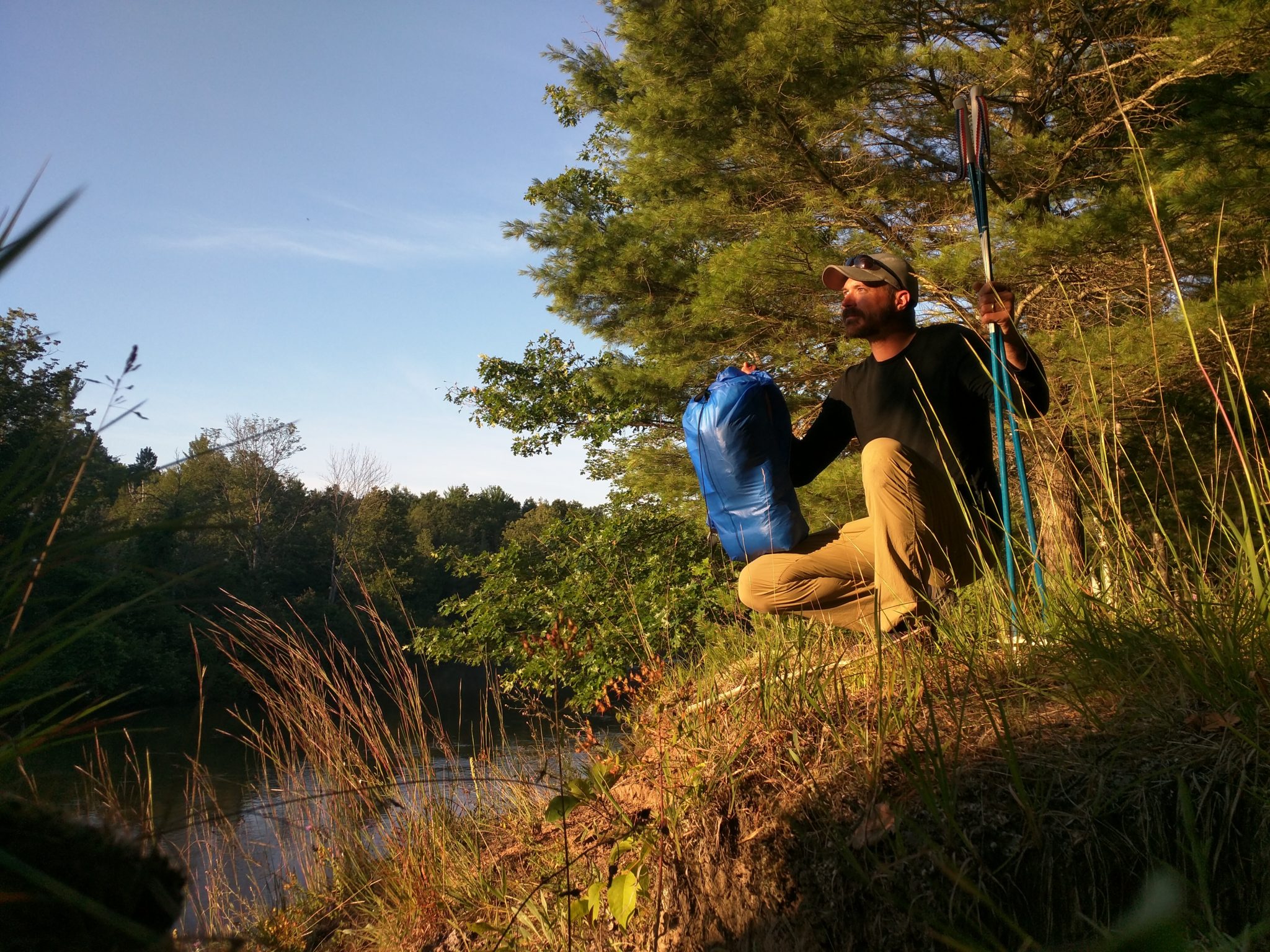
I awoke soon after dawn and participated in one of the other joys of the art of minimalist backcountry camping – the five minute camp cleanup. Â Although I’d not slept under my tarp I had left it up in the event weather had come in so I walked over to take it down, and then gathered my other items which were all actually already in my backpack where I’d left them while I slept. Â The whole process took six minutes. Â I had thought I would simply hit the trail, hike a ways and then stop for coffee and granola but instead I sat back down in my trusty spot, took out my stove and stayed another hour sipping coffee and eating.
I had a planned pick up time of 11am and what I thought to be around eight or so miles of hiking so I knew that if I walked quickly I would have plenty of time to stop anytime I pleased for a photograph, to read any sign posts, or appreciate any views I’d encounter. Â So that’s what I did. Â I began to move quickly making my way along the river. Â Much of the morning section was on a two-track shared by ATV traffic and although I didn’t see any there were plenty of signs of camping spots with the tell tale firepit full of empty cans of shitty beer and other detritus shot full of holes.
The sun rising up and over the trees along the Manistee and the trail leaving the sandy two track for more gorgeous singletrack carved lovingly by NCTA volunteers can sure put a smile on a hiker’s face. Â As the sun rose over the treed banks it made for some beautiful light and given this was a weekday I saw no one for the entire morning, having the landscape all to myself.
I missed a crucial blue blaze depicting a spot where the trail made a sharp 90 degree turn and I walked up a very steep hill about a hundred feet and then farther along the top of the rim about a 1/4 mile without seeing any sign and on quickly degrading trail. Â I could tell by my location that I’d rejoin the trail somewhere ahead if I forged on but I had been enjoying the trail tread the NCT volunteers have built so much that I instead decided to retrace my steps to find the trail. Â This proved to be a good choice for the route they’d chosen to gain the ridge was in a spectacular draw of which had such a sublime character it would have been a shame to miss.

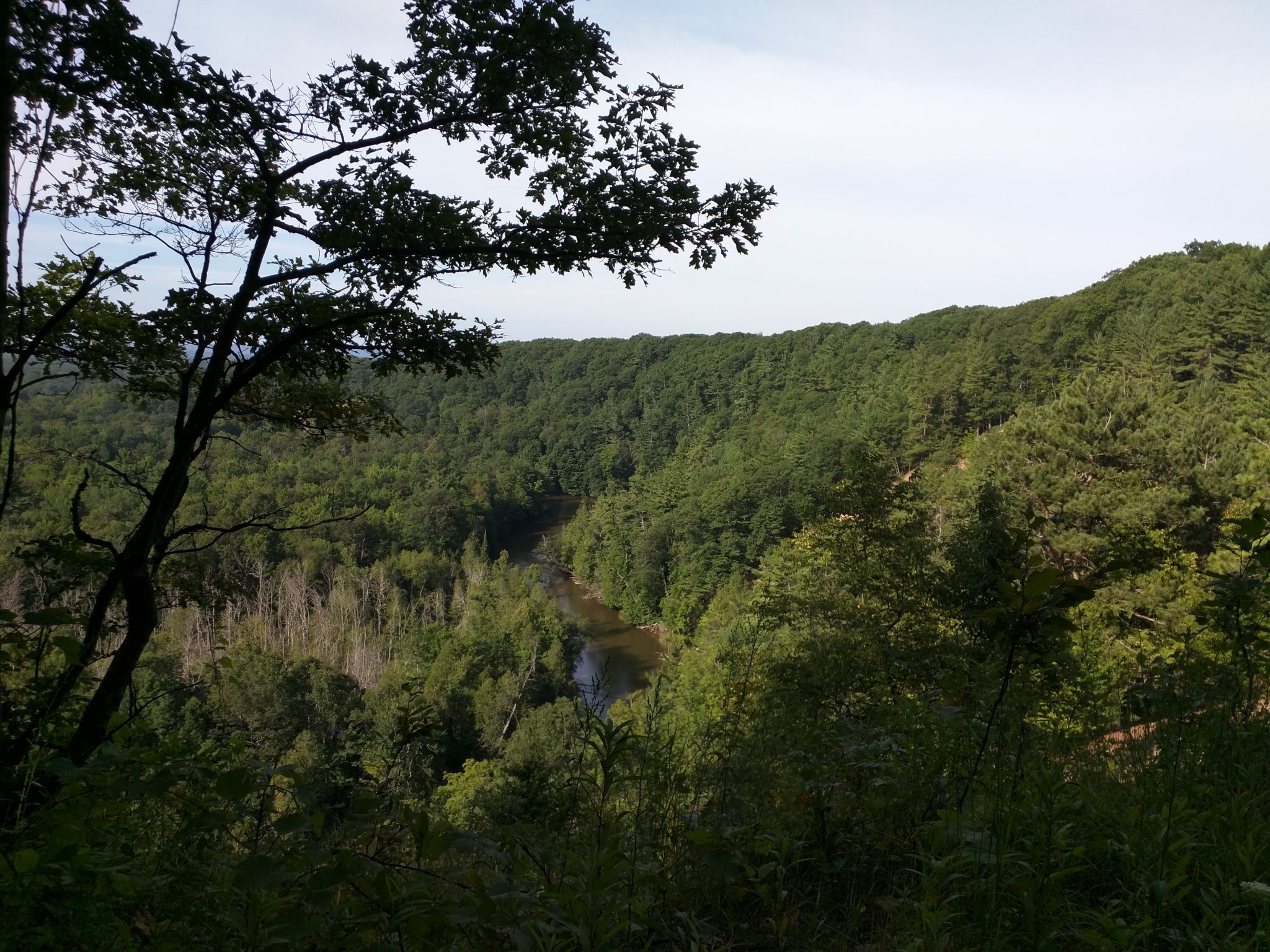
The remainder of the hiking day was truly exceptional as the trail remained high up on a sandy bluff above the Manistee. Â Hiking through forests of birch and maple with a carpet of lush fern immediately around me with twenty-mile views of the Michigan forests expanding off to my right at wonderfully spaced open vistas would be hard to beat. Â I hiked quickly but took in the sights and sounds around me with gratitude.

I arrived at the end of the trail section about 15 minutes prior to my scheduled 11am pickup which was alongside a highway. Â At this location there was another nicely done NCT sign with well defined distances back from where I’d come. Â The section ahead of me which I would not be hiking this go around is on the highway for what appeared to be two or three miles North, East, and then South which I can only assume is due to access issues around a section of land. Â The NCT is a pretty amazing patchwork of trail that stretches 4,000 some odd miles from New York to North Dakota. Â To string together a footpath that distance is pretty amazing considering the multitude of land ownership along the way and as such it needs to be expected there will be little bumps like this as the trail follows a county or state right of way to avoid a piece of inaccessible land.
I would highly recommend hiking sections of the NCT in the Traverse City area as the chapter of the NCT there cares very deeply about their section of trail. Â I plan to further explore sections of it on future trips to the area but chose this one first due to it’s seeming lack of popularity all while having such a gorgeous location along the Manistee.

For those interested in such things a packing list for this trip can be seen here:Â https://lighterpack.com/r/3n6mwx
Do you have stories of the NCT in your state or perhaps right in Michigan? Drop a comment for me to read below.